Trail Walking Gemeinde Oetz - Oetzel sommets  - Photo
 rvapeldo
rvapeldo

User GUIDE

© OpenStreetMap contributors
Length
Length
7.1 km
Max alt
Max alt
2576 m
Uphill gradient
Uphill gradient
529 m
Km-Effort
Km-Effort  
15.6 km
Min alt
Min alt
1602 m
Downhill gradient
Downhill gradient
962 m
Boucle
Boucle
No
Creation date :
2022-07-09 08:15:19.0
Updated on :
2022-07-14 15:33:06.48

(0 Reviews)

Walking
Walking
5h20
Difficulty : Medium

Scan this QR Code to open this trail in the SityTrail application

FREE GPS app for hiking

Logo SityTrail SityTrail

IGN / Geographical institutes

Download SityTrail from the App Store Download SityTrail from Google Play

Logo SityTrail SityTrail World

The world is yours!

Download SityTrail from the App Store Download SityTrail from Google Play Download SityTrail on Huawei AppGallery

About

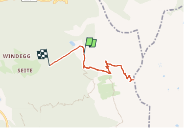
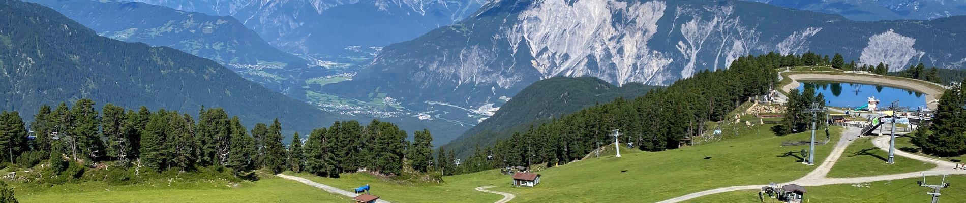
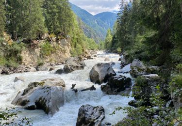
Trail Walking of 7.1 km to be discovered at Tyrol, Bezirk Imst, Gemeinde Oetz. This trail is proposed by rvapeldo.

Description

Balades vers deux petits sommets, Rosskopf et Wetterkreutzkogel, au départ de l’arrivée du téléphérique d’Oetzel. Attention, une partie de la trace vers la vallée ne fait pas partie de la marche, j’ai arrêté l’application dansle téléphérique, en descandant vers Oetzel, donc la longueur du parcours est sans doute plutôt de 6,5 km.

Elevation profile

Photos

Positioning

Country:
Austria
Region :
Tyrol
Department/Province :
Bezirk Imst
Municipality :
Gemeinde Oetz
Location:
Unknown
Start:(UTM)
646398 ; 5230366 (32T) N.

Trails nearby

Trail Walking Gemeinde Oetz - Oetztal lac 12 km - Photo
Walking
GUIDE
rvapeldo

Walking

Medium
Gemeinde Oetz, Tyrol, Bezirk Imst, Austria
11.7 km | 18.4 km-effort
5h 8min
No
Trail Walking Gemeinde Oetz - lac de piburg - Photo
Walking
leon40

Walking

Very easy
Gemeinde Oetz, Tyrol, Bezirk Imst, Austria
6.8 km | 10.5 km-effort
3h 10min
No


Close
My subscriptions