Trail Running La Haie-Fouassière - LaHayeFouassière-Pont Cafino - Photo
 laet
laet

User

© OpenStreetMap contributors
Length
Length
16.4 km
Max alt
Max alt
51 m
Uphill gradient
Uphill gradient
250 m
Km-Effort
Km-Effort  
19.7 km
Min alt
Min alt
6 m
Downhill gradient
Downhill gradient
245 m
Boucle
Boucle
No
Creation date :
2019-05-26 16:14:47.766
Updated on :
2019-05-26 16:14:47.958

(0 Reviews)

Running
Running
1h30
Difficulty : Easy

Scan this QR Code to open this trail in the SityTrail application

FREE GPS app for hiking

Logo SityTrail SityTrail

IGN / Geographical institutes

Download SityTrail from the App Store Download SityTrail from Google Play

Logo SityTrail SityTrail World

The world is yours!

Download SityTrail from the App Store Download SityTrail from Google Play Download SityTrail on Huawei AppGallery

About

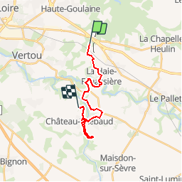
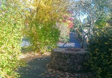
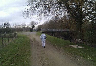
Trail Running of 16.4 km to be discovered at Pays de la Loire, Loire-Atlantique, La Haie-Fouassière. This trail is proposed by laet.

Elevation profile

Positioning

Country:
France
Region :
Pays de la Loire
Department/Province :
Loire-Atlantique
Municipality :
La Haie-Fouassière
Location:
Unknown
Start:(UTM)
620370 ; 5225932 (30T) N.

Trails nearby

Trail On foot La Haie-Fouassière - Entre Sèvre et Côteaux - Photo
On foot
GUIDE+

On foot

Easy
La Haie-Fouassière, Pays de la Loire, Loire-Atlantique, France
9.3 km | 10.5 km-effort
2h 22min
Yes
Trail Walking Saint-Fiacre-sur-Maine - vigne - Photo
Walking
bouchaudpl

Walking

Very easy
(1)
Saint-Fiacre-sur-Maine, Pays de la Loire, Loire-Atlantique, France
19.5 km | 23 km-effort
3h 41min
No
Trail Mountain bike Monnières - Sèvre et Maine - Monnières - Photo
Mountain bike
tracegps

Mountain bike

Difficult
(1)
Monnières, Pays de la Loire, Loire-Atlantique, France
34 km | 39 km-effort
2h 30min
Yes
Trail Walking Haute-Goulaine - Haute Goulaine Circuit des Marais - Photo
Walking
eric.batard

Walking

Very easy
(1)
Haute-Goulaine, Pays de la Loire, Loire-Atlantique, France
14.9 km | 16.2 km-effort
5min
Yes
Trail Walking Vertou - vertou Monnieres - Photo
Walking
yves le sommer

Walking

Difficult
Vertou, Pays de la Loire, Loire-Atlantique, France
13.1 km | 15.2 km-effort
3h 45min
No
Trail Mountain bike Basse-Goulaine - 22222 - Photo
Mountain bike
challenger

Mountain bike

Easy
Basse-Goulaine, Pays de la Loire, Loire-Atlantique, France
5.8 km | 6.5 km-effort
31min
No
Trail Other activity Monnières - Monnieres (44) - Photo
Other activity
bellicaud

Other activity

Easy
Monnières, Pays de la Loire, Loire-Atlantique, France
8 km | 9.1 km-effort
2h 2min
Yes
Trail Running Vertou - Les Reigniers - 20161030 - Photo
Running
filisport

Running

Easy
Vertou, Pays de la Loire, Loire-Atlantique, France
18.4 km | 21 km-effort
1h 48min
Yes
Trail Walking Basse-Goulaine - Basse Goulaine - Le canal de Goulaine - Photo
Walking
jylera

Walking

Easy
(1)
Basse-Goulaine, Pays de la Loire, Loire-Atlantique, France
8.3 km | 8.8 km-effort
2h 0min
Yes


Close
My subscriptions