


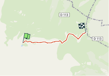

9.8 km | 14.9 km-effort


User


FREE GPS app for hiking
 SityTrail
IGN / Geographical institutes
SityTrail World
The world is yours!
Trail Walking of 3.6 km to be discovered at Occitania, Hautespyrenees, Ancizan. This trail is proposed by ego .

Walking

Walking

Walking

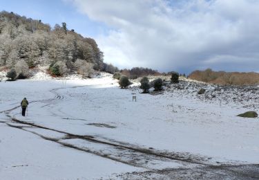
Snowshoes
Walking

Walking

Walking
Walking

Walking
Compter plutôt 2h aller et 2h retour. A noter que 50% du chemin est à flanc de montagne, donc un peu délicat si des personnes sont sujettes aux vertiges dans quelques passages. sinon, très beaux paysages et traversée d estives avec vaches, chevaux , moutons tous bien pacifiques en liberté.