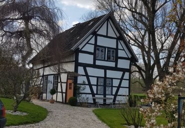
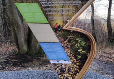
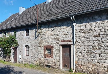
Trail Walking Aachen - 2022-07-02_21h22m54_910 - Photo
© OpenStreetMap contributors
Length
Length
17.5 km
Max alt
Max alt
263 m
Uphill gradient
Uphill gradient
283 m
Km-Effort
Km-Effort  
21 km
Min alt
Min alt
127 m
Downhill gradient
Downhill gradient
282 m
Boucle
Boucle
Yes
Creation date :
2022-07-02 19:22:54.94
Updated on :
2024-04-26 13:56:35.607

(1 Reviews)

Walking
Walking
4h50
Difficulty : Easy

Scan this QR Code to open this trail in the SityTrail application

FREE GPS app for hiking

Logo SityTrail SityTrail

IGN / Geographical institutes

Download SityTrail from the App Store Download SityTrail from Google Play

Logo SityTrail SityTrail World

The world is yours!

Download SityTrail from the App Store Download SityTrail from Google Play Download SityTrail on Huawei AppGallery

About

Trail Walking of 17.5 km to be discovered at North Rhine-Westphalia, Städteregion Aachen, Aachen. This trail is proposed by mumu.larandonneuse.

Description

Le hameau de Seffent est situé à la limite ouest d'Aix-la-Chapelle. Vous traversez d'abord la partie historique de Seffent, puis vous montez jusqu'au Wikensberg où vous avez de belles vues. Ensuite, vous marchez vers l'Universitätsklinikum Aix-la-Chapelle et traversez le jardin botanique (Karlsgarten) avec ses nombreuses plantes médicinales. Vous remontez le Schneeberg et passez la ligne Siegfried. Ensuite, vous marchez avec de belles vues jusqu'au village d'Orsbach où vous pouvez raccourcir le parcours à 13,2 km. Vous descendez un chemin escarpé jusqu'au Michaelshof isolé. Ensuite, vous descendez jusqu'à la lisière du hameau néerlandais de Mamelis où se trouve un banc sur le Selzerbeek, un endroit agréable pour faire une pause. Le chemin du retour traverse la magnifique vallée de Selzerbeek et vous arrivez ensuite au bord d'Orsbach au café Bellevue, un lieu de pause avec une belle vue. Ensuite, vous suivez pendant quelque temps un sentier le long du Schneeberg, où vous avez également de belles vues. Vous serez à proximité du grand et spécial Uniklinikum, l'hôpital universitaire d'Aix-la-Chapelle qui collabore avec l'hôpital universitaire de Maastricht. Par un chemin facile, vous passez le Sieben Quellen où 7 sources forment un ruisseau. Il y a plusieurs bancs avec de belles vues. Malgré le dénivelé, cette balade est assez facile à parcourir et constitue un incontournable pour tout amateur de marche !

ℹ️ www.wandelgidszuidlimburg.com n° 910.

Elevation profile

Positioning

Country:
Germany
Region :
North Rhine-Westphalia
Department/Province :
Städteregion Aachen
Municipality :
Aachen
Location:
Unknown
Start:(UTM)
291360 ; 5630481 (32U) N.

Comments

Please log in to post a review or rate the element


Très beau parcours limitrophe 🇩🇪🇭🇺 offrant de magnifiques panoramas.


Trails nearby

Trail Walking Vaals - 2023-04-07_19h11m12_788 - Photo
Walking
GUIDE
mumu.larandonneuse

Walking

Medium
(1)
Vaals, Limburg, Unknown, Netherlands
12.9 km | 16.3 km-effort
3h 42min
Yes
Trail Walking Vaals - 2023-04-07_19h07m33_235 - Photo
Walking
GUIDE
mumu.larandonneuse

Walking

Medium
(1)
Vaals, Limburg, Unknown, Netherlands
14.7 km | 18.3 km-effort
4h 9min
Yes
Trail Walking Aachen - Aix-la-Chapelle  - Photo
Walking
GUIDE
mumu.larandonneuse

Walking

Easy
(1)
Aachen, North Rhine-Westphalia, Städteregion Aachen, Germany
11.4 km | 15.4 km-effort
3h 30min
Yes
Trail Walking Vaals - 2021-07-14_08h55m00_1431 - Photo
Walking
GUIDE
mumu.larandonneuse

Walking

Medium
(1)
Vaals, Limburg, Unknown, Netherlands
13.1 km | 16.6 km-effort
3h 46min
Yes
Trail Walking Kelmis - 20200730 - Les 3 Bornes 7.3 Km - Photo
Walking
GUIDE
pierreh01

Walking

Difficult
(1)
Kelmis, Wallonia, Liège, Belgium
7.4 km | 10.4 km-effort
1h 50min
Yes
Trail Walking Kelmis - Venn Trilogie (1er étape) - Photo
Walking
Godasses et Grosses Pattes

Walking

Medium
(1)
Kelmis, Wallonia, Liège, Belgium
25 km | 30 km-effort
5h 0min
No
Trail Walking Plombières - Promenade du Vieux Moulin (9,5km) - Photo
Walking
GUIDE+

Walking

Very easy
(2)
Plombières, Wallonia, Liège, Belgium
8.3 km | 11 km-effort
Unknown
Yes
Trail Walking Plombières - les trois bornes ...voir info - Photo
Walking
GUIDE
stef789

Walking

Easy
Plombières, Wallonia, Liège, Belgium
12.8 km | 16.1 km-effort
4h 17min
Yes
Trail Walking Kelmis - Trois,Bornes  -  Vaals - Photo
Walking
GUIDE
mumu.larandonneuse

Walking

Medium
Kelmis, Wallonia, Liège, Belgium
12.4 km | 16.1 km-effort
3h 9min
Yes


Close
My subscriptions