![](/images/other/stat-length.png)
![Trail Walking Montpezat-sous-Bauzon - GRP Tour de la Montagne Ardéchoise - partie nord - Photo](https://media.geolcdn.com/t/1900/400/ext.pjpeg?maxdim=2&url=https%3A%2F%2Fstatic1.geolcdn.com%2Fsiteimages%2Fupload%2Ffiles%2F1553511878bg_sport_marche.png)
GRP Tour de la Montagne Ardéchoise - partie nord
loicthev
User
![Length](/images/other/stat-length.png)
Length
73 km
![Max alt](https://static1.geolcdn.com/siteimages/upload/files/1508320355ic_sort_altitude_max_24dp.png)
Max alt
1585 m
![Uphill gradient](https://static1.geolcdn.com/siteimages/upload/files/1508320355ic_sort_den_pos_24dp.png)
Uphill gradient
2112 m
![Km-Effort](/images/other/stat-length.png)
Km-Effort
102 km
![Min alt](https://static1.geolcdn.com/siteimages/upload/files/1508320355ic_sort_altitude_min_24dp.png)
Min alt
908 m
![Downhill gradient](https://static1.geolcdn.com/siteimages/upload/files/1508320355ic_sort_den_neg_24dp.png)
Downhill gradient
2112 m
![Boucle](https://static1.geolcdn.com/siteimages/upload/files/16400158638029165_repeat_loop_refresh_sync_direction_icon.png)
Boucle
Yes
Creation date :
2022-07-02 16:33:05.847
Updated on :
2022-07-02 16:33:24.284
![Walking](https://static1.geolcdn.com/sitytour/trail-icons/101.png)
20h20
Difficulty : Difficult
![Scan this QR Code to open this trail in the SityTrail application](https://capi.geolives.com/qq0zvz2zws4bq2lad0pu/sitytour/trails/3302142/qr.png?size=200)
FREE GPS app for hiking
About
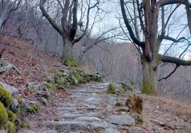
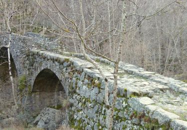
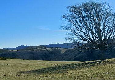
Trail Walking of 73 km to be discovered at Auvergne-Rhône-Alpes, Ardèche, Montpezat-sous-Bauzon. This trail is proposed by loicthev.
Description
J1 : 27,7km ; 1020m d ; 630m d- ; 8h
J2 : 24,6km ; 405m d ; 1000m d- ; 6h50
J3 : 20,7km ; 700m d ; 515m d- ; 5h30
Alexandre
29, 30 juin et 1 juillet 2022
Positioning
Country:
France
Region :
Auvergne-Rhône-Alpes
Department/Province :
Ardèche
Municipality :
Montpezat-sous-Bauzon
Location:
Unknown
Start:(Dec)
Start:(UTM)
592650 ; 4954711 (31T) N.
Comments
Trails nearby
![Trail Walking Montpezat-sous-Bauzon - SityTrail - 2227661 - montpezat-x-dxune-rive-a-lxautre-de-la-fontauliere (1) - Photo](https://media.geolcdn.com/t/375/260/ext.jpg?maxdim=2&url=https%3A%2F%2Fstatic1.geolcdn.com%2Fsiteimages%2Fupload%2Ffiles%2F1553511878bg_sport_marche.png)
![Walking Walking](https://static1.geolcdn.com/sitytour/trail-icons/101.png)
SityTrail - 2227661 - montpezat-x-dxune-rive-a-lxautre-de-la-fontauliere (1)
Walking
Medium
(1)
Montpezat-sous-Bauzon,
Auvergne-Rhône-Alpes,
Ardèche,
France
![](/images/other/stat-length.png)
6.9 km | 9.7 km-effort
2h 12min
![](https://static1.geolcdn.com/siteimages/upload/files/16400158638029165_repeat_loop_refresh_sync_direction_icon.png)
Yes
![Trail Walking Saint-Cirgues-en-Montagne - 2023-01-26_11h40m10_Rieutord Bauzon Vestide 13km-1 - Photo](https://media.geolcdn.com/t/375/260/56b36f0d-9619-4a34-88ef-ce2e5208d8ff.jpg&format=jpg&maxdim=2)
![Walking Walking](https://static1.geolcdn.com/sitytour/trail-icons/101.png)
2023-01-26_11h40m10_Rieutord Bauzon Vestide 13km-1
Walking
Difficult
Saint-Cirgues-en-Montagne,
Auvergne-Rhône-Alpes,
Ardèche,
France
![](/images/other/stat-length.png)
12.6 km | 17.6 km-effort
3h 59min
![](https://static1.geolcdn.com/siteimages/upload/files/16400158638029165_repeat_loop_refresh_sync_direction_icon.png)
Yes
![Trail Walking Montpezat-sous-Bauzon - 07 Montpezat-sous-Bauzon - Plantades-Clastre-St-Roch-Clastre - Photo](https://media.geolcdn.com/t/375/260/eea78bd6-64a6-4986-bc01-b25c24a7750c.jpg&format=jpg&maxdim=2)
![Walking Walking](https://static1.geolcdn.com/sitytour/trail-icons/101.png)
07 Montpezat-sous-Bauzon - Plantades-Clastre-St-Roch-Clastre
Walking
Medium
Montpezat-sous-Bauzon,
Auvergne-Rhône-Alpes,
Ardèche,
France
![](/images/other/stat-length.png)
7.3 km | 11.6 km-effort
2h 0min
![](https://static1.geolcdn.com/siteimages/upload/files/16400158638029165_repeat_loop_refresh_sync_direction_icon.png)
Yes
![Trail Walking Le Roux - 2012-06-24 14h24m52 le roux - Photo](https://media.geolcdn.com/t/375/260/ext.jpg?maxdim=2&url=https%3A%2F%2Fstatic1.geolcdn.com%2Fsiteimages%2Fupload%2Ffiles%2F1553511878bg_sport_marche.png)
![Walking Walking](https://static1.geolcdn.com/sitytour/trail-icons/101.png)
2012-06-24 14h24m52 le roux
Walking
Medium
(2)
Le Roux,
Auvergne-Rhône-Alpes,
Ardèche,
France
![](/images/other/stat-length.png)
12.9 km | 19.9 km-effort
3h 31min
![](https://static1.geolcdn.com/siteimages/upload/files/16400158638029165_repeat_loop_refresh_sync_direction_icon.png)
Yes
![Walking Walking](https://static1.geolcdn.com/sitytour/trail-icons/101.png)
Balade-Le Villaret-La Forêt- Les Malfaugères
Walking
Medium
Montpezat-sous-Bauzon,
Auvergne-Rhône-Alpes,
Ardèche,
France
![](/images/other/stat-length.png)
5.8 km | 7.7 km-effort
1h 50min
![](https://static1.geolcdn.com/siteimages/upload/files/16400158638029165_repeat_loop_refresh_sync_direction_icon.png)
Yes
![Trail Walking Montpezat-sous-Bauzon - Montpezat - Le Fau - Chalias - Les plantades - Photo](https://media.geolcdn.com/t/375/260/85540c14-745e-4d28-b661-b64719d9e40c.jpg&format=jpg&maxdim=2)
![Walking Walking](https://static1.geolcdn.com/sitytour/trail-icons/101.png)
Montpezat - Le Fau - Chalias - Les plantades
Walking
Difficult
Montpezat-sous-Bauzon,
Auvergne-Rhône-Alpes,
Ardèche,
France
![](/images/other/stat-length.png)
11.1 km | 18.6 km-effort
4h 14min
![](https://static1.geolcdn.com/siteimages/upload/files/16400158638029165_repeat_loop_refresh_sync_direction_icon.png)
Yes
![Walking Walking](https://static1.geolcdn.com/sitytour/trail-icons/101.png)
SityTrail - 2961881 - lalligierxhaute-grace-v2
Walking
Very difficult
Le Roux,
Auvergne-Rhône-Alpes,
Ardèche,
France
![](/images/other/stat-length.png)
14 km | 19.1 km-effort
4h 19min
![](https://static1.geolcdn.com/siteimages/upload/files/16400158638029165_repeat_loop_refresh_sync_direction_icon.png)
Yes
![Trail Walking Montpezat-sous-Bauzon - Fontaulière-Montpezat sous Bauzon - Photo](https://media.geolcdn.com/t/375/260/dd8830b6-de58-4bd5-b138-1fc06e403bcc.jpg&format=jpg&maxdim=2)
![Walking Walking](https://static1.geolcdn.com/sitytour/trail-icons/101.png)
Fontaulière-Montpezat sous Bauzon
Walking
Easy
Montpezat-sous-Bauzon,
Auvergne-Rhône-Alpes,
Ardèche,
France
![](/images/other/stat-length.png)
7.6 km | 10.2 km-effort
1h 49min
![](https://static1.geolcdn.com/siteimages/upload/files/16400158638029165_repeat_loop_refresh_sync_direction_icon.png)
No
![Trail Walking Usclades-et-Rieutord - Bas de rieutore - Photo](https://media.geolcdn.com/t/375/260/b6649b4e-cbcc-488f-b7be-2d6333117b26.jpg&format=jpg&maxdim=2)
![Walking Walking](https://static1.geolcdn.com/sitytour/trail-icons/101.png)
Bas de rieutore
Walking
Very easy
Usclades-et-Rieutord,
Auvergne-Rhône-Alpes,
Ardèche,
France
![](/images/other/stat-length.png)
18.6 km | 28 km-effort
9h 14min
![](https://static1.geolcdn.com/siteimages/upload/files/16400158638029165_repeat_loop_refresh_sync_direction_icon.png)
No