![](/images/other/stat-length.png)
![Trail Cycle Pontivy - Parcours vélo orange 24 - Photo](https://media.geolcdn.com/t/1900/400/ext.pjpeg?maxdim=2&url=https%3A%2F%2Fstatic1.geolcdn.com%2Fsiteimages%2Fupload%2Ffiles%2F1524743154velo.jpg)
Parcours vélo orange 24
neoroll44
User
![Length](/images/other/stat-length.png)
![Max alt](https://static1.geolcdn.com/siteimages/upload/files/1508320355ic_sort_altitude_max_24dp.png)
![Uphill gradient](https://static1.geolcdn.com/siteimages/upload/files/1508320355ic_sort_den_pos_24dp.png)
![Km-Effort](/images/other/stat-length.png)
![Min alt](https://static1.geolcdn.com/siteimages/upload/files/1508320355ic_sort_altitude_min_24dp.png)
![Downhill gradient](https://static1.geolcdn.com/siteimages/upload/files/1508320355ic_sort_den_neg_24dp.png)
![Boucle](https://static1.geolcdn.com/siteimages/upload/files/16400158638029165_repeat_loop_refresh_sync_direction_icon.png)
![Cycle](https://static1.geolcdn.com/sitytour/trail-icons/200.png)
3h00
Difficulty : Very easy
![Scan this QR Code to open this trail in the SityTrail application](https://capi.geolives.com/qq0zvz2zws4bq2lad0pu/sitytour/trails/3301778/qr.png?size=200)
FREE GPS app for hiking
About
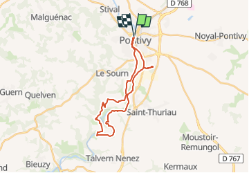
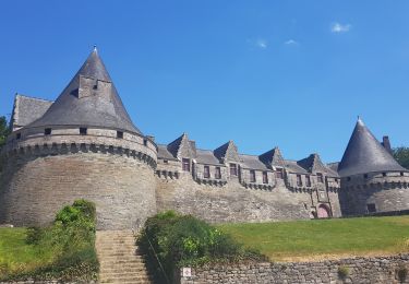
Trail Cycle of 24 km to be discovered at Brittany, Morbihan, Pontivy. This trail is proposed by neoroll44.
Description
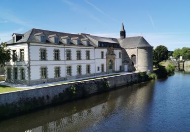
1 En sortant de la péniche de l’Office de tourisme de Pontivy Communauté, suivez le chemin de halage sur la droite.
2 Passer sous 4 ponts puis sortir du chemin de halage à gauche juste avant le pont à structure métallique verte (vous arrivez en face du magasin vélo Pontivy Bike)
3 Traverser la route et prendre en face rue Clémentel et poursuivre entre Pontivy Bike et le concessionnaire automobile.
4 Au carrefour, prendre tout droit
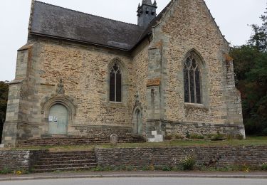
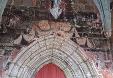
5 Prendre le 1er chemin sur votre gauche puis toujours tout droit jusqu’à la Chapelle Notre-Dame de la Houssaye
6 Faire demi-tour pour revenir sur le chemin de halage et poursuivre votre route
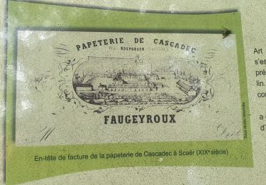
7 Continuer sur environ 3km jusqu’à la Chapelle Notre-Dame de Joie, le Gohazé au bord du Blavet
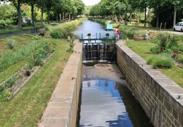
8 Poursuivre sur le halage et 500m après l’écluse du Roch, prendre à gauche pour sortir du halage
9 A l’intersection, tourner à droite. Passer le village de Vieux Rimaison.
10 A la prochaine intersection (impasse en face) tourner à droite pour récupérer le chemin de halage (écluse n°5 Le Divit)
11 Après l’écluse de Rimaison, prendre la route pour traverser le pont et suivre tout droit la D188. Vous pouvez suivre le fléchage jaune circuit voiture jusqu’à la chapelle.
12 A l’intersection face au Golf de Rimaison, tourner à droite, direction Le Sourn/Pontivy sur 2km
13 Tourner à droite en épingle vers Kerdanet (panneau en contre-sens)
14 Monter jusqu’à la Chapelle St Jean
15 Poursuivre la route, au carrefour, prendre à droite vers Pontivy
16 Passer Tréhonin, au rond-point, prendre en face
17 Avant la voie ferrée, tourner à gauche vers Le Sourn/Chapelle Saint-Michel
18 Continuer tout droit, aux 2 stops, prendre tout droit direction Centre-ville
19 Au cédez-le-passage, tourner à droite puis au rond-point prendre en face direction Centre-ville
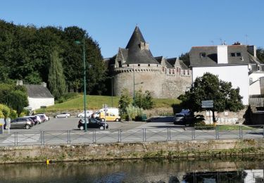
20 Traverser le pont et au rond-point, prendre à gauche jusqu’à la péniche de l’Office de tourisme
Positioning
Comments
Trails nearby
![Trail Electric bike Pontivy - Pontivy Écluses de Rouvray - Photo](https://media.geolcdn.com/t/375/260/ba666932-a972-43b8-99e6-5507ce2df7da.jpg&format=jpg&maxdim=2)
![Electric bike Electric bike](https://static1.geolcdn.com/sitytour/trail-icons/205.png)
Electric bike
![](/images/other/stat-length.png)
![](https://static1.geolcdn.com/siteimages/upload/files/16400158638029165_repeat_loop_refresh_sync_direction_icon.png)
![Trail Walking Pontivy - TSM - Autour de Pontivy - Photo](https://media.geolcdn.com/t/375/260/8774bc35-9c8c-45c6-99f9-2eb6a800d84c.jpg&format=jpg&maxdim=2)
![Walking Walking](https://static1.geolcdn.com/sitytour/trail-icons/101.png)
Walking
![](/images/other/stat-length.png)
![](https://static1.geolcdn.com/siteimages/upload/files/16400158638029165_repeat_loop_refresh_sync_direction_icon.png)
![Trail Walking Pontivy - GR_37_DE_25_Pontivy_Cleguerec_20210826 - Photo](https://media.geolcdn.com/t/375/260/8a08a1d7-ff84-406b-8d2c-18db5a72e027.jpg&format=jpg&maxdim=2)
![Walking Walking](https://static1.geolcdn.com/sitytour/trail-icons/101.png)
Walking
![](/images/other/stat-length.png)
![](https://static1.geolcdn.com/siteimages/upload/files/16400158638029165_repeat_loop_refresh_sync_direction_icon.png)
![Trail Walking Neulliac - GR_37_DD_04_Neulliac_Pontivy_20200601 - Photo](https://media.geolcdn.com/t/375/260/cbcc16e7-e8a9-42c5-aad1-faa79b7a29bf.jpg&format=jpg&maxdim=2)
![Walking Walking](https://static1.geolcdn.com/sitytour/trail-icons/101.png)
Walking
![](/images/other/stat-length.png)
![](https://static1.geolcdn.com/siteimages/upload/files/16400158638029165_repeat_loop_refresh_sync_direction_icon.png)
![Trail Bicycle tourism Pontivy - Pontivy Saint-Nicolas-des-eaux - Photo](https://media.geolcdn.com/t/375/260/0fc55161-18e1-46b1-a8a1-685bd415874b.jpg&format=jpg&maxdim=2)
![Bicycle tourism Bicycle tourism](https://static1.geolcdn.com/sitytour/trail-icons/204.png)
Bicycle tourism
![](/images/other/stat-length.png)
![](https://static1.geolcdn.com/siteimages/upload/files/16400158638029165_repeat_loop_refresh_sync_direction_icon.png)
![Trail Bicycle tourism Pontivy - Pontivy - Photo](https://media.geolcdn.com/t/375/260/3ad5b68e-fa3f-4dbd-afbf-3722bf25a131.jpg&format=jpg&maxdim=2)
![Bicycle tourism Bicycle tourism](https://static1.geolcdn.com/sitytour/trail-icons/204.png)
Bicycle tourism
![](/images/other/stat-length.png)
![](https://static1.geolcdn.com/siteimages/upload/files/16400158638029165_repeat_loop_refresh_sync_direction_icon.png)
![Trail Electric bike Pontivy - L'Art dans les chapelles circuit cyan - Photo](https://media.geolcdn.com/t/375/260/0184a9db-84ec-4d8d-aa31-e7791572ff9f.jpg&format=jpg&maxdim=2)
![Electric bike Electric bike](https://static1.geolcdn.com/sitytour/trail-icons/205.png)
Electric bike
![](/images/other/stat-length.png)
![](https://static1.geolcdn.com/siteimages/upload/files/16400158638029165_repeat_loop_refresh_sync_direction_icon.png)
![Trail Mountain bike Pontivy - 2011-09-21 17h41m24 - Photo](https://media.geolcdn.com/t/375/260/ext.jpg?maxdim=2&url=https%3A%2F%2Fstatic1.geolcdn.com%2Fsiteimages%2Fupload%2Ffiles%2F1524743154velo.jpg)
![Mountain bike Mountain bike](https://static1.geolcdn.com/sitytour/trail-icons/202.png)
Mountain bike
![](/images/other/stat-length.png)
![](https://static1.geolcdn.com/siteimages/upload/files/16400158638029165_repeat_loop_refresh_sync_direction_icon.png)
![Trail Electric bike Pontivy - moelans....par pontivy et Carhaix retour moelans - Photo](https://media.geolcdn.com/t/375/260/3118cc24-7ab7-49db-86c0-cd7723ceae42.jpg&format=jpg&maxdim=2)
![Electric bike Electric bike](https://static1.geolcdn.com/sitytour/trail-icons/205.png)
Electric bike
![](/images/other/stat-length.png)
![](https://static1.geolcdn.com/siteimages/upload/files/16400158638029165_repeat_loop_refresh_sync_direction_icon.png)