![](/images/other/stat-length.png)
![Trail Walking Saint-Baudille-et-Pipet - Esclops Trièves Col de l'Aiguille - Photo](https://media.geolcdn.com/t/1900/400/c1c5675d-bfe6-4e05-80f5-bbfac132efec.jpg&format=pjpeg&maxdim=2)
Esclops Trièves Col de l'Aiguille
TOULAUDIN
User
![Length](/images/other/stat-length.png)
Length
13.3 km
![Max alt](https://static1.geolcdn.com/siteimages/upload/files/1508320355ic_sort_altitude_max_24dp.png)
Max alt
2028 m
![Uphill gradient](https://static1.geolcdn.com/siteimages/upload/files/1508320355ic_sort_den_pos_24dp.png)
Uphill gradient
1034 m
![Km-Effort](/images/other/stat-length.png)
Km-Effort
27 km
![Min alt](https://static1.geolcdn.com/siteimages/upload/files/1508320355ic_sort_altitude_min_24dp.png)
Min alt
1016 m
![Downhill gradient](https://static1.geolcdn.com/siteimages/upload/files/1508320355ic_sort_den_neg_24dp.png)
Downhill gradient
1032 m
![Boucle](https://static1.geolcdn.com/siteimages/upload/files/16400158638029165_repeat_loop_refresh_sync_direction_icon.png)
Boucle
Yes
Creation date :
2022-06-28 07:07:45.453
Updated on :
2022-07-12 15:29:19.003
![Walking](https://static1.geolcdn.com/sitytour/trail-icons/101.png)
5h46
Difficulty : Difficult
![Scan this QR Code to open this trail in the SityTrail application](https://capi.geolives.com/qq0zvz2zws4bq2lad0pu/sitytour/trails/3297733/qr.png?size=200)
FREE GPS app for hiking
About
Trail Walking of 13.3 km to be discovered at Auvergne-Rhône-Alpes, Isère, Saint-Baudille-et-Pipet. This trail is proposed by TOULAUDIN.
Description
rando effectuée lors du séjour Esclops dans le trièves , nuages bas donc montée dans la brume ,mais découvert en Altitude magnifique mais ça se mérite car 1000M de dénivelé sur 6.5KM
ça grimpe très raide.c'est un A/R
Positioning
Country:
France
Region :
Auvergne-Rhône-Alpes
Department/Province :
Isère
Municipality :
Saint-Baudille-et-Pipet
Location:
Unknown
Start:(Dec)
Start:(UTM)
721258 ; 4963748 (31T) N.
Comments
Trails nearby
![Trail Walking Châtel-en-Trièves - Arête de Rattier depuis le col de la brêche - Photo](https://media.geolcdn.com/t/375/260/645aac14-c825-4b01-9c22-da781fdfea33.jpg&format=jpg&maxdim=2)
![Walking Walking](https://static1.geolcdn.com/sitytour/trail-icons/101.png)
Arête de Rattier depuis le col de la brêche
Walking
Difficult
(1)
Châtel-en-Trièves,
Auvergne-Rhône-Alpes,
Isère,
France
![](/images/other/stat-length.png)
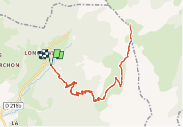
10.3 km | 24 km-effort
8h 12min
![](https://static1.geolcdn.com/siteimages/upload/files/16400158638029165_repeat_loop_refresh_sync_direction_icon.png)
Yes
![Trail Walking Mens - Bonnet Calvin reco - Photo](https://media.geolcdn.com/t/375/260/71237d58-2b29-4521-9351-2dded8929675.jpg&format=jpg&maxdim=2)
![Walking Walking](https://static1.geolcdn.com/sitytour/trail-icons/101.png)
Bonnet Calvin reco
Walking
Difficult
(1)
Mens,
Auvergne-Rhône-Alpes,
Isère,
France
![](/images/other/stat-length.png)
10.7 km | 21 km-effort
4h 25min
![](https://static1.geolcdn.com/siteimages/upload/files/16400158638029165_repeat_loop_refresh_sync_direction_icon.png)
No
![Trail Walking Saint-Baudille-et-Pipet - Bonnet de Calvin - Photo](https://media.geolcdn.com/t/375/260/b711d778-2624-48ca-9a09-33141db7aca2.jpg&format=jpg&maxdim=2)
![Walking Walking](https://static1.geolcdn.com/sitytour/trail-icons/101.png)
Bonnet de Calvin
Walking
Medium
Saint-Baudille-et-Pipet,
Auvergne-Rhône-Alpes,
Isère,
France
![](/images/other/stat-length.png)
15 km | 31 km-effort
6h 35min
![](https://static1.geolcdn.com/siteimages/upload/files/16400158638029165_repeat_loop_refresh_sync_direction_icon.png)
Yes
![Trail Walking Saint-Baudille-et-Pipet - Des Lames d'Arçon au Col de l'Aiguille - Photo](https://media.geolcdn.com/t/375/260/6a7d919f-0a46-4fb6-a03a-1cd4dec1d339.jpg&format=jpg&maxdim=2)
![Walking Walking](https://static1.geolcdn.com/sitytour/trail-icons/101.png)
Des Lames d'Arçon au Col de l'Aiguille
Walking
Very difficult
Saint-Baudille-et-Pipet,
Auvergne-Rhône-Alpes,
Isère,
France
![](/images/other/stat-length.png)
14.9 km | 31 km-effort
6h 56min
![](https://static1.geolcdn.com/siteimages/upload/files/16400158638029165_repeat_loop_refresh_sync_direction_icon.png)
Yes
![Trail Walking Mens - bonnet de Calvin - Photo](https://media.geolcdn.com/t/375/260/809ecc75-03b4-4bae-9bda-776611be3043.jpg&format=jpg&maxdim=2)
![Walking Walking](https://static1.geolcdn.com/sitytour/trail-icons/101.png)
bonnet de Calvin
Walking
Medium
Mens,
Auvergne-Rhône-Alpes,
Isère,
France
![](/images/other/stat-length.png)
8.3 km | 16.9 km-effort
6h 10min
![](https://static1.geolcdn.com/siteimages/upload/files/16400158638029165_repeat_loop_refresh_sync_direction_icon.png)
Yes
![Trail Walking Mens - Esclops Trièves Tour de Mens - Photo](https://media.geolcdn.com/t/375/260/009e9f5f-8365-4132-9701-b10e3311f406.jpg&format=jpg&maxdim=2)
![Walking Walking](https://static1.geolcdn.com/sitytour/trail-icons/101.png)
Esclops Trièves Tour de Mens
Walking
Easy
Mens,
Auvergne-Rhône-Alpes,
Isère,
France
![](/images/other/stat-length.png)
17.7 km | 26 km-effort
6h 40min
![](https://static1.geolcdn.com/siteimages/upload/files/16400158638029165_repeat_loop_refresh_sync_direction_icon.png)
Yes
![Trail Walking Saint-Baudille-et-Pipet - Col de la l'Aiguille - Photo](https://media.geolcdn.com/t/375/260/2743f076-6474-4350-bcdf-a04402ad0013.jpg&format=jpg&maxdim=2)
![Walking Walking](https://static1.geolcdn.com/sitytour/trail-icons/101.png)
Col de la l'Aiguille
Walking
Medium
Saint-Baudille-et-Pipet,
Auvergne-Rhône-Alpes,
Isère,
France
![](/images/other/stat-length.png)
13.3 km | 26 km-effort
4h 10min
![](https://static1.geolcdn.com/siteimages/upload/files/16400158638029165_repeat_loop_refresh_sync_direction_icon.png)
Yes
![Trail Electric bike Saint-Baudille-et-Pipet - Sainte Baudille de Pipet - St Pancrasse - Photo](https://media.geolcdn.com/t/375/260/98775b0d-8be1-4414-b804-8cc2ea33e09e.jpg&format=jpg&maxdim=2)
![Electric bike Electric bike](https://static1.geolcdn.com/sitytour/trail-icons/205.png)
Sainte Baudille de Pipet - St Pancrasse
Electric bike
Easy
Saint-Baudille-et-Pipet,
Auvergne-Rhône-Alpes,
Isère,
France
![](/images/other/stat-length.png)
34 km | 46 km-effort
3h 36min
![](https://static1.geolcdn.com/siteimages/upload/files/16400158638029165_repeat_loop_refresh_sync_direction_icon.png)
Yes
![Trail Walking Mens - bonnet de Calvin - Photo](https://media.geolcdn.com/t/375/260/e0867dac-c8ad-4bc3-be49-12c40a0ad975.jpg&format=jpg&maxdim=2)
![Walking Walking](https://static1.geolcdn.com/sitytour/trail-icons/101.png)
bonnet de Calvin
Walking
Easy
Mens,
Auvergne-Rhône-Alpes,
Isère,
France
![](/images/other/stat-length.png)
9.5 km | 18.9 km-effort
4h 15min
![](https://static1.geolcdn.com/siteimages/upload/files/16400158638029165_repeat_loop_refresh_sync_direction_icon.png)
Yes