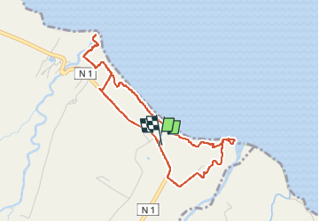
![](/images/other/stat-length.png)
![Trail Walking Basse-Pointe - Boucle de chalvet, Pécoule vers Chalvet. - Photo](https://media.geolcdn.com/t/1900/400/1e4cabaa-63c0-46f7-b111-2c87348cf0ee.jpg&format=pjpeg&maxdim=2)
Boucle de chalvet, Pécoule vers Chalvet.
GabyG
User GUIDE
![Length](/images/other/stat-length.png)
![Max alt](https://static1.geolcdn.com/siteimages/upload/files/1508320355ic_sort_altitude_max_24dp.png)
![Uphill gradient](https://static1.geolcdn.com/siteimages/upload/files/1508320355ic_sort_den_pos_24dp.png)
![Km-Effort](/images/other/stat-length.png)
![Min alt](https://static1.geolcdn.com/siteimages/upload/files/1508320355ic_sort_altitude_min_24dp.png)
![Downhill gradient](https://static1.geolcdn.com/siteimages/upload/files/1508320355ic_sort_den_neg_24dp.png)
![Boucle](https://static1.geolcdn.com/siteimages/upload/files/16400158638029165_repeat_loop_refresh_sync_direction_icon.png)
![Walking](https://static1.geolcdn.com/sitytour/trail-icons/101.png)
3h02
Difficulty : Medium
![Scan this QR Code to open this trail in the SityTrail application](https://capi.geolives.com/qq0zvz2zws4bq2lad0pu/sitytour/trails/3295594/qr.png?size=200)
FREE GPS app for hiking
About
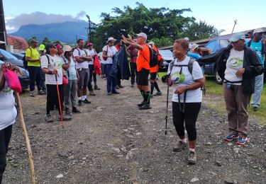
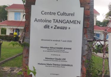
Trail Walking of 6.5 km to be discovered at Martinique, Unknown, Basse-Pointe. This trail is proposed by GabyG.
Description
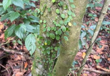
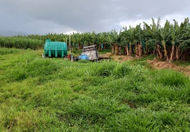
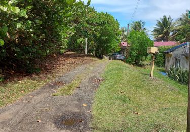
Randonnée de famille, en quittant le parking de Chalvet vers le site de fév. 74 ! faire une petite jonction vers l'embouchure de la rivière Capote, puis revenir vers le site et poursuivre sa randonnée. Arrivé à Pécoule avec un peut de temps devant soi, se rendre vers l'embouchure de la rivière Poquet, puis revenir vers l'Habitation Pécoule pour terminer la randonnée vers Chalvet.
Positioning
Comments
Trails nearby
![Trail Walking Le Lorrain - Boucle Lorrinoise via Morne Wawa - Photo](https://media.geolcdn.com/t/375/260/2260d5fa-b236-443e-94b6-198d12135800.jpg&format=jpg&maxdim=2)
![Walking Walking](https://static1.geolcdn.com/sitytour/trail-icons/101.png)
Walking
![](/images/other/stat-length.png)
![](https://static1.geolcdn.com/siteimages/upload/files/16400158638029165_repeat_loop_refresh_sync_direction_icon.png)
![Trail Walking Le Lorrain - Boucle Morne Capot via La Pirogue - Photo](https://media.geolcdn.com/t/375/260/88d336cd-6544-44b1-ab6c-880c93dcc1a4.jpg&format=jpg&maxdim=2)
![Walking Walking](https://static1.geolcdn.com/sitytour/trail-icons/101.png)
Walking
![](/images/other/stat-length.png)
![](https://static1.geolcdn.com/siteimages/upload/files/16400158638029165_repeat_loop_refresh_sync_direction_icon.png)
![Trail Walking L'Ajoupa-Bouillon - Cascade Dany - Photo](https://media.geolcdn.com/t/375/260/3f4633dd-5480-45ae-9d52-d53ad8f8f6d0.jpg&format=jpg&maxdim=2)
![Walking Walking](https://static1.geolcdn.com/sitytour/trail-icons/101.png)
Walking
![](/images/other/stat-length.png)
![](https://static1.geolcdn.com/siteimages/upload/files/16400158638029165_repeat_loop_refresh_sync_direction_icon.png)
![Walking Walking](https://static1.geolcdn.com/sitytour/trail-icons/101.png)
Walking
![](/images/other/stat-length.png)
![](https://static1.geolcdn.com/siteimages/upload/files/16400158638029165_repeat_loop_refresh_sync_direction_icon.png)
![Trail Walking Basse-Pointe - Exploitations agricoles en boucle N°1 - Photo](https://media.geolcdn.com/t/375/260/25d4e89e-0741-47b9-9c1b-39c4a8472812.jpg&format=jpg&maxdim=2)
![Walking Walking](https://static1.geolcdn.com/sitytour/trail-icons/101.png)
Walking
![](/images/other/stat-length.png)
![](https://static1.geolcdn.com/siteimages/upload/files/16400158638029165_repeat_loop_refresh_sync_direction_icon.png)
![Trail Walking Le Lorrain - Mornes Capot / Lorrain Martinique - Photo](https://media.geolcdn.com/t/375/260/bf3e9288-2731-4804-b2e5-dccb9a2b816e.jpg&format=jpg&maxdim=2)
![Walking Walking](https://static1.geolcdn.com/sitytour/trail-icons/101.png)
Walking
![](/images/other/stat-length.png)
![](https://static1.geolcdn.com/siteimages/upload/files/16400158638029165_repeat_loop_refresh_sync_direction_icon.png)
![Trail Walking Basse-Pointe - Grande Boucle sur Basse pointe. - Photo](https://media.geolcdn.com/t/375/260/08174d61-6359-47a0-ac79-c9191649aa79.jpg&format=jpg&maxdim=2)
![Walking Walking](https://static1.geolcdn.com/sitytour/trail-icons/101.png)
Walking
![](/images/other/stat-length.png)
![](https://static1.geolcdn.com/siteimages/upload/files/16400158638029165_repeat_loop_refresh_sync_direction_icon.png)
![Trail Walking Le Lorrain - trace des Amérindiens - Photo](https://media.geolcdn.com/t/375/260/5dbbcceb-f0b2-4ef7-8df6-def9c209f94d.jpg&format=jpg&maxdim=2)
![Walking Walking](https://static1.geolcdn.com/sitytour/trail-icons/101.png)
Walking
![](/images/other/stat-length.png)
![](https://static1.geolcdn.com/siteimages/upload/files/16400158638029165_repeat_loop_refresh_sync_direction_icon.png)
![Trail Walking Le Lorrain - Boucle La Crabiere - Hbt Assier - Photo](https://media.geolcdn.com/t/375/260/411cf4ff-70b2-4b04-9c7e-524092131d90.jpg&format=jpg&maxdim=2)
![Walking Walking](https://static1.geolcdn.com/sitytour/trail-icons/101.png)
Walking
![](/images/other/stat-length.png)
![](https://static1.geolcdn.com/siteimages/upload/files/16400158638029165_repeat_loop_refresh_sync_direction_icon.png)