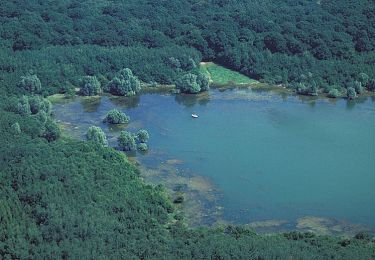
Trail Walking Hallignicourt - St Dizier Meeting aérien  - Photo

St Dizier Meeting aérien

 sgazaix
sgazaix

User

© OpenStreetMap contributors
Length
Length
8.5 km
Max alt
Max alt
137 m
Uphill gradient
Uphill gradient
41 m
Km-Effort
Km-Effort  
9 km
Min alt
Min alt
126 m
Downhill gradient
Downhill gradient
41 m
Boucle
Boucle
Yes
Creation date :
2022-06-25 07:37:33.871
Updated on :
2022-06-25 12:17:45.781

(0 Reviews)

Walking
Walking
2h28
Difficulty : Very easy

Scan this QR Code to open this trail in the SityTrail application

FREE GPS app for hiking

Logo SityTrail SityTrail

IGN / Geographical institutes

Download SityTrail from the App Store Download SityTrail from Google Play

Logo SityTrail SityTrail World

The world is yours!

Download SityTrail from the App Store Download SityTrail from Google Play Download SityTrail on Huawei AppGallery

About

Trail Walking of 8.5 km to be discovered at Grand Est, Haute-Marne, Hallignicourt. This trail is proposed by sgazaix.

Description

chaud et bruyant !

Elevation profile

Positioning

Country:
France
Region :
Grand Est
Department/Province :
Haute-Marne
Municipality :
Hallignicourt
Location:
Unknown
Start:(UTM)
638511 ; 5388332 (31U) N.

Trails nearby

Trail Mountain bike Éclaron-Braucourt-Sainte-Livière - Espace VTT FFC Lac du Der en Champagne - Circuit n°04 - Le Vieux Der - Photo
Mountain bike
tracegps

Mountain bike

Medium
Éclaron-Braucourt-Sainte-Livière, Grand Est, Haute-Marne, France
11.1 km | 12.1 km-effort
40min
Yes
Trail Walking Humbécourt - Humbécourt cimetière Nadine - Photo
Walking
Monique KOVAC

Walking

Humbécourt, Grand Est, Haute-Marne, France
8.3 km | 9.2 km-effort
2h 25min
Yes
Trail Walking Valcourt - Valcourt pneus matin Nadine ronces orties - Photo
Walking
René Kovac

Walking

Valcourt, Grand Est, Haute-Marne, France
8.1 km | 9 km-effort
2h 31min
Yes
Trail Walking Humbécourt - Humbécourt cimetière Nadine - Photo
Walking
René Kovac

Walking

Humbécourt, Grand Est, Haute-Marne, France
8.6 km | 9.7 km-effort
2h 38min
Yes
Trail Walking Moëslains - Virage Moeslains ASLH  pas dd tour ètang paint ball - Photo
Walking
René Kovac

Walking

Moëslains, Grand Est, Haute-Marne, France
6.8 km | 7.6 km-effort
2h 0min
Yes
Trail Walking Saint-Dizier - Ballastière Nadine - Photo
Walking
René Kovac

Walking

Saint-Dizier, Grand Est, Haute-Marne, France
9.1 km | 9.6 km-effort
2h 44min
Yes
Trail Walking Hallignicourt - La Garenne 9 kms - Photo
Walking
René Kovac

Walking

Hallignicourt, Grand Est, Haute-Marne, France
13.5 km | 14.4 km-effort
3h 2min
No
Trail Electric bike Éclaron-Braucourt-Sainte-Livière - Entre Ste Livière et le lac du Der - Photo
Electric bike
th.feur

Electric bike

Very easy
Éclaron-Braucourt-Sainte-Livière, Grand Est, Haute-Marne, France
29 km | 32 km-effort
2h 17min
Yes
Trail Walking Éclaron-Braucourt-Sainte-Livière - gps ou appli problème - Photo
Walking
Jeff_314

Walking

Medium
Éclaron-Braucourt-Sainte-Livière, Grand Est, Haute-Marne, France
7.9 km | 8.4 km-effort
2h 0min
Yes


Close
My subscriptions