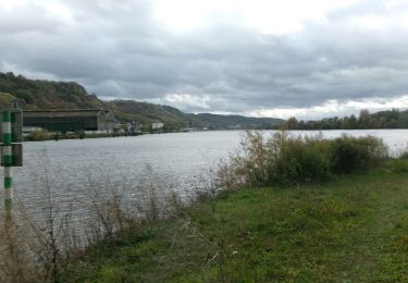
Trail Walking Déville-lès-Rouen - 2022-06-21_18h17m11_Cirkwi-Balade_le_long_du_Cailly - Photo

2022-06-21_18h17m11_Cirkwi-Balade_le_long_du_Cailly

 rvs147
rvs147

User

© OpenStreetMap contributors
Length
Length
5.1 km
Max alt
Max alt
37 m
Uphill gradient
Uphill gradient
47 m
Km-Effort
Km-Effort  
5.7 km
Min alt
Min alt
10 m
Downhill gradient
Downhill gradient
38 m
Boucle
Boucle
No
Creation date :
2022-06-21 16:17:11.782
Updated on :
2022-09-21 12:37:19.783

(0 Reviews)

Walking
Walking
1h18
Difficulty : Easy

Scan this QR Code to open this trail in the SityTrail application

FREE GPS app for hiking

Logo SityTrail SityTrail

IGN / Geographical institutes

Download SityTrail from the App Store Download SityTrail from Google Play

Logo SityTrail SityTrail World

The world is yours!

Download SityTrail from the App Store Download SityTrail from Google Play Download SityTrail on Huawei AppGallery

About

Trail Walking of 5.1 km to be discovered at Normandy, Seine-Maritime, Déville-lès-Rouen. This trail is proposed by rvs147.

Description

Au départ de la mairie de Déville, suivez les chemins aménagés le long du Cailly pour découvrir l'histoire industrielle de la vallée. Cette petite rivière a permis le développement, dès le Moyen-âge, de nombreux moulins tout le long de son cours. Mais elle a surtout connu une industrialisation intense, avec l'implantation à la fin du XVIIIe siècle, d'une puissante industrie textile utilisant la force motrice de ses eaux. En 1850, 51 filatures, 4 entreprises de tissage, 22 indienneries et 17 teintureries jalonnent un territoire long de 44km. L'urbanisation s'est accélérée elle aussi, par nécessité de loger la main d'oeuvre recrutée par ces établissements. Si, aujourd'hui, la majorité de ces entreprises a fermé, des vestiges de ce riche patrimoine industriel sont encore visibles. La roue Tifine, la cheminée Gresland et le musée de la Corderie Vallois, que  vous pourrez visiter en chemin, en sont les exemples les plus notables.

Elevation profile

Photos

Positioning

Country:
France
Region :
Normandy
Department/Province :
Seine-Maritime
Municipality :
Déville-lès-Rouen
Location:
Unknown
Start:(UTM)
358734 ; 5481522 (31U) N.

Trails nearby

Trail Walking Mont-Saint-Aignan - Mont-saint-aignan - Chasse-Marée -  - Photo
Walking
MichelRando7656

Walking

Difficult
(1)
Mont-Saint-Aignan, Normandy, Seine-Maritime, France
11.7 km | 15.2 km-effort
3h 27min
Yes
Trail Walking Le Houlme - 076-65-le Houlme Malaunay Canicule 9km - Photo
Walking
rvs147

Walking

Medium
(1)
Le Houlme, Normandy, Seine-Maritime, France
10 km | 13.7 km-effort
2h 56min
Yes
Trail Walking Canteleu - Canteleu - Montigny - GD - Photo
Walking
philippe76

Walking

Difficult
(1)
Canteleu, Normandy, Seine-Maritime, France
11.4 km | 13.3 km-effort
3h 0min
Yes
Trail Mountain bike Canteleu - Randonnée VTT Oxibike 2011 Canteleu 40 Kms - Photo
Mountain bike
tracegps

Mountain bike

Difficult
(1)
Canteleu, Normandy, Seine-Maritime, France
40 km | 49 km-effort
3h 0min
Yes
Trail Walking Rouen - Découverte du Vieux Rouen - Photo
Walking
rigol05

Walking

Medium
Rouen, Normandy, Seine-Maritime, France
9.6 km | 10.6 km-effort
2h 23min
Yes
Trail Walking Canteleu - Canteleu forêt monumentale - Photo
Walking
Klgmartini@2022

Walking

Medium
(1)
Canteleu, Normandy, Seine-Maritime, France
10 km | 11.4 km-effort
2h 35min
Yes
Trail Walking Rouen - 20231109-Rouen  - Photo
Walking
doudet

Walking

Easy
Rouen, Normandy, Seine-Maritime, France
3.2 km | 3.6 km-effort
57min
Yes
Trail Walking Le Houlme - 20231026-Le Houlme - Photo
Walking
doudet

Walking

Medium
Le Houlme, Normandy, Seine-Maritime, France
12 km | 15.7 km-effort
3h 29min
Yes
Trail Nordic walking Bois-Guillaume - MN - Bois-Guillaume - Bretèque - Photo
Nordic walking
philippe76

Nordic walking

Very easy
(1)
Bois-Guillaume, Normandy, Seine-Maritime, France
6.9 km | 7.9 km-effort
1h 15min
Yes


Close
My subscriptions