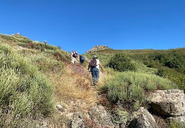
13.6 km | 23 km-effort
Prunet autour de Prunet
coureursdecretes
User
Length
13.7 km
Max alt
889 m
Uphill gradient
519 m
Km-Effort
21 km
Min alt
468 m
Downhill gradient
518 m
Boucle
Yes
Creation date :
2022-06-20 07:39:13.868
Updated on :
2023-12-01 11:07:30.647
4h56
Difficulty : Very difficult
FREE GPS app for hiking
About
Trail Walking of 13.7 km to be discovered at Auvergne-Rhône-Alpes, Ardèche, Prunet. This trail is proposed by coureursdecretes.
Description
piste puis forêt et calades
Positioning
Country:
France
Region :
Auvergne-Rhône-Alpes
Department/Province :
Ardèche
Municipality :
Prunet
Location:
Unknown
Start:(Dec)
Start:(UTM)
600121 ; 4938959 (31T) N.
Comments
Trails nearby
Jaujac Le Ventapet 14km
Walking
Very difficult
(1)
Jaujac,
Auvergne-Rhône-Alpes,
Ardèche,
France
5h 18min
Yes
roubreau col de bauzon
Mountain bike
Very difficult
(1)
Joannas,
Auvergne-Rhône-Alpes,
Ardèche,
France
65 km | 93 km-effort
6h 20min
Yes
07 pissas bouteillac
Walking
Medium
Rocles,
Auvergne-Rhône-Alpes,
Ardèche,
France
11.8 km | 23 km-effort
7h 12min
Yes
07 jaujac rocher de l aigle
Walking
Easy
(1)
Jaujac,
Auvergne-Rhône-Alpes,
Ardèche,
France
11.2 km | 19.7 km-effort
6h 23min
Yes
De la Souche à Jaujac
sport
Very easy
La Souche,
Auvergne-Rhône-Alpes,
Ardèche,
France
13.3 km | 18 km-effort
Unknown
No
07_jaujac_Orgues_9km360m
Walking
Medium
Jaujac,
Auvergne-Rhône-Alpes,
Ardèche,
France
9.1 km | 13.8 km-effort
3h 7min
Yes
La Souche : de Montflat au Rocher du Midi avec un retour par les Rudils
Walking
Difficult
La Souche,
Auvergne-Rhône-Alpes,
Ardèche,
France
6.8 km | 12.8 km-effort
2h 53min
Yes
rocle
Walking
Medium
Rocles,
Auvergne-Rhône-Alpes,
Ardèche,
France
8.3 km | 12.7 km-effort
2h 47min
Yes
Crêtes de Lentilleres
Walking
Very easy
(1)
Lentillères,
Auvergne-Rhône-Alpes,
Ardèche,
France
12.1 km | 18.9 km-effort
4h 52min
Yes