Trail  Saint-Germain-du-Teil - Cirkwi-Tombes_Juives - Photo
© OpenStreetMap contributors
Length
Length
21 km
Max alt
Max alt
984 m
Uphill gradient
Uphill gradient
763 m
Km-Effort
Km-Effort  
31 km
Min alt
Min alt
556 m
Downhill gradient
Downhill gradient
764 m
Boucle
Boucle
Yes
Creation date :
2022-06-15 13:36:24.379
Updated on :
2022-06-15 13:36:24.379

(0 Reviews)


Scan this QR Code to open this trail in the SityTrail application

FREE GPS app for hiking

Logo SityTrail SityTrail

IGN / Geographical institutes

Download SityTrail from the App Store Download SityTrail from Google Play

Logo SityTrail SityTrail World

The world is yours!

Download SityTrail from the App Store Download SityTrail from Google Play Download SityTrail on Huawei AppGallery

About

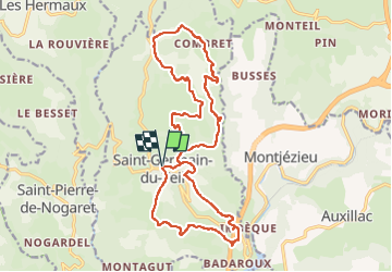
Trail of 21 km to be discovered at Occitania, Lozère, Saint-Germain-du-Teil. This trail is proposed by CASSISFRAMBOISE.

Description

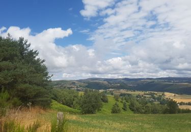
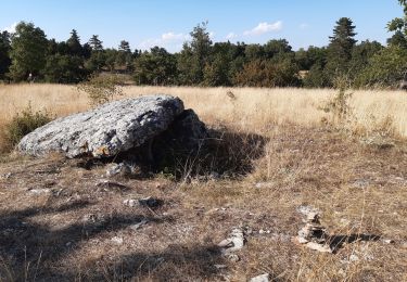
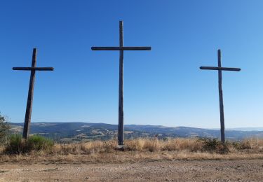
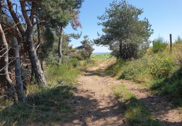
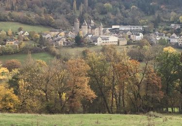
Serpenter sur les chemins ruraux de hameaux en hameaux alternant avec d'agréables passages en forêt.Remonter la rue des écoles pour traverser et remonter une route sur 1km jusqu'à une croix et tourner à gauche. Monter sur 300m et bifurquer à nouveau à gauche, continuer jusqu'à un croisement pour prendre à gauche. Descender sur 300m et prendre le chemin sur la droite qui surplombe le ruisseau jusqu'à l'autoroute.Passer sous l'autoroute et remonter dans le hameau de Malbousquet jusqu'à rejoindre la D52 pour la prendre sur la gauche. Après le pont, prendre le chemin sur la gauche pour les tombes juives (aller-retour), puis continuer sur la D52 sur 100m et prendre la route à droite, prendre le virage et droite et monter ensuite sur la gauche par la piste sur 2km.Arrivé aux maisons prendre à droite, puis à nouveau à droite après 150m. Au niveau du petit banc tourner à gauche sur le chemin rural, continuer jusqu'à arriver à une exploitation, la dépasser et tourner à droite. Descendre et tourner sur la gauche pour rejoindre le Picard. Remonter jusqu'à la Violle Basse, serpenter entre les maisons pour rejoindre Beauregard, dépasser le hameau. Après avoir marché 500m tourner à gauche, marcher à nouveau 500m et prendre à gauche. Une fois sur le goudron descendre jusqu'à la piste qui part sur la gauche en remontant dans la forêt, restez vigilant pour ne pas la manquer. A la sortie de la piste, prendre à droite et continuer tout droit jusqu'à une fourche, aller sur la droite.Au croisement prendre à droite eet descendre jusqu'au village de Combret, le traverser, dépasser l'église et descendre par la route jusq'au Bartassou. Remonter par la piste jusqu'à Champcros. Une fois dans le hameau prendre à gauche puis à droite et descendre dans la forêt. Continuer jusqu'à traverser un ruisseau puis regagner la route empruntée auparavant pour remonter jusqu'à l'exploitation et tourner à gauche vers Saint Germain du Teil.

Elevation profile

Points of interest

Point of interest Saint-Germain-du-Teil - Le Hameau du Combret et son église - Photo
CASSISFRAMBOISE
SAINT-GERMAIN-DU-TEIL 
Point of interest Saint-Germain-du-Teil - Terrains de chasses - Photo
CASSISFRAMBOISE
SAINT-GERMAIN-DU-TEIL 
Point of interest Saint-Germain-du-Teil - Les sépultures mérovingiennes du Malbousquet - Photo
CASSISFRAMBOISE
SAINT-GERMAIN-DU-TEIL 
Point of interest Saint-Germain-du-Teil - Croix de la Thieule - Photo
CASSISFRAMBOISE
SAINT-GERMAIN-DU-TEIL 

Positioning

Country:
France
Region :
Occitania
Department/Province :
Lozère
Municipality :
Saint-Germain-du-Teil
Location:
Unknown
Start:(UTM)
513566 ; 4925152 (31T) N.

Trails nearby

Trail Nordic walking Banassac-Canilhac - 48 La Canourgue Banassac Les grès rouges - Photo
Nordic walking
Maryma

Nordic walking

Easy
(1)
Banassac-Canilhac, Occitania, Lozère, France
12.5 km | 17.7 km-effort
2h 30min
Yes
Trail Walking Les Hermaux - Lou saltou - Photo
Walking
Bobzebob

Walking

Easy
Les Hermaux, Occitania, Lozère, France
17.4 km | 23 km-effort
4h 53min
Yes
Trail Walking Saint-Pierre-de-Nogaret - la croix du Pal - Photo
Walking
Bobzebob

Walking

Medium
Saint-Pierre-de-Nogaret, Occitania, Lozère, France
19.1 km | 26 km-effort
5h 1min
Yes
Trail Other activity Saint-Germain-du-Teil - fête amitié 15 mai - Photo
Other activity
colettedeltour

Other activity

Very easy
(1)
Saint-Germain-du-Teil, Occitania, Lozère, France
7.3 km | 9.7 km-effort
8min
Yes
Trail Walking Banassac-Canilhac - GR60 jour 7 - Photo
Walking
werth

Walking

Difficult
Banassac-Canilhac, Occitania, Lozère, France
22 km | 29 km-effort
9h 43min
No
Trail Walking Saint-Germain-du-Teil - GR60 je La Mothe - Photo
Walking
werth

Walking

Easy
Saint-Germain-du-Teil, Occitania, Lozère, France
10.4 km | 14 km-effort
3h 56min
No
Trail Walking Saint-Pierre-de-Nogaret - nogardel in live - Photo
Walking
CASSISFRAMBOISE

Walking

Medium
Saint-Pierre-de-Nogaret, Occitania, Lozère, France
21 km | 28 km-effort
5h 14min
Yes
Trail Other activity La Canourgue - le chemin des falaises  - Photo
Other activity
Lecoester

Other activity

Easy
La Canourgue, Occitania, Lozère, France
12.1 km | 16.4 km-effort
2h 55min
Yes
Trail Walking Saint-Germain-du-Teil - boraldes 1 - Photo
Walking
blancsylvain

Walking

Very difficult
Saint-Germain-du-Teil, Occitania, Lozère, France
11.4 km | 21 km-effort
6h 7min
No


Close
My subscriptions