


SityTrail - 3275012 - islande

DomiBrau
User

Length
44 km
Boucle
No
Creation date :
2022-06-13 20:05:01.0
Updated on :
2022-06-13 20:05:02.484

FREE GPS app for hiking
 SityTrail
IGN / Geographical institutes
SityTrail World
The world is yours!
About
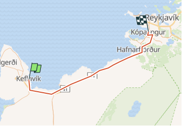
Trail of 44 km to be discovered at Unknown, Reykjanesbær. This trail is proposed by DomiBrau.
Positioning
Country:
Iceland
Region :
Unknown
Department/Province :
Reykjanesbær
Municipality :
Unknown
Location:
Unknown
Start:(Dec)
Start:(UTM)
424079 ; 7097710 (27V) N.
Comments
Trails nearby