![](/images/other/stat-length.png)
![Trail Bicycle tourism Le Pouzin - 2022_06_Ardèche_Boucle_de_6_jrs_332_km - Photo](https://media.geolcdn.com/t/1900/400/ffd58ebf-1b0e-4596-8488-f814a69e6618.jpg&format=pjpeg&maxdim=2)
2022_06_Ardèche_Boucle_de_6_jrs_332_km
ericf64
User
![Length](/images/other/stat-length.png)
Length
333 km
![Max alt](https://static1.geolcdn.com/siteimages/upload/files/1508320355ic_sort_altitude_max_24dp.png)
Max alt
825 m
![Uphill gradient](https://static1.geolcdn.com/siteimages/upload/files/1508320355ic_sort_den_pos_24dp.png)
Uphill gradient
4680 m
![Km-Effort](/images/other/stat-length.png)
Km-Effort
395 km
![Min alt](https://static1.geolcdn.com/siteimages/upload/files/1508320355ic_sort_altitude_min_24dp.png)
Min alt
36 m
![Downhill gradient](https://static1.geolcdn.com/siteimages/upload/files/1508320355ic_sort_den_neg_24dp.png)
Downhill gradient
4680 m
![Boucle](https://static1.geolcdn.com/siteimages/upload/files/16400158638029165_repeat_loop_refresh_sync_direction_icon.png)
Boucle
Yes
Creation date :
2022-06-13 13:27:26.434
Updated on :
2022-06-13 13:42:39.816
![Bicycle tourism](https://static1.geolcdn.com/sitytour/trail-icons/204.png)
1h00
Difficulty : Medium
![Scan this QR Code to open this trail in the SityTrail application](https://capi.geolives.com/qq0zvz2zws4bq2lad0pu/sitytour/trails/3280637/qr.png?size=200)
FREE GPS app for hiking
About
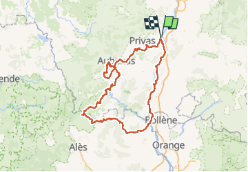
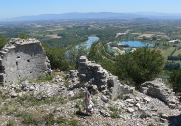
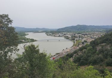
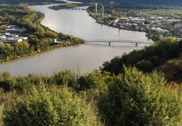
Trail Bicycle tourism of 333 km to be discovered at Auvergne-Rhône-Alpes, Ardèche, Le Pouzin. This trail is proposed by ericf64.
Description
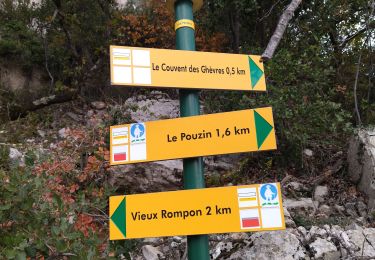
J1 Le Pouzin à Vogüé
J2 Vogüé à Vogüé
J3 Vogüé à Gagnières
J4 Gagnières à Goudargues
j5 Goudargues à Bourg St Andéol
j6 Bourg St Andéol à Le Pouzin
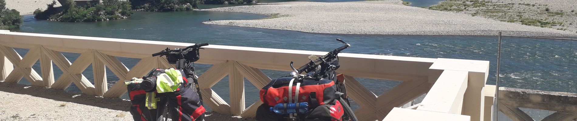
Parcours avec des parties sur chemins mais qui peuvent être évitées sur routes
Positioning
Country:
France
Region :
Auvergne-Rhône-Alpes
Department/Province :
Ardèche
Municipality :
Le Pouzin
Location:
Unknown
Start:(Dec)
Start:(UTM)
638390 ; 4956255 (31T) N.
Comments
Trails nearby
![Trail Walking Le Pouzin - 07 balcon Ouvèze pouzin - Photo](https://media.geolcdn.com/t/375/260/e1f893af-61d3-4cd8-a418-b5cde15229b8.jpg&format=jpg&maxdim=2)
![Walking Walking](https://static1.geolcdn.com/sitytour/trail-icons/101.png)
07 balcon Ouvèze pouzin
Walking
Medium
(1)
Le Pouzin,
Auvergne-Rhône-Alpes,
Ardèche,
France
![](/images/other/stat-length.png)
15.3 km | 24 km-effort
6h 58min
![](https://static1.geolcdn.com/siteimages/upload/files/16400158638029165_repeat_loop_refresh_sync_direction_icon.png)
No
![Trail Walking Saint-Symphorien-sous-Chomérac - St-Symphorien-sous-Chomerac](https://media.geolcdn.com/t/375/260/b69406d1-b9d6-4e5a-81ea-edd2877facfa.jpg&format=jpg&maxdim=2)
![Walking Walking](https://static1.geolcdn.com/sitytour/trail-icons/101.png)
St-Symphorien-sous-Chomerac "Col de Linte"11km.
Walking
Difficult
(2)
Saint-Symphorien-sous-Chomérac,
Auvergne-Rhône-Alpes,
Ardèche,
France
![](/images/other/stat-length.png)
11.4 km | 15.8 km-effort
3h 35min
![](https://static1.geolcdn.com/siteimages/upload/files/16400158638029165_repeat_loop_refresh_sync_direction_icon.png)
Yes
![Trail Walking Le Pouzin - Le Pouzin : Couvent des Chèvres 8km. - Photo](https://media.geolcdn.com/t/375/260/3b82990a-638d-4172-b8c9-858402e07317.jpg&format=jpg&maxdim=2)
![Walking Walking](https://static1.geolcdn.com/sitytour/trail-icons/101.png)
Le Pouzin : Couvent des Chèvres 8km.
Walking
Difficult
(1)
Le Pouzin,
Auvergne-Rhône-Alpes,
Ardèche,
France
![](/images/other/stat-length.png)
8.2 km | 12.8 km-effort
2h 55min
![](https://static1.geolcdn.com/siteimages/upload/files/16400158638029165_repeat_loop_refresh_sync_direction_icon.png)
Yes
![Trail Walking Baix - 07 baix 07 01 23 - Photo](https://media.geolcdn.com/t/375/260/6f38ce73-6c19-4eb6-98ff-8ad86517b683.jpg&format=jpg&maxdim=2)
![Walking Walking](https://static1.geolcdn.com/sitytour/trail-icons/101.png)
07 baix 07 01 23
Walking
Medium
Baix,
Auvergne-Rhône-Alpes,
Ardèche,
France
![](/images/other/stat-length.png)
16.5 km | 28 km-effort
7h 5min
![](https://static1.geolcdn.com/siteimages/upload/files/16400158638029165_repeat_loop_refresh_sync_direction_icon.png)
Yes
![Trail Walking Le Pouzin - 07 pouzin couvent des chèvres zel - Photo](https://media.geolcdn.com/t/375/260/27e3009c-a2c9-4a5b-9e79-278e69de3846.jpg&format=jpg&maxdim=2)
![Walking Walking](https://static1.geolcdn.com/sitytour/trail-icons/101.png)
07 pouzin couvent des chèvres zel
Walking
Medium
Le Pouzin,
Auvergne-Rhône-Alpes,
Ardèche,
France
![](/images/other/stat-length.png)
15.2 km | 24 km-effort
6h 32min
![](https://static1.geolcdn.com/siteimages/upload/files/16400158638029165_repeat_loop_refresh_sync_direction_icon.png)
Yes
![Walking Walking](https://static1.geolcdn.com/sitytour/trail-icons/101.png)
2023-10-29_11h20m28_Le Pouzin-Couvent Chèvres-Falaises 15km
Walking
Very difficult
Le Pouzin,
Auvergne-Rhône-Alpes,
Ardèche,
France
![](/images/other/stat-length.png)
14.7 km | 23 km-effort
5h 13min
![](https://static1.geolcdn.com/siteimages/upload/files/16400158638029165_repeat_loop_refresh_sync_direction_icon.png)
Yes
![Trail Walking Le Pouzin - le Pouzin le couvent des Chèvres vieux Rompon - Photo](https://media.geolcdn.com/t/375/260/2a1fff91-e20b-436c-b942-1b82467f68e9.jpg&format=jpg&maxdim=2)
![Walking Walking](https://static1.geolcdn.com/sitytour/trail-icons/101.png)
le Pouzin le couvent des Chèvres vieux Rompon
Walking
Easy
Le Pouzin,
Auvergne-Rhône-Alpes,
Ardèche,
France
![](/images/other/stat-length.png)
7.9 km | 12.4 km-effort
2h 49min
![](https://static1.geolcdn.com/siteimages/upload/files/16400158638029165_repeat_loop_refresh_sync_direction_icon.png)
Yes
![Trail Walking Saint-Julien-en-Saint-Alban - saint julien en Saint Alban-Le Pouzain 07 - Photo](https://media.geolcdn.com/t/375/260/1e4688d6-1dfb-4151-9a3f-8e9b2b55e268.jpg&format=jpg&maxdim=2)
![Walking Walking](https://static1.geolcdn.com/sitytour/trail-icons/101.png)
saint julien en Saint Alban-Le Pouzain 07
Walking
Very easy
Saint-Julien-en-Saint-Alban,
Auvergne-Rhône-Alpes,
Ardèche,
France
![](/images/other/stat-length.png)
35 km | 40 km-effort
2h 0min
![](https://static1.geolcdn.com/siteimages/upload/files/16400158638029165_repeat_loop_refresh_sync_direction_icon.png)
No
![Trail Walking Le Pouzin - Balcon de l'Ouvèze - Photo](https://media.geolcdn.com/t/375/260/60f01936-1b34-45ee-ae81-570080e25fbf.jpg&format=jpg&maxdim=2)
![Walking Walking](https://static1.geolcdn.com/sitytour/trail-icons/101.png)
Balcon de l'Ouvèze
Walking
Difficult
Le Pouzin,
Auvergne-Rhône-Alpes,
Ardèche,
France
![](/images/other/stat-length.png)
14.9 km | 23 km-effort
7h 2min
![](https://static1.geolcdn.com/siteimages/upload/files/16400158638029165_repeat_loop_refresh_sync_direction_icon.png)
No