Trail Walking Origny-Sainte-Benoite - Origny Sainte Benoite - Photo
 mjh
mjh

User

© OpenStreetMap contributors
Length
Length
16.6 km
Max alt
Max alt
125 m
Uphill gradient
Uphill gradient
145 m
Km-Effort
Km-Effort  
18.5 km
Min alt
Min alt
71 m
Downhill gradient
Downhill gradient
146 m
Boucle
Boucle
Yes
Creation date :
2022-06-12 08:02:26.918
Updated on :
2022-06-12 13:07:38.934

(0 Reviews)

Walking
Walking
4h06
Difficulty : Easy

Scan this QR Code to open this trail in the SityTrail application

FREE GPS app for hiking

Logo SityTrail SityTrail

IGN / Geographical institutes

Download SityTrail from the App Store Download SityTrail from Google Play

Logo SityTrail SityTrail World

The world is yours!

Download SityTrail from the App Store Download SityTrail from Google Play Download SityTrail on Huawei AppGallery

About

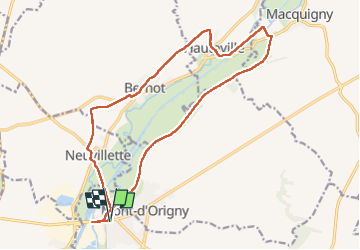
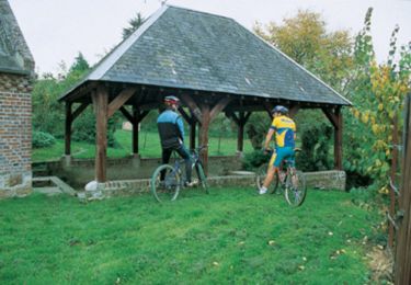
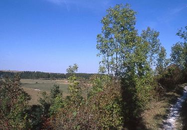
Trail Walking of 16.6 km to be discovered at Hauts-de-France, Aisne, Origny-Sainte-Benoite. This trail is proposed by mjh.

Description

jolie randonnée le lond de l'oise

Elevation profile

Photos

Positioning

Country:
France
Region :
Hauts-de-France
Department/Province :
Aisne
Municipality :
Origny-Sainte-Benoite
Location:
Unknown
Start:(UTM)
535070 ; 5520940 (31U) N.

Trails nearby

Trail Walking Sissy - Sissy sery-les-mézières Senercy chatillon-sur-oise - Photo
Walking
alainwald

Walking

Easy
Sissy, Hauts-de-France, Aisne, France
23 km | 26 km-effort
4h 32min
Yes
Trail Walking Fontaine-Notre-Dame - Fontaine-notre-Dame     -     Fonsomme     -    Fieulaine - Photo
Walking
alainwald

Walking

Easy
Fontaine-Notre-Dame, Hauts-de-France, Aisne, France
17.2 km | 20 km-effort
3h 27min
Yes
Trail Walking Mont-d'Origny - Falaise bloucard - Photo
Walking
ggguerin

Walking

Medium
Mont-d'Origny, Hauts-de-France, Aisne, France
6.2 km | 7.2 km-effort
1h 27min
Yes
Trail Mountain bike Sissy - Les étangs - Photo
Mountain bike
tracegps

Mountain bike

Medium
(1)
Sissy, Hauts-de-France, Aisne, France
26 km | 28 km-effort
3h 45min
Yes
Trail Walking Origny-Sainte-Benoite - Les Rayères - Photo
Walking
tracegps

Walking

Very difficult
(1)
Origny-Sainte-Benoite, Hauts-de-France, Aisne, France
15.5 km | 17.5 km-effort
4h 0min
Yes
Trail Walking Mont-d'Origny - bernot hauteville  - Photo
Walking
alainwald

Walking

Very easy
Mont-d'Origny, Hauts-de-France, Aisne, France
10 km | 11.2 km-effort
2h 55min
Yes
Trail Walking Mont-d'Origny - bernot autre circuit  - Photo
Walking
alainwald

Walking

Very easy
Mont-d'Origny, Hauts-de-France, Aisne, France
13.1 km | 15 km-effort
3h 17min
Yes
Trail Walking Mont-d'Origny - bernot par les eoliennes  - Photo
Walking
alainwald

Walking

Easy
Mont-d'Origny, Hauts-de-France, Aisne, France
15.8 km | 18.5 km-effort
4h 17min
Yes
Trail Mountain bike Thenelles - vtt avec Clément  - Photo
Mountain bike
alainwald

Mountain bike

Easy
Thenelles, Hauts-de-France, Aisne, France
59 km | 63 km-effort
4h 31min
Yes


Close
My subscriptions