21 km | 28 km-effort
pont de Térénez
aizat
User
Length
8.3 km
Max alt
89 m
Uphill gradient
166 m
Km-Effort
10.5 km
Min alt
0 m
Downhill gradient
166 m
Boucle
Yes
Creation date :
2022-06-09 07:18:35.913
Updated on :
2022-06-09 09:21:28.69
1h44
Difficulty : Very easy
FREE GPS app for hiking
About
Trail Nordic walking of 8.3 km to be discovered at Brittany, Finistère, Argol. This trail is proposed by aizat.
Description
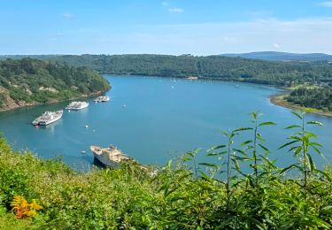
départ de Térénez Aulne et chapelle de Folgoet
Positioning
Country:
France
Region :
Brittany
Department/Province :
Finistère
Municipality :
Argol
Location:
Unknown
Start:(Dec)
Start:(UTM)
406158 ; 5346751 (30U) N.
Comments
Trails nearby
Le tour de Landévennec Boucle 21 km
Walking
Very difficult
Landévennec,
Brittany,
Finistère,
France
5h 10min
Yes
Landévennec - boucles locales et GR34 - 13.8km 250m 4h10 (35mn) - 2019 09 12
Walking
Easy
Landévennec,
Brittany,
Finistère,
France
13.8 km | 17.2 km-effort
4h 10min
Yes
Menez Hom_10,3km_Trace GPS
Walking
Medium
(1)
Trégarvan,
Brittany,
Finistère,
France
10.2 km | 14 km-effort
3h 0min
Yes
TREGARVAN_6,7km_Trace GPS
Walking
Easy
(1)
Trégarvan,
Brittany,
Finistère,
France
6.7 km | 8.4 km-effort
1h 50min
Yes
LANDÉVENNEC
Walking
Difficult
Landévennec,
Brittany,
Finistère,
France
19.4 km | 25 km-effort
4h 41min
No
les chemins de Telgruc
Walking
Easy
(1)
Telgruc-sur-Mer,
Brittany,
Finistère,
France
13.2 km | 16.1 km-effort
3h 45min
Yes
Térénez - Kerivin
Walking
Very easy
(1)
Argol,
Brittany,
Finistère,
France
11.9 km | 15 km-effort
3h 15min
Yes
Presqu'île Crozon - Day 02
Walking
Medium
Landévennec,
Brittany,
Finistère,
France
23 km | 30 km-effort
5h 54min
No
Belle balade