Trail 4x4 Molina de Aragón - Molinas de Aragon boucle 7 juin 22 - Photo

Molinas de Aragon boucle 7 juin 22

© OpenStreetMap contributors
Length
Length
217 km
Max alt
Max alt
1339 m
Uphill gradient
Uphill gradient
4148 m
Km-Effort
Km-Effort  
272 km
Min alt
Min alt
979 m
Downhill gradient
Downhill gradient
4145 m
Boucle
Boucle
Yes
Creation date :
2022-06-07 07:35:24.114
Updated on :
2022-06-07 17:44:55.825

(0 Reviews)

4x4
4x4
5h50
Difficulty : Very easy

Scan this QR Code to open this trail in the SityTrail application

FREE GPS app for hiking

Logo SityTrail SityTrail

IGN / Geographical institutes

Download SityTrail from the App Store Download SityTrail from Google Play

Logo SityTrail SityTrail World

The world is yours!

Download SityTrail from the App Store Download SityTrail from Google Play Download SityTrail on Huawei AppGallery

About

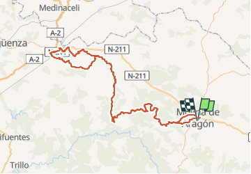
Trail 4x4 of 217 km to be discovered at Castile-La Mancha, Guadalajara, Molina de Aragón. This trail is proposed by CriCri .

Elevation profile

Positioning

Country:
Spain
Region :
Castile-La Mancha
Department/Province :
Guadalajara
Municipality :
Molina de Aragón
Location:
Unknown
Start:(UTM)
593819 ; 4520958 (30T) N.

Trails nearby

Trail 4x4 Molina de Aragón - Aragon Catalayut Albarrasin 8 juin 22 - Photo
4x4
CriCri

4x4

Very easy
Molina de Aragón, Castile-La Mancha, Guadalajara, Spain
167 km | 204 km-effort
4h 46min
No


Close
My subscriptions