Trail Walking Noyant-Villages - Pont ménard - Photo
 laoj
laoj

User

© OpenStreetMap contributors
Length
Length
5.6 km
Max alt
Max alt
69 m
Uphill gradient
Uphill gradient
58 m
Km-Effort
Km-Effort  
6.4 km
Min alt
Min alt
46 m
Downhill gradient
Downhill gradient
57 m
Boucle
Boucle
Yes
Creation date :
2022-06-06 13:08:42.08
Updated on :
2022-06-06 13:10:19.579

(0 Reviews)

Walking
Walking
1h27
Difficulty : Medium

Scan this QR Code to open this trail in the SityTrail application

FREE GPS app for hiking

Logo SityTrail SityTrail

IGN / Geographical institutes

Download SityTrail from the App Store Download SityTrail from Google Play

Logo SityTrail SityTrail World

The world is yours!

Download SityTrail from the App Store Download SityTrail from Google Play Download SityTrail on Huawei AppGallery

About

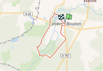
Trail Walking of 5.6 km to be discovered at Pays de la Loire, Maine-et-Loire, Noyant-Villages. This trail is proposed by laoj.

Description

sud linières bouton ballade en forêt de pont ménard

Elevation profile

Positioning

Country:
France
Region :
Pays de la Loire
Department/Province :
Maine-et-Loire
Municipality :
Noyant-Villages
Location:
Unknown
Start:(UTM)
279697 ; 5260544 (31T) N.

Trails nearby

Trail Walking Mouliherne - Mouliherne - Photo
Walking

Walking

Medium
Mouliherne, Pays de la Loire, Maine-et-Loire, France
10.9 km | 12.8 km-effort
2h 47min
Yes
Trail Walking Mouliherne - Au pays de l'escargot - Photo
Walking
laoj

Walking

Difficult
(1)
Mouliherne, Pays de la Loire, Maine-et-Loire, France
11.2 km | 13 km-effort
2h 50min
Yes
Trail Other activity Noyant-Villages - Angers-Noyant - Photo
Other activity
st141230

Other activity

Very easy
Noyant-Villages, Pays de la Loire, Maine-et-Loire, France
65 km | 70 km-effort
Unknown
No
Trail Running Vernantes - 2011-08-09 19h01m18 - Photo
Running
nitoglycerine

Running

Easy
Vernantes, Pays de la Loire, Maine-et-Loire, France
4.4 km | 5 km-effort
Unknown
Yes


Close
My subscriptions