


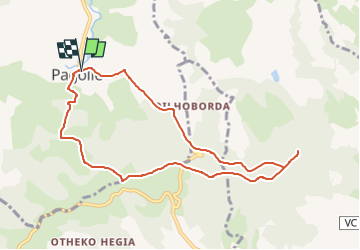

6.1 km | 8.9 km-effort


User GUIDE


FREE GPS app for hiking
 SityTrail
IGN / Geographical institutes
SityTrail World
The world is yours!
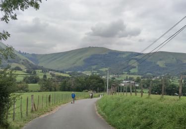
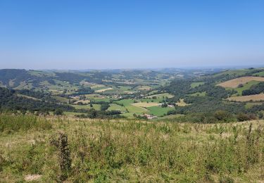
Trail Walking of 9.2 km to be discovered at New Aquitaine, Pyrénées-Atlantiques, Pagolle. This trail is proposed by LouisROGER.
tracé d'après Sity trail automatique
43 HKG E2 surement T2 R2

Walking
Walking

Walking
Walking

Walking

Walking

On foot
Walking

Walking