![](/images/other/stat-length.png)
Parc Robillard • Moulin de Montalon
Miclm
User
![Length](/images/other/stat-length.png)
![Max alt](https://static1.geolcdn.com/siteimages/upload/files/1508320355ic_sort_altitude_max_24dp.png)
![Uphill gradient](https://static1.geolcdn.com/siteimages/upload/files/1508320355ic_sort_den_pos_24dp.png)
![Km-Effort](/images/other/stat-length.png)
![Min alt](https://static1.geolcdn.com/siteimages/upload/files/1508320355ic_sort_altitude_min_24dp.png)
![Downhill gradient](https://static1.geolcdn.com/siteimages/upload/files/1508320355ic_sort_den_neg_24dp.png)
![Boucle](https://static1.geolcdn.com/siteimages/upload/files/16400158638029165_repeat_loop_refresh_sync_direction_icon.png)
![Walking](https://static1.geolcdn.com/sitytour/trail-icons/101.png)
48m
Difficulty : Easy
![Scan this QR Code to open this trail in the SityTrail application](https://capi.geolives.com/qq0zvz2zws4bq2lad0pu/sitytour/trails/3265665/qr.png?size=200)
FREE GPS app for hiking
About
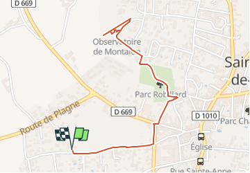
Trail Walking of 2.8 km to be discovered at New Aquitaine, Gironde, Saint-André-de-Cubzac. This trail is proposed by Miclm.
Description
Marche cool de 2.8 km
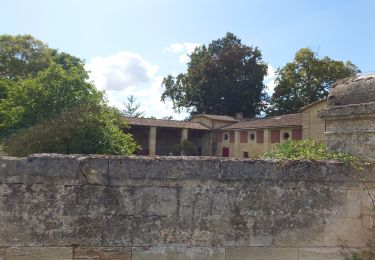
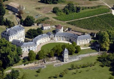
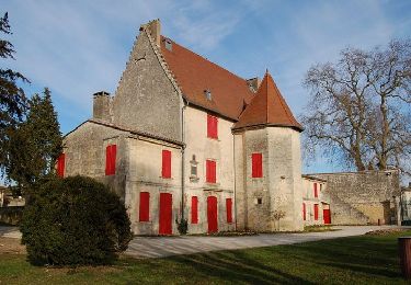
Parc et Château Robillard / jeux d'enfants
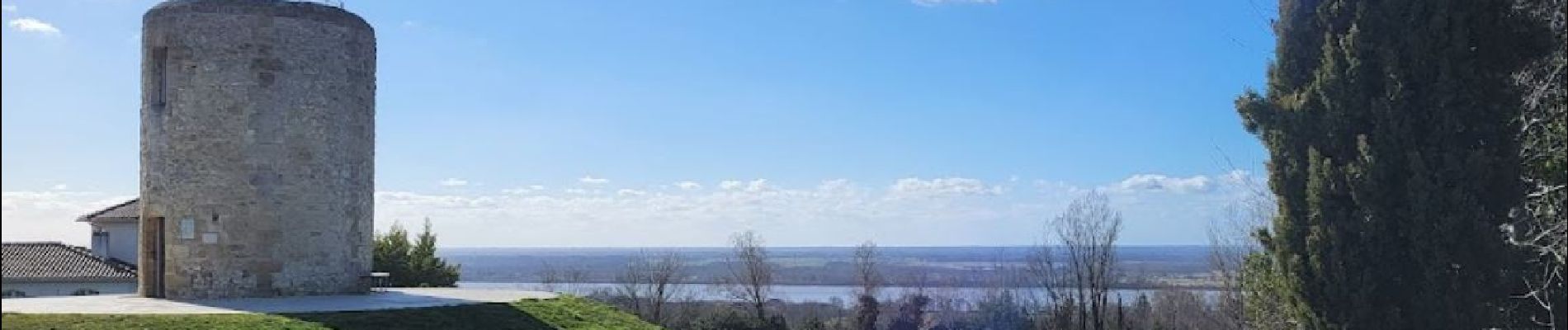
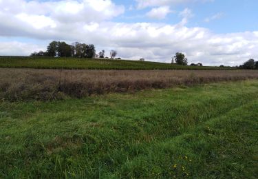
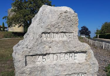
Moulin de Montalon / 45èm parallèle / Vue panoramique sur la Gironde
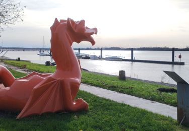
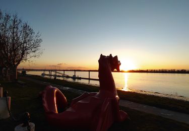
Selon saison magnifiques couchers de soleil
2.8 km cool walk
Park and Château Robillard / children's games
Moulin de Montalon / 45th parallel / Panoramic view of the Gironde
Depending on the season, magnificent sunsets
Positioning
Comments
Trails nearby
![Trail Walking Saint-André-de-Cubzac - Saint André de C2 - Photo](https://media.geolcdn.com/t/375/260/ext.jpg?maxdim=2&url=https%3A%2F%2Fstatic1.geolcdn.com%2Fsiteimages%2Fupload%2Ffiles%2F1553511878bg_sport_marche.png)
![Walking Walking](https://static1.geolcdn.com/sitytour/trail-icons/101.png)
Walking
![](/images/other/stat-length.png)
![](https://static1.geolcdn.com/siteimages/upload/files/16400158638029165_repeat_loop_refresh_sync_direction_icon.png)
![Trail Walking Saint-André-de-Cubzac - PLAGNE CUBZAC LES PONTS - Photo](https://media.geolcdn.com/t/375/260/88f1a1f5-ef6b-4e63-8c4f-954e01f741e5.jpg&format=jpg&maxdim=2)
![Walking Walking](https://static1.geolcdn.com/sitytour/trail-icons/101.png)
Walking
![](/images/other/stat-length.png)
![](https://static1.geolcdn.com/siteimages/upload/files/16400158638029165_repeat_loop_refresh_sync_direction_icon.png)
![Trail Walking Saint-Romain-la-Virvée - Asques - Photo](https://media.geolcdn.com/t/375/260/6c02e975-82bf-484e-b498-3a9dec8e76f5.jpg&format=jpg&maxdim=2)
![Walking Walking](https://static1.geolcdn.com/sitytour/trail-icons/101.png)
Walking
![](/images/other/stat-length.png)
![](https://static1.geolcdn.com/siteimages/upload/files/16400158638029165_repeat_loop_refresh_sync_direction_icon.png)
![Trail Walking Saint-André-de-Cubzac - Boucle St André - Photo](https://media.geolcdn.com/t/375/260/3b2cb73f-e91d-4da2-8005-6a734b71af46.jpg&format=jpg&maxdim=2)
![Walking Walking](https://static1.geolcdn.com/sitytour/trail-icons/101.png)
Walking
![](/images/other/stat-length.png)
![](https://static1.geolcdn.com/siteimages/upload/files/16400158638029165_repeat_loop_refresh_sync_direction_icon.png)
![Trail Walking Saint-André-de-Cubzac - SAINT ANDRE campagne 8.2 km - Photo](https://media.geolcdn.com/t/375/260/5a3a7ec0-cadd-4e90-9e7e-9c8d0d2d650d.jpg&format=jpg&maxdim=2)
![Walking Walking](https://static1.geolcdn.com/sitytour/trail-icons/101.png)
Walking
![](/images/other/stat-length.png)
![](https://static1.geolcdn.com/siteimages/upload/files/16400158638029165_repeat_loop_refresh_sync_direction_icon.png)
![Trail Walking Prignac-et-Marcamps - Prignac et mrc - Photo](https://media.geolcdn.com/t/375/260/a2f85a4b-fec6-49e1-8ec2-5e4e8a719a51.jpg&format=jpg&maxdim=2)
![Walking Walking](https://static1.geolcdn.com/sitytour/trail-icons/101.png)
Walking
![](/images/other/stat-length.png)
![](https://static1.geolcdn.com/siteimages/upload/files/16400158638029165_repeat_loop_refresh_sync_direction_icon.png)
![Trail Walking Saint-André-de-Cubzac - BALADE COTEAU DE MONTALON - Photo](https://media.geolcdn.com/t/375/260/6707bce7-330c-4003-84a4-f597d0484788.jpg&format=jpg&maxdim=2)
![Walking Walking](https://static1.geolcdn.com/sitytour/trail-icons/101.png)
Walking
![](/images/other/stat-length.png)
![](https://static1.geolcdn.com/siteimages/upload/files/16400158638029165_repeat_loop_refresh_sync_direction_icon.png)
![Walking Walking](https://static1.geolcdn.com/sitytour/trail-icons/101.png)
Walking
![](/images/other/stat-length.png)
![](https://static1.geolcdn.com/siteimages/upload/files/16400158638029165_repeat_loop_refresh_sync_direction_icon.png)
![Walking Walking](https://static1.geolcdn.com/sitytour/trail-icons/101.png)
Walking
![](/images/other/stat-length.png)
![](https://static1.geolcdn.com/siteimages/upload/files/16400158638029165_repeat_loop_refresh_sync_direction_icon.png)