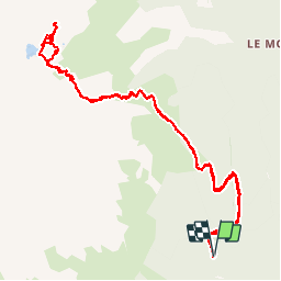
![](/images/other/stat-length.png)
![Trail Walking Allemond - Lac de Belledonne - Photo](https://media.geolcdn.com/t/1900/400/ext.pjpeg?maxdim=2&url=https%3A%2F%2Fservices.sitytrail.com%2FGeolivesWS%2FDownloadMedia.ashx%3FTrailID%3D325958%26Media%3Dfix__20140719114309.jpg)
Lac de Belledonne
Noiraude
User
![Length](/images/other/stat-length.png)
![Max alt](https://static1.geolcdn.com/siteimages/upload/files/1508320355ic_sort_altitude_max_24dp.png)
![Uphill gradient](https://static1.geolcdn.com/siteimages/upload/files/1508320355ic_sort_den_pos_24dp.png)
![Km-Effort](/images/other/stat-length.png)
![Min alt](https://static1.geolcdn.com/siteimages/upload/files/1508320355ic_sort_altitude_min_24dp.png)
![Downhill gradient](https://static1.geolcdn.com/siteimages/upload/files/1508320355ic_sort_den_neg_24dp.png)
![Boucle](https://static1.geolcdn.com/siteimages/upload/files/16400158638029165_repeat_loop_refresh_sync_direction_icon.png)
![Walking](https://static1.geolcdn.com/sitytour/trail-icons/101.png)
6h41
Difficulty : Medium
![Scan this QR Code to open this trail in the SityTrail application](https://capi.geolives.com/qq0zvz2zws4bq2lad0pu/sitytour/trails/325958/qr.png?size=200)
FREE GPS app for hiking
About
Trail Walking of 13.4 km to be discovered at Auvergne-Rhône-Alpes, Isère, Allemond. This trail is proposed by Noiraude.
Description
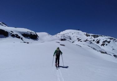
Agréable randonnée au départ d'Allemond sur un versant moins couru de Belledonne.
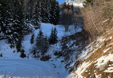
Sentier agréable qui démarre en forêt (départ un peu raide sur les premiers 500m)pour se poursuivre dans les Rhododendrons et Myrtilles.
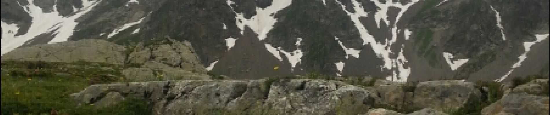
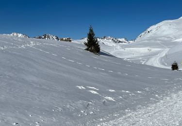
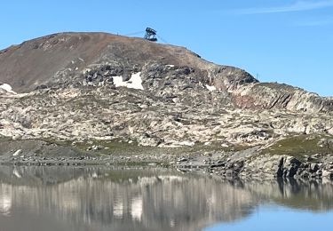
Un dernier effort pour passer le verrou du lac avant de découvrir un joli lac d'un bleu limpide au pied du grand pic de Belledonne.
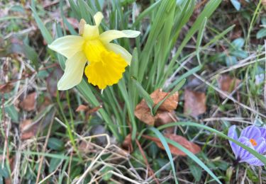
Beaucoup de faune dans le secteur (mouflons, aigles, chamois, bouquetins et marmottes).
Positioning
Comments
Trails nearby
![Trail Walking Allemond - allemond-les chalanches - Photo](https://media.geolcdn.com/t/375/260/ext.jpg?maxdim=2&url=https%3A%2F%2Fservices.sitytrail.com%2FGeolivesWS%2FDownloadMedia.ashx%3FTrailID%3D359050%26Media%3Dfix__20141101111257.jpg)
![Walking Walking](https://static1.geolcdn.com/sitytour/trail-icons/101.png)
Walking
![](/images/other/stat-length.png)
![](https://static1.geolcdn.com/siteimages/upload/files/16400158638029165_repeat_loop_refresh_sync_direction_icon.png)
![Trail Touring skiing Allemond - col PT 2459m près de la gde Lance d'Allemond - Photo](https://media.geolcdn.com/t/375/260/9c8ab575-4333-48a0-9046-13f36910fc12.jpg&format=jpg&maxdim=2)
![Touring skiing Touring skiing](https://static1.geolcdn.com/sitytour/trail-icons/503.png)
Touring skiing
![](/images/other/stat-length.png)
![](https://static1.geolcdn.com/siteimages/upload/files/16400158638029165_repeat_loop_refresh_sync_direction_icon.png)
![Trail Touring skiing Huez - tentative col de la pyramide et tricotage vers les lacs - Photo](https://media.geolcdn.com/t/375/260/1580236e-056d-49cc-9364-57fad8fab5e5.jpg&format=jpg&maxdim=2)
![Touring skiing Touring skiing](https://static1.geolcdn.com/sitytour/trail-icons/503.png)
Touring skiing
![](/images/other/stat-length.png)
![](https://static1.geolcdn.com/siteimages/upload/files/16400158638029165_repeat_loop_refresh_sync_direction_icon.png)
![Trail sport Vaujany - Randonnée - Photo](https://media.geolcdn.com/t/375/260/031a3bee-458a-4b9a-b2e3-d9cf5829f63e.jpg&format=jpg&maxdim=2)
sport
![](/images/other/stat-length.png)
![](https://static1.geolcdn.com/siteimages/upload/files/16400158638029165_repeat_loop_refresh_sync_direction_icon.png)
![Trail sport Vaujany - Raquettes dans sabot - Photo](https://media.geolcdn.com/t/375/260/1d7fce42-c97d-4bcb-be58-c648ac018506.jpg&format=jpg&maxdim=2)
sport
![](/images/other/stat-length.png)
![](https://static1.geolcdn.com/siteimages/upload/files/16400158638029165_repeat_loop_refresh_sync_direction_icon.png)
![Trail sport Vaujany - Orgieres - Photo](https://media.geolcdn.com/t/375/260/3b6ec6ca-b514-4adf-b590-4942c7f4475c.jpg&format=jpg&maxdim=2)
sport
![](/images/other/stat-length.png)
![](https://static1.geolcdn.com/siteimages/upload/files/16400158638029165_repeat_loop_refresh_sync_direction_icon.png)
![Trail Walking Allemond - Lac de Belledonne trace réelle - Photo](https://media.geolcdn.com/t/375/260/3c006e55-5416-422b-8475-727a88b53584.jpg&format=jpg&maxdim=2)
![Walking Walking](https://static1.geolcdn.com/sitytour/trail-icons/101.png)
Walking
![](/images/other/stat-length.png)
![](https://static1.geolcdn.com/siteimages/upload/files/16400158638029165_repeat_loop_refresh_sync_direction_icon.png)
![Trail Walking Vaujany - Sabot Aiguillettes Couard Lac de la Fare 2800 trace réelle - Photo](https://media.geolcdn.com/t/375/260/31a52714-3260-4a16-80d8-ce1486182f6b.jpg&format=jpg&maxdim=2)
![Walking Walking](https://static1.geolcdn.com/sitytour/trail-icons/101.png)
Walking
![](/images/other/stat-length.png)
![](https://static1.geolcdn.com/siteimages/upload/files/16400158638029165_repeat_loop_refresh_sync_direction_icon.png)
![Trail sport Allemond - Allemond et les hameaux - Photo](https://media.geolcdn.com/t/375/260/9ef2955e-597c-4a93-b262-e89ce8d66961.jpg&format=jpg&maxdim=2)
sport
![](/images/other/stat-length.png)
![](https://static1.geolcdn.com/siteimages/upload/files/16400158638029165_repeat_loop_refresh_sync_direction_icon.png)