![](/images/other/stat-length.png)
![Trail Walking Haacht - Wespelaar: Haachts Broek et Antitankgracht - Photo](https://media.geolcdn.com/t/1900/400/e85e6feb-7b0b-4775-a84c-505ebdc4aad1.jpeg&format=pjpeg&maxdim=2)
Wespelaar: Haachts Broek et Antitankgracht
dauzata
User
![Length](/images/other/stat-length.png)
Length
13.6 km
![Max alt](https://static1.geolcdn.com/siteimages/upload/files/1508320355ic_sort_altitude_max_24dp.png)
Max alt
15 m
![Uphill gradient](https://static1.geolcdn.com/siteimages/upload/files/1508320355ic_sort_den_pos_24dp.png)
Uphill gradient
76 m
![Km-Effort](/images/other/stat-length.png)
Km-Effort
14.6 km
![Min alt](https://static1.geolcdn.com/siteimages/upload/files/1508320355ic_sort_altitude_min_24dp.png)
Min alt
3 m
![Downhill gradient](https://static1.geolcdn.com/siteimages/upload/files/1508320355ic_sort_den_neg_24dp.png)
Downhill gradient
78 m
![Boucle](https://static1.geolcdn.com/siteimages/upload/files/16400158638029165_repeat_loop_refresh_sync_direction_icon.png)
Boucle
Yes
Creation date :
2022-05-27 10:42:23.0
Updated on :
2022-05-28 11:57:05.981
![Walking](https://static1.geolcdn.com/sitytour/trail-icons/101.png)
3h57
Difficulty : Easy
![Scan this QR Code to open this trail in the SityTrail application](https://capi.geolives.com/qq0zvz2zws4bq2lad0pu/sitytour/trails/3259420/qr.png?size=200)
FREE GPS app for hiking
About
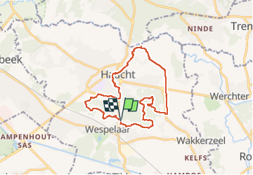
Trail Walking of 13.6 km to be discovered at Flanders, Flemish Brabant, Haacht. This trail is proposed by dauzata.
Description
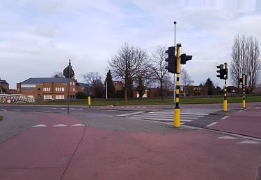
Départ: parking centre sportif de Wespelaar ( 5 Dijkstraat, 3150 Haacht)
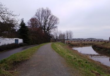
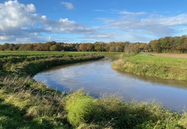
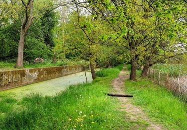
Parcours très sauvage par endroit !
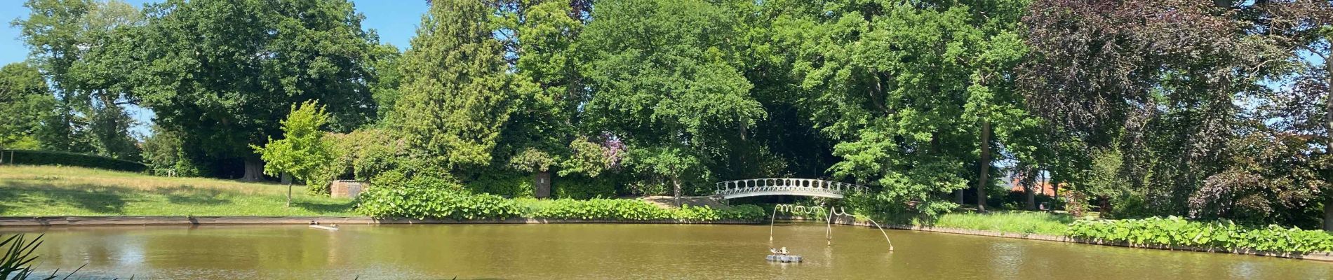
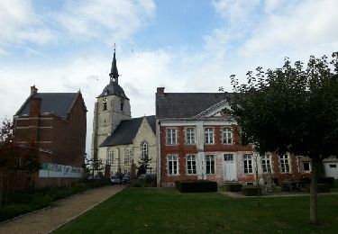
Positioning
Country:
Belgium
Region :
Flanders
Department/Province :
Flemish Brabant
Municipality :
Haacht
Location:
Wespelaar
Start:(Dec)
Start:(UTM)
615177 ; 5646939 (31U) N.
Comments
Trails nearby
![Trail Walking Bonheiden - Hever - Photo](https://media.geolcdn.com/t/375/260/ext.jpg?maxdim=2&url=https%3A%2F%2Fservices.sitytrail.com%2FGeolivesWS%2FDownloadMedia.ashx%3FTrailID%3D656803%26Media%3Dfix__20161020152445.jpg)
![Walking Walking](https://static1.geolcdn.com/sitytour/trail-icons/101.png)
![Trail Walking Haacht - Wespelaar - Leuven 22 km - Photo](https://media.geolcdn.com/t/375/260/0e0abcdd-4dc0-4fa3-9db9-e658c130a57b.jpg&format=jpg&maxdim=2)
![Walking Walking](https://static1.geolcdn.com/sitytour/trail-icons/101.png)
Wespelaar - Leuven 22 km
Walking
Medium
Haacht,
Flanders,
Flemish Brabant,
Belgium
![](/images/other/stat-length.png)
23 km | 26 km-effort
6h 2min
![](https://static1.geolcdn.com/siteimages/upload/files/16400158638029165_repeat_loop_refresh_sync_direction_icon.png)
No
![Trail On foot Rotselaar - Zegbroek Rood Vierkant - Photo](https://media.geolcdn.com/t/375/260/77e1137b-05dd-4358-a25f-2bc0db9b4976.jpeg&format=jpg&maxdim=2)
![On foot On foot](https://static1.geolcdn.com/sitytour/trail-icons/100.png)
Zegbroek Rood Vierkant
On foot
Easy
Rotselaar,
Flanders,
Flemish Brabant,
Belgium
![](/images/other/stat-length.png)
4.2 km | 4.4 km-effort
1h 0min
![](https://static1.geolcdn.com/siteimages/upload/files/16400158638029165_repeat_loop_refresh_sync_direction_icon.png)
Yes
![Trail On foot Rotselaar - Zegbroek Groene Ruit - Photo](https://media.geolcdn.com/t/375/260/77e1137b-05dd-4358-a25f-2bc0db9b4976.jpeg&format=jpg&maxdim=2)
![On foot On foot](https://static1.geolcdn.com/sitytour/trail-icons/100.png)
Zegbroek Groene Ruit
On foot
Easy
Rotselaar,
Flanders,
Flemish Brabant,
Belgium
![](/images/other/stat-length.png)
7.8 km | 8.3 km-effort
1h 53min
![](https://static1.geolcdn.com/siteimages/upload/files/16400158638029165_repeat_loop_refresh_sync_direction_icon.png)
Yes
![Trail On foot Rotselaar - Demer- en Dijlewandeling - Photo](https://media.geolcdn.com/t/375/260/07ab4046-9445-4412-b949-db02a814aaf8.jpeg&format=jpg&maxdim=2)
![On foot On foot](https://static1.geolcdn.com/sitytour/trail-icons/100.png)
Demer- en Dijlewandeling
On foot
Easy
Rotselaar,
Flanders,
Flemish Brabant,
Belgium
![](/images/other/stat-length.png)
11.4 km | 12.4 km-effort
2h 48min
![](https://static1.geolcdn.com/siteimages/upload/files/16400158638029165_repeat_loop_refresh_sync_direction_icon.png)
Yes
![Trail Walking Kampenhout - kalmthout1 - Photo](https://media.geolcdn.com/t/375/260/65b8a2b2-6179-4a30-95cf-59d99607e1c6.jpg&format=jpg&maxdim=2)
![Walking Walking](https://static1.geolcdn.com/sitytour/trail-icons/101.png)
kalmthout1
Walking
Very easy
Kampenhout,
Flanders,
Flemish Brabant,
Belgium
![](/images/other/stat-length.png)
11.3 km | 12 km-effort
3h 1min
![](https://static1.geolcdn.com/siteimages/upload/files/16400158638029165_repeat_loop_refresh_sync_direction_icon.png)
Yes
![Trail Walking Haacht - S-GR Dijleland: Haacht - Muizen - Photo](https://media.geolcdn.com/t/375/260/088fa55e-fe65-4e9b-8757-364eafed9bb1.jpeg&format=jpg&maxdim=2)
![Walking Walking](https://static1.geolcdn.com/sitytour/trail-icons/101.png)
S-GR Dijleland: Haacht - Muizen
Walking
Medium
Haacht,
Flanders,
Flemish Brabant,
Belgium
![](/images/other/stat-length.png)
17.1 km | 18.3 km-effort
4h 10min
![](https://static1.geolcdn.com/siteimages/upload/files/16400158638029165_repeat_loop_refresh_sync_direction_icon.png)
No
![Trail Walking Haacht - Haecht - Photo](https://media.geolcdn.com/t/375/260/3d78cd58-fd60-41d9-a7d8-78323be4334b.jpg&format=jpg&maxdim=2)
![Walking Walking](https://static1.geolcdn.com/sitytour/trail-icons/101.png)
Haecht
Walking
Difficult
Haacht,
Flanders,
Flemish Brabant,
Belgium
![](/images/other/stat-length.png)
17.6 km | 19 km-effort
4h 18min
![](https://static1.geolcdn.com/siteimages/upload/files/16400158638029165_repeat_loop_refresh_sync_direction_icon.png)
Yes
![Trail On foot Tremelo - Laekdal Blauwe Rechthoek - Photo](https://media.geolcdn.com/t/375/260/7d888d33-9d48-470a-b9f8-0f55a82f9335.jpeg&format=jpg&maxdim=2)
![On foot On foot](https://static1.geolcdn.com/sitytour/trail-icons/100.png)
Laekdal Blauwe Rechthoek
On foot
Easy
Tremelo,
Flanders,
Flemish Brabant,
Belgium
![](/images/other/stat-length.png)
5.3 km | 5.7 km-effort
1h 18min
![](https://static1.geolcdn.com/siteimages/upload/files/16400158638029165_repeat_loop_refresh_sync_direction_icon.png)
Yes