Trail Walking Viols-en-Laval - Tour du Pic Saint Loup - Et. 6 - Viols le Fort - Les Matelles - Photo

Tour du Pic Saint Loup - Et. 6 - Viols le Fort - Les Matelles

 Kargil
Kargil

User GUIDE

© OpenStreetMap contributors
Length
Length
21 km
Max alt
Max alt
265 m
Uphill gradient
Uphill gradient
378 m
Km-Effort
Km-Effort  
26 km
Min alt
Min alt
105 m
Downhill gradient
Downhill gradient
500 m
Boucle
Boucle
No
Creation date :
2022-05-24 06:01:21.195
Updated on :
2022-05-26 15:54:31.225

(0 Reviews)

Walking
Walking
5h53
Difficulty : Medium

Scan this QR Code to open this trail in the SityTrail application

FREE GPS app for hiking

Logo SityTrail SityTrail

IGN / Geographical institutes

Download SityTrail from the App Store Download SityTrail from Google Play

Logo SityTrail SityTrail World

The world is yours!

Download SityTrail from the App Store Download SityTrail from Google Play Download SityTrail on Huawei AppGallery

About

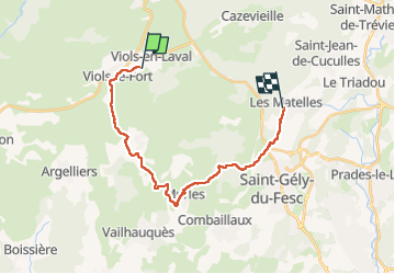
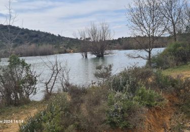
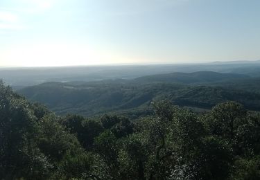
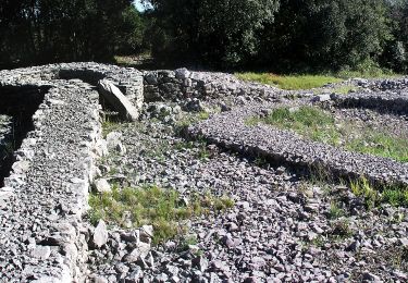
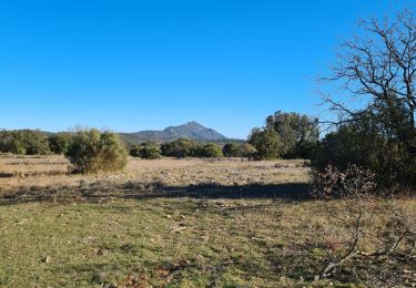
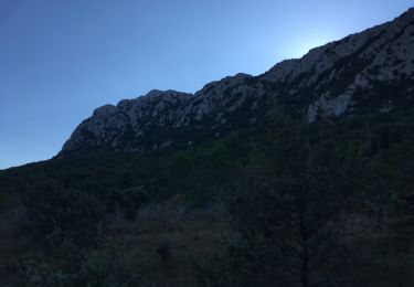
Trail Walking of 21 km to be discovered at Occitania, Hérault, Viols-en-Laval. This trail is proposed by Kargil.

Elevation profile

Photos

Points of interest

Point of interest Viols-le-Fort - Le Mas de l'escale - Photo
Kargil
VIOLS-LE-FORT 
Point of interest Viols-en-Laval - BnB A la Carte - Photo
Kargil
VIOLS-EN-LAVAL 
Point of interest Les Matelles - Les ailes des Matelles - Photo
Kargil
Point of interest Argelliers - Auberge de Saugras - Photo
Kargil
ARGELLIERS 

Positioning

Country:
France
Region :
Occitania
Department/Province :
Hérault
Municipality :
Viols-en-Laval
Location:
Unknown
Start:(UTM)
557925 ; 4843903 (31T) N.

Trails nearby

Trail Walking Viols-en-Laval - Fontaine Terou - Photo
Walking
daniel34

Walking

Medium
(1)
Viols-en-Laval, Occitania, Hérault, France
12.5 km | 14.9 km-effort
4h 5min
Yes
Trail Walking Saint-Martin-de-Londres - l'ouradou - Photo
Walking
genevieve

Walking

Medium
(1)
Saint-Martin-de-Londres, Occitania, Hérault, France
14.4 km | 19.2 km-effort
3h 39min
Yes
Trail Walking Viols-en-Laval - Viols-en-Laval - Cazarils - Montagne de Labat - Paillas - Photo
Walking
vertygo

Walking

Medium
(1)
Viols-en-Laval, Occitania, Hérault, France
15.7 km | 19.2 km-effort
4h 8min
Yes
Trail Walking Mas-de-Londres - La Jasse Cazevieille par l’ubac - Photo
Walking
daniel34

Walking

Medium
Mas-de-Londres, Occitania, Hérault, France
12.6 km | 16 km-effort
3h 43min
Yes
Trail Walking Saint-Martin-de-Londres - Saint-Martin-de-Londres-la-jasse - Photo
Walking
v.rabot

Walking

Medium
Saint-Martin-de-Londres, Occitania, Hérault, France
14.4 km | 17.1 km-effort
4h 16min
Yes
Trail Walking Mas-de-Londres - Mas de Londres - le Pic St Loup du 05-02-2024 - Photo
Walking
GUIDE
VANDERPUTTENMi

Walking

Very difficult
Mas-de-Londres, Occitania, Hérault, France
16.7 km | 25 km-effort
5h 40min
Yes
Trail On foot Viols-le-Fort - Circuit des dolmens de Viols-le-Fort à Cantagrils - Photo
On foot
GUIDE+

On foot

Easy
Viols-le-Fort, Occitania, Hérault, France
13.2 km | 16.6 km-effort
3h 46min
Yes
Trail Walking Viols-le-Fort - violslefort-avens-drailles - Photo
Walking
v.rabot

Walking

Medium
(1)
Viols-le-Fort, Occitania, Hérault, France
13.1 km | 15.2 km-effort
3h 30min
Yes
Trail Walking Mas-de-Londres - tour du Pic St Loup  - Photo
Walking
ajd26

Walking

Medium
Mas-de-Londres, Occitania, Hérault, France
14.8 km | 23 km-effort
4h 30min
Yes


Close
My subscriptions