![](/images/other/stat-length.png)
![Trail Horseback riding Unknown - 21 mai 2022 - Photo](https://media.geolcdn.com/t/1900/400/ext.pjpeg?maxdim=2&url=https%3A%2F%2Fstatic1.geolcdn.com%2Fsiteimages%2Fupload%2Ffiles%2F1524743154cheval.jpg)
21 mai 2022
roi
User
![Length](/images/other/stat-length.png)
![Max alt](https://static1.geolcdn.com/siteimages/upload/files/1508320355ic_sort_altitude_max_24dp.png)
![Uphill gradient](https://static1.geolcdn.com/siteimages/upload/files/1508320355ic_sort_den_pos_24dp.png)
![Km-Effort](/images/other/stat-length.png)
![Min alt](https://static1.geolcdn.com/siteimages/upload/files/1508320355ic_sort_altitude_min_24dp.png)
![Downhill gradient](https://static1.geolcdn.com/siteimages/upload/files/1508320355ic_sort_den_neg_24dp.png)
![Boucle](https://static1.geolcdn.com/siteimages/upload/files/16400158638029165_repeat_loop_refresh_sync_direction_icon.png)
![Horseback riding](https://static1.geolcdn.com/sitytour/trail-icons/301.png)
5h15
Difficulty : Medium
![Scan this QR Code to open this trail in the SityTrail application](https://capi.geolives.com/qq0zvz2zws4bq2lad0pu/sitytour/trails/3251414/qr.png?size=200)
FREE GPS app for hiking
About
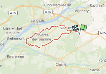
Trail Horseback riding of 26 km to be discovered at Centre-Loire Valley, Indre-et-Loire. This trail is proposed by roi.
Description
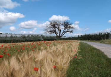
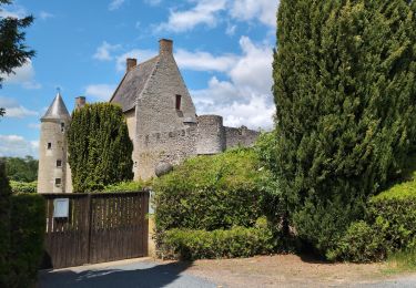
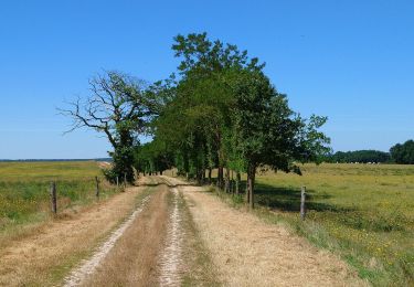
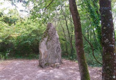
Rando fait toute seule. Arrêt casse-croûte en plein milieu. Première partie de balade avec des chemins avec pas mal de cailloux mais de la banquette pour y marcher tranquillement. Un superbe petit endroit pour avoir de l’eau sur les membres et se baigner un petit peu pour le cheval. Joli chemin. Pas non plus beaucoup d’ombre tout le temps. C’est en 5h10 d’activité, pour une moyenne de 5 km heures. J’ai beaucoup marché pour préserver mon cheval !
Positioning
Comments
Trails nearby
![Walking Walking](https://static1.geolcdn.com/sitytour/trail-icons/101.png)
Walking
![](/images/other/stat-length.png)
![](https://static1.geolcdn.com/siteimages/upload/files/16400158638029165_repeat_loop_refresh_sync_direction_icon.png)
![Trail Walking Vallères - Vallères le Hay - Zig zag Lignières-de-Touraine - 27.2km 300m 6h00 (50mn) - 2024 06 05 - Photo](https://media.geolcdn.com/t/375/260/b3324c15-4c92-4d98-acdf-5b4b32a3e010.jpg&format=jpg&maxdim=2)
![Walking Walking](https://static1.geolcdn.com/sitytour/trail-icons/101.png)
Walking
![](/images/other/stat-length.png)
![](https://static1.geolcdn.com/siteimages/upload/files/16400158638029165_repeat_loop_refresh_sync_direction_icon.png)
![Trail Walking Vallères - Vallères - Zig zag Manoir de Fontenay - 26.2km 350m 6h00 (35mn) - 2024 05 31 - Photo](https://media.geolcdn.com/t/375/260/2dd7bae2-e64d-4c31-aa25-080d87181237.jpg&format=jpg&maxdim=2)
![Walking Walking](https://static1.geolcdn.com/sitytour/trail-icons/101.png)
Walking
![](/images/other/stat-length.png)
![](https://static1.geolcdn.com/siteimages/upload/files/16400158638029165_repeat_loop_refresh_sync_direction_icon.png)
![Trail Walking Cinq-Mars-la-Pile - Cinq-Mars-la-Pile - Langeais - 14km 205m 3h05 - 2024 02 14 - Photo](https://media.geolcdn.com/t/375/260/bfe42b2e-405a-46df-8533-fbac70b0d338.jpg&format=jpg&maxdim=2)
![Walking Walking](https://static1.geolcdn.com/sitytour/trail-icons/101.png)
Walking
![](/images/other/stat-length.png)
![](https://static1.geolcdn.com/siteimages/upload/files/16400158638029165_repeat_loop_refresh_sync_direction_icon.png)
![Trail Walking Azay-le-Rideau - Azay-le-Rideau - Goupillières Baulay - 15.1km 185m 3h35 - 2022 07 12 - Photo](https://media.geolcdn.com/t/375/260/8707bc61-0cf0-4af2-87b1-fc906fb58702.jpg&format=jpg&maxdim=2)
![Walking Walking](https://static1.geolcdn.com/sitytour/trail-icons/101.png)
Walking
![](/images/other/stat-length.png)
![](https://static1.geolcdn.com/siteimages/upload/files/16400158638029165_repeat_loop_refresh_sync_direction_icon.png)
![Trail Walking Savonnières - Savonnières - les Fontaines GR3 et PRs - 20.1km 190m 4h40 - 2022 05 12 - Photo](https://media.geolcdn.com/t/375/260/58a53b1f-8878-4695-8af8-d5fb36baa215.jpg&format=jpg&maxdim=2)
![Walking Walking](https://static1.geolcdn.com/sitytour/trail-icons/101.png)
Walking
![](/images/other/stat-length.png)
![](https://static1.geolcdn.com/siteimages/upload/files/16400158638029165_repeat_loop_refresh_sync_direction_icon.png)
![Trail Walking Vallères - Vallères - Circuit 11km - 10.7km 115m 2h20 - 2020 07 11 - Photo](https://media.geolcdn.com/t/375/260/dacfb651-3bef-48cd-bbc1-bfa3f2be3086.jpg&format=jpg&maxdim=2)
![Walking Walking](https://static1.geolcdn.com/sitytour/trail-icons/101.png)
Walking
![](/images/other/stat-length.png)
![](https://static1.geolcdn.com/siteimages/upload/files/16400158638029165_repeat_loop_refresh_sync_direction_icon.png)
![Trail Walking - Druye - Sentier du menhir - 14km 95m 2h50 - 2019 08 03 - Photo](https://media.geolcdn.com/t/375/260/c6989684-aee6-4647-b6d8-0c0e44444f1d.jpg&format=jpg&maxdim=2)
![Walking Walking](https://static1.geolcdn.com/sitytour/trail-icons/101.png)
Walking
![](/images/other/stat-length.png)
![](https://static1.geolcdn.com/siteimages/upload/files/16400158638029165_repeat_loop_refresh_sync_direction_icon.png)
![Trail Walking Villandry - Villandry - Vallée du Vau - GR3 - 2016 02 27 - Photo](https://media.geolcdn.com/t/375/260/b4bedcce-c3ef-4637-9d7c-92bc166e5e4b.jpg&format=jpg&maxdim=2)
![Walking Walking](https://static1.geolcdn.com/sitytour/trail-icons/101.png)
Walking
![](/images/other/stat-length.png)
![](https://static1.geolcdn.com/siteimages/upload/files/16400158638029165_repeat_loop_refresh_sync_direction_icon.png)