Trail On foot Luz-Saint-Sauveur - Le Tour de Luz avec Sabine - Photo

Le Tour de Luz avec Sabine

© OpenStreetMap contributors
Length
Length
15.1 km
Max alt
Max alt
1249 m
Uphill gradient
Uphill gradient
799 m
Km-Effort
Km-Effort  
26 km
Min alt
Min alt
664 m
Downhill gradient
Downhill gradient
800 m
Boucle
Boucle
Yes
Creation date :
2022-05-18 13:32:56.863
Updated on :
2022-05-18 14:50:22.645

(0 Reviews)

On foot
On foot
5h51
Difficulty : Medium

Scan this QR Code to open this trail in the SityTrail application

FREE GPS app for hiking

Logo SityTrail SityTrail

IGN / Geographical institutes

Download SityTrail from the App Store Download SityTrail from Google Play

Logo SityTrail SityTrail World

The world is yours!

Download SityTrail from the App Store Download SityTrail from Google Play Download SityTrail on Huawei AppGallery

About

Trail On foot of 15.1 km to be discovered at Occitania, Hautespyrenees, Luz-Saint-Sauveur. This trail is proposed by mitch1952.

Description

Randonnée réalisée le 17 mai 2022 avec Sabine , très beau temps .
Le départ se fait du parking place centrale de Luz près de l' office de tourisme .
Il est recommandé de bien suivre  trace et waypoints pour vous aider .
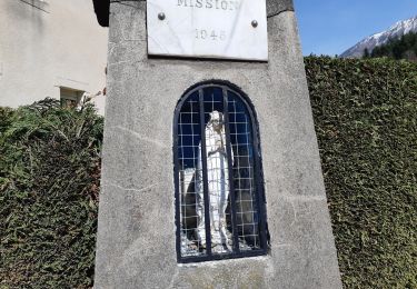
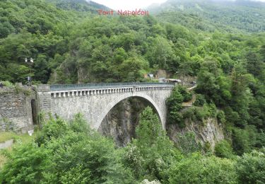
C' est ainsi que vous passerez à l' église des templiers ( ouverte  à visiter ) puis à la chapelle Solférino en empruntant la promenade Napoléon - Eugénie , ensuite descente en empruntant la route puis un sentier pour traverser le gave par le pont de Gontaud . Remonter à Saint Sauveur ( passage près de Luzéa ) . De là , prendre le superbe sentier en direction d' Agnouède avec un passage en marches d' escalier près de la cascade , vue panoramique sur Luz.
Ensuite pas mal de goudron de liaison entre les sentiers bucoliques ombragés .
La montée depuis le haut de Sazos est exigeante ( passages raides par endroit ) se fait par un sentier balisé fléché inversé.
Attaque de la descente d' abord par la route puis par un autre sentier pour atteindre Grust ( superbe village fleuri avec son belvédère lieu idéal pour se restaurer , admirer la vue ) son église ouverte à visiter puis au retour passage aux moulins de Sazos ( visite éventuelle sur demande préalable ) .
Retour par Sassis , on emprunte une passerelle puis  la promenade du Bastan aménagée qui nous ramène au point de départ .
Dommage pour le goudron , les sentiers utilisés, les différentes vues en valant la peine .
IBP 76 cotation E4 T3  R3

Elevation profile

Points of interest

Point of interest Luz-Saint-Sauveur - TdL01 - Photo
mitch1952
LUZ-SAINT-SAUVEUR 
Point of interest Luz-Saint-Sauveur - TdL02 - Photo
mitch1952
LUZ-SAINT-SAUVEUR 
Point of interest Luz-Saint-Sauveur - TdL03 - Photo
mitch1952
LUZ-SAINT-SAUVEUR 
Point of interest Luz-Saint-Sauveur - TdL04 - Photo
mitch1952
LUZ-SAINT-SAUVEUR 
Point of interest Luz-Saint-Sauveur - TdL05 - Photo
mitch1952
LUZ-SAINT-SAUVEUR 
Point of interest Luz-Saint-Sauveur - TdL06 - Photo
mitch1952
LUZ-SAINT-SAUVEUR 
Point of interest Luz-Saint-Sauveur - TdL07 - Photo
mitch1952
LUZ-SAINT-SAUVEUR 
Point of interest Luz-Saint-Sauveur - TdL08 - Photo
mitch1952
LUZ-SAINT-SAUVEUR 
Point of interest Luz-Saint-Sauveur - TdL09 - Photo
mitch1952
LUZ-SAINT-SAUVEUR 
Point of interest Luz-Saint-Sauveur - TdL10 - Photo
mitch1952
LUZ-SAINT-SAUVEUR 
Point of interest Luz-Saint-Sauveur - TdL11 - Photo
mitch1952
LUZ-SAINT-SAUVEUR 
Point of interest Luz-Saint-Sauveur - TdL12 - Photo
mitch1952
LUZ-SAINT-SAUVEUR 
Point of interest Sazos - TdL13 - Photo
mitch1952
SAZOS 
Point of interest Sazos - TdL14 - Photo
mitch1952
SAZOS 
Point of interest Sazos - TdL15 - Photo
mitch1952
SAZOS 
Point of interest Sazos - TdL16 - Photo
mitch1952
SAZOS 
Point of interest Sazos - TdL17 - Photo
mitch1952
SAZOS 
Point of interest Sazos - TdL18 - Photo
mitch1952
SAZOS 
Point of interest Sazos - TdL19 - Photo
mitch1952
SAZOS 
Point of interest Sazos - TdL20 - Photo
mitch1952
SAZOS 
Point of interest Sazos - TdL21 - Photo
mitch1952
SAZOS 
Point of interest Grust - TdL22 - Photo
mitch1952
GRUST 
Point of interest Grust - TdL23 - Photo
mitch1952
GRUST 
Point of interest Grust - TdL24 - Photo
mitch1952
GRUST 
Point of interest Sazos - TdL25 - Photo
mitch1952
SAZOS 
Point of interest Sazos - TdL26 - Photo
mitch1952
SAZOS 
Point of interest Sazos - TdL27 - Photo
mitch1952
SAZOS 
Point of interest Sassis - TdL28 - Photo
mitch1952
SASSIS 
Point of interest Sassis - TdL29 - Photo
mitch1952
SASSIS 

Positioning

Country:
France
Region :
Occitania
Department/Province :
Hautespyrenees
Municipality :
Luz-Saint-Sauveur
Location:
Unknown
Start:(UTM)
744845 ; 4751091 (30T) N.

Trails nearby

Trail Walking Sazos - Lac de Lagües - Photo
Walking
DuMarsan

Walking

Medium
(2)
Sazos, Occitania, Hautespyrenees, France
9.1 km | 18.9 km-effort
5h 14min
Yes
Trail Walking Grust - PIC DE VISCOS - Photo
Walking
PVERTICAL

Walking

Medium
(1)
Grust, Occitania, Hautespyrenees, France
10.5 km | 18.4 km-effort
4h 7min
Yes
Trail Walking Luz-Saint-Sauveur - Le Pic Bergons - Photo
Walking
tracegps

Walking

Medium
(2)
Luz-Saint-Sauveur, Occitania, Hautespyrenees, France
4.6 km | 10.2 km-effort
2h 10min
Yes
Trail On foot Esterre - SityTrail - ESTERRE Viella / Luz /  Esquieze /  Esterre en boucle bis - Photo
On foot
GUIDE
marmotte65

On foot

Very easy
(1)
Esterre, Occitania, Hautespyrenees, France
9.4 km | 15.5 km-effort
Unknown
Yes
Trail Walking Luz-Saint-Sauveur - Pic Bergons 2068m - Photo
Walking
tracegps

Walking

Medium
(1)
Luz-Saint-Sauveur, Occitania, Hautespyrenees, France
5.9 km | 14 km-effort
6h 0min
Yes
Trail Walking Sazos - Lac de Bastampe 2019m - Photo
Walking
tracegps

Walking

Difficult
(1)
Sazos, Occitania, Hautespyrenees, France
13 km | 27 km-effort
5h 0min
Yes
Trail On foot Esterre - ESTERRE  Villenave st Sauveur Luz Esterre G4
On foot
GUIDE
marmotte65

On foot

Easy
Esterre, Occitania, Hautespyrenees, France
9.4 km | 14.2 km-effort
3h 13min
Yes
Trail On foot Luz-Saint-Sauveur - LUZ SAINT SAUVEUR Les chemins de l agnouede bis - Photo
On foot
GUIDE
marmotte65

On foot

Easy
Luz-Saint-Sauveur, Occitania, Hautespyrenees, France
11.8 km | 18.5 km-effort
4h 12min
Yes
Trail Walking Luz-Saint-Sauveur - Luz Saint Sauveur  - Photo
Walking
GUIDE
donda

Walking

Easy
Luz-Saint-Sauveur, Occitania, Hautespyrenees, France
7.5 km | 10.3 km-effort
1h 48min
No


Close
My subscriptions