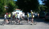

Vouglans

albert39
User

Length
79 km

Max alt
747 m

Uphill gradient
1312 m

Km-Effort
96 km

Min alt
348 m

Downhill gradient
1312 m
Boucle
Yes
Creation date :
2014-12-10 00:00:00.0
Updated on :
2014-12-10 00:00:00.0
4h40
Difficulty : Difficult

FREE GPS app for hiking
About
Trail Cycle of 79 km to be discovered at Bourgogne-Franche-Comté, Jura, La Tour-du-Meix. This trail is proposed by albert39.
Description
Sortie vélo journée. Parking Base de Loisir de Surchauffant. Repas resto midi. Circuit en deux boucles, matin par Onoz, Arinthod et Orgelet ; Après-midi, St Christophe, Pont-de-Poitte, Toiria, Meussia et retour voiture.
Positioning
Country:
France
Region :
Bourgogne-Franche-Comté
Department/Province :
Jura
Municipality :
La Tour-du-Meix
Location:
Unknown
Start:(Dec)
Start:(UTM)
704898 ; 5155274 (31T) N.
Comments
Trails nearby
Lac de Vouglans nord - La Tour-du-Meix


Mountain bike
Difficult
(3)
La Tour-du-Meix,
Bourgogne-Franche-Comté,
Jura,
France

36 km | 46 km-effort
3h 0min
Yes
Vouglans depuis St Christophe


Walking
Easy
(1)
La Tour-du-Meix,
Bourgogne-Franche-Comté,
Jura,
France

8.3 km | 10.8 km-effort
28h 50min
Yes
Thoiria : grotte et cascades


Walking
Medium
(1)
Thoiria,
Bourgogne-Franche-Comté,
Jura,
France

7.1 km | 9.6 km-effort
3h 26min
Yes
St Christophe


Walking
Very easy
La Tour-du-Meix,
Bourgogne-Franche-Comté,
Jura,
France

8.6 km | 11.3 km-effort
3h 25min
Yes
coyron


Walking
Medium
Coyron,
Bourgogne-Franche-Comté,
Jura,
France

12.8 km | 17.1 km-effort
5h 15min
Yes
coyron


Walking
Easy
Coyron,
Bourgogne-Franche-Comté,
Jura,
France

12.4 km | 17.1 km-effort
3h 37min
Yes
Jura - La tour du Meix VTT


Mountain bike
Medium
La Tour-du-Meix,
Bourgogne-Franche-Comté,
Jura,
France

17.8 km | 24 km-effort
2h 28min
Yes
Sentier Nature


On foot
Easy
Dompierre-sur-Mont,
Bourgogne-Franche-Comté,
Jura,
France

3.7 km | 4.4 km-effort
59min
Yes
Soucia


Walking
Medium
Barésia-sur-l'Ain,
Bourgogne-Franche-Comté,
Jura,
France

8.4 km | 10.9 km-effort
2h 20min
Yes


 SityTrail


