Trail Walking Les Déserts - Le Mont Peney en boucle - Photo

Le Mont Peney en boucle

 phidge
phidge

User

© OpenStreetMap contributors
Length
Length
7.8 km
Max alt
Max alt
1349 m
Uphill gradient
Uphill gradient
399 m
Km-Effort
Km-Effort  
13.1 km
Min alt
Min alt
1061 m
Downhill gradient
Downhill gradient
398 m
Boucle
Boucle
Yes
Creation date :
2022-05-16 13:00:20.478
Updated on :
2022-05-16 13:14:11.462

(0 Reviews)

Walking
Walking
2h59
Difficulty : Difficult

Scan this QR Code to open this trail in the SityTrail application

FREE GPS app for hiking

Logo SityTrail SityTrail

IGN / Geographical institutes

Download SityTrail from the App Store Download SityTrail from Google Play

Logo SityTrail SityTrail World

The world is yours!

Download SityTrail from the App Store Download SityTrail from Google Play Download SityTrail on Huawei AppGallery

About

Trail Walking of 7.8 km to be discovered at Auvergne-Rhône-Alpes, Savoy, Les Déserts. This trail is proposed by phidge.

Description

VISORANDO Très bons commentaires. près du gîte
Le Mont Peney en boucle
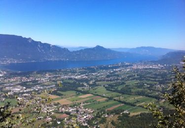
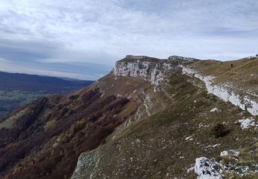
L'itinéraire traverse agréablement pâturages et forêts. Puis il longe un grand moment les crêtes du Peney avant d'arriver à son sommet; on profite alors de superbes points de vue sur les vallées et massifs environnants.
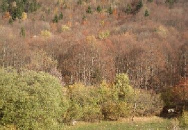
En automne, les feuillus des Bois du Peney et du Cruet offrent une palette de couleurs des plus chatoyantes.

Elevation profile

Points of interest

Point of interest Les Déserts - Place des Charmettes - Photo
phidge
LES DÉSERTS 
Point of interest Les Déserts - les bois 1140 - Photo
phidge
LES DÉSERTS 
Point of interest Saint-Jean-d'Arvey - Panneau Les Charmettes tourner à gauche - Photo
phidge
SAINT-JEAN-D'ARVEY 
Point of interest Saint-Jean-d'Arvey - Intersection - Photo
phidge
SAINT-JEAN-D'ARVEY 
Point of interest Saint-Jean-d'Arvey - Sur le col de la Doria 1170m - Photo
phidge
SAINT-JEAN-D'ARVEY 
Point of interest Saint-Jean-d'Arvey - Intersection Sous le Peney - Photo
phidge
SAINT-JEAN-D'ARVEY 
Point of interest Saint-Jean-d'Arvey - Mont Peney  - Photo
phidge
SAINT-JEAN-D'ARVEY 
Point of interest Saint-Jean-d'Arvey - Mont Peney 1356m - Photo
phidge
SAINT-JEAN-D'ARVEY 
Point of interest Saint-Jean-d'Arvey - sommet ? - Photo
phidge
SAINT-JEAN-D'ARVEY 
Point of interest Saint-Jean-d'Arvey - Passage de la Féclaz  - Photo
phidge
SAINT-JEAN-D'ARVEY 
Point of interest Saint-Jean-d'Arvey - passage de la Féclaz - Photo
phidge
SAINT-JEAN-D'ARVEY 
Point of interest Saint-Jean-d'Arvey - Intersection Le Bois du Peney - Photo
phidge
SAINT-JEAN-D'ARVEY 
Point of interest Saint-Jean-d'Arvey - Le bois du Peney. 1175m - Photo
phidge
SAINT-JEAN-D'ARVEY 
Point of interest Saint-Jean-d'Arvey - Intersection Léchat - Photo
phidge
SAINT-JEAN-D'ARVEY 
Point of interest Saint-Jean-d'Arvey - «Léchat» 1096m prendre sentier qui monte à droite - Photo
phidge
Point of interest Saint-Jean-d'Arvey - baraque forestière - Photo
phidge
SAINT-JEAN-D'ARVEY 
Point of interest Les Déserts - Intersection Les Bois - Photo
phidge
LES DÉSERTS 
Point of interest Les Déserts - Abreuvoir et panneau GR - Photo
phidge
Point of interest Les Déserts - Parc à bestiaux portail - Photo
phidge
Point of interest Les Déserts - Place des Charmettes - Photo
phidge
LES DÉSERTS 

Positioning

Country:
France
Region :
Auvergne-Rhône-Alpes
Department/Province :
Savoy
Municipality :
Les Déserts
Location:
Unknown
Start:(UTM)
266599 ; 5055487 (32T) N.

Trails nearby

Trail Running Saint-Jean-d'Arvey - Tour du plateau de la Leysse - Photo
Running
pzellner

Running

Very easy
(1)
Saint-Jean-d'Arvey, Auvergne-Rhône-Alpes, Savoy, France
47 km | 82 km-effort
10h 0min
Yes
Trail Walking Les Déserts - golet de l'agneau - Photo
Walking
druilhe

Walking

Medium
(1)
Les Déserts, Auvergne-Rhône-Alpes, Savoy, France
3.9 km | 10.2 km-effort
1h 44min
No
Trail Mountain bike Bassens - Pragondra - Photo
Mountain bike
Gorki

Mountain bike

Very easy
(1)
Bassens, Auvergne-Rhône-Alpes, Savoy, France
24 km | 34 km-effort
2h 49min
No
Trail Walking Les Déserts - Circuit de la Croix Nivolet - Photo
Walking
GUIDE
pscheven

Walking

Very easy
(1)
Les Déserts, Auvergne-Rhône-Alpes, Savoy, France
3.5 km | 5.6 km-effort
Unknown
Yes
Trail Snowshoes Thoiry - Bauges Pointe de la Galoppaz  - Photo
Snowshoes
c.gourme

Snowshoes

Medium
(1)
Thoiry, Auvergne-Rhône-Alpes, Savoy, France
9.7 km | 18.7 km-effort
4h 22min
Yes
Trail Walking Thoiry - le golet de l'agneau  - Photo
Walking
GUIDE
nadd73

Walking

Medium
Thoiry, Auvergne-Rhône-Alpes, Savoy, France
13.2 km | 26 km-effort
5h 20min
Yes
Trail Walking Les Déserts - Revard : La Féclaz - Photo
Walking
Celine1217

Walking

Easy
(1)
Les Déserts, Auvergne-Rhône-Alpes, Savoy, France
8.8 km | 10.6 km-effort
2h 22min
Yes
Trail Cycle Saint-Jean-d'Arvey - st jean meythet via plainpalais et semnoz - Photo
Cycle
jojoimothep

Cycle

Difficult
(1)
Saint-Jean-d'Arvey, Auvergne-Rhône-Alpes, Savoy, France
66 km | 92 km-effort
3h 16min
No
Trail Walking Saint-Alban-Leysse - 73- Le chemin des poussettes - Photo
Walking
cavpsy74

Walking

Easy
(1)
Saint-Alban-Leysse, Auvergne-Rhône-Alpes, Savoy, France
4.9 km | 10.6 km-effort
2h 2min
Yes


Close
My subscriptions