![](/images/other/stat-length.png)
![Trail Walking Zonnebeke - Ypres - Photo](https://media.geolcdn.com/t/1900/400/ext.pjpeg?maxdim=2&url=https%3A%2F%2Fmedia.geolcdn.com%2Ff%2F55018540-5b8f-47e0-93a7-52fe3762e9e1.jpg)
Ypres
Greg813
User
![Length](/images/other/stat-length.png)
Length
21 km
![Max alt](https://static1.geolcdn.com/siteimages/upload/files/1508320355ic_sort_altitude_max_24dp.png)
Max alt
71 m
![Uphill gradient](https://static1.geolcdn.com/siteimages/upload/files/1508320355ic_sort_den_pos_24dp.png)
Uphill gradient
252 m
![Km-Effort](/images/other/stat-length.png)
Km-Effort
24 km
![Min alt](https://static1.geolcdn.com/siteimages/upload/files/1508320355ic_sort_altitude_min_24dp.png)
Min alt
24 m
![Downhill gradient](https://static1.geolcdn.com/siteimages/upload/files/1508320355ic_sort_den_neg_24dp.png)
Downhill gradient
252 m
![Boucle](https://static1.geolcdn.com/siteimages/upload/files/16400158638029165_repeat_loop_refresh_sync_direction_icon.png)
Boucle
Yes
Creation date :
2022-05-15 07:38:20.924
Updated on :
2022-09-19 15:46:34.007
![Walking](https://static1.geolcdn.com/sitytour/trail-icons/101.png)
4h18
Difficulty : Medium
![Scan this QR Code to open this trail in the SityTrail application](https://capi.geolives.com/qq0zvz2zws4bq2lad0pu/sitytour/trails/3243214/qr.png?size=200)
FREE GPS app for hiking
About
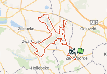
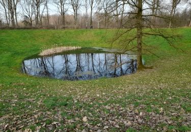
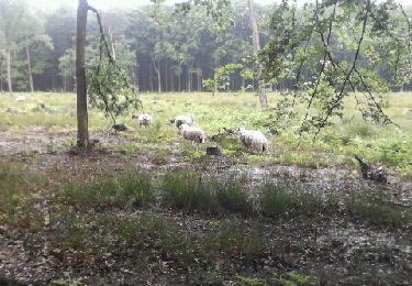
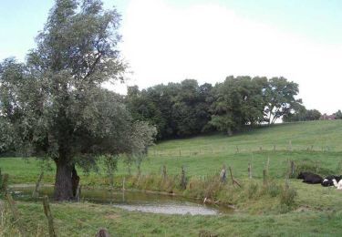
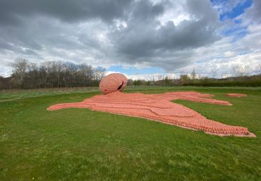
Trail Walking of 21 km to be discovered at Flanders, West Flanders, Zonnebeke. This trail is proposed by Greg813.
Description
Randonnée avec Mettons le Monde en Marche aux environs d'Ypres.
Découverte des tranchées de la première guerre mondiale et des nombreux monuments qui jalonnent le parcours.
Pour d'autres photos, voir le site de l'association :
https://mmm-rando.org/randonnee-ypres-2022/
Positioning
Country:
Belgium
Region :
Flanders
Department/Province :
West Flanders
Municipality :
Zonnebeke
Location:
Zandvoorde
Start:(Dec)
Start:(UTM)
498638 ; 5629072 (31U) N.
Comments
Trails nearby
![Trail On foot Wervik - Kruiseke wandelroute - Photo](https://media.geolcdn.com/t/375/260/ext.jpg?maxdim=2&url=https%3A%2F%2Fmedia.geolcdn.com%2Ff%2F4700ca75-a123-4e08-bea6-76f1c1794d28.jpeg)
![On foot On foot](https://static1.geolcdn.com/sitytour/trail-icons/100.png)
Kruiseke wandelroute
On foot
Easy
Wervik,
Flanders,
West Flanders,
Belgium
![](/images/other/stat-length.png)
6.3 km | 7 km-effort
1h 35min
![](https://static1.geolcdn.com/siteimages/upload/files/16400158638029165_repeat_loop_refresh_sync_direction_icon.png)
Yes
![Trail On foot Zonnebeke - Heksen wandelroute - Photo](https://media.geolcdn.com/t/375/260/ext.jpg?maxdim=2&url=https%3A%2F%2Fmedia.geolcdn.com%2Ff%2Fa9121705-01d0-4e7a-845d-18305b5164cf.jpeg)
![On foot On foot](https://static1.geolcdn.com/sitytour/trail-icons/100.png)
Heksen wandelroute
On foot
Easy
Zonnebeke,
Flanders,
West Flanders,
Belgium
![](/images/other/stat-length.png)
8.1 km | 8.9 km-effort
2h 2min
![](https://static1.geolcdn.com/siteimages/upload/files/16400158638029165_repeat_loop_refresh_sync_direction_icon.png)
Yes
![Trail Walking Wervicq-Sud - Milpattes - 08042013 - Photo](https://media.geolcdn.com/t/375/260/ext.jpg?maxdim=2&url=https%3A%2F%2Fstatic1.geolcdn.com%2Fsiteimages%2Fupload%2Ffiles%2F1553511878bg_sport_marche.png)
![Walking Walking](https://static1.geolcdn.com/sitytour/trail-icons/101.png)
Milpattes - 08042013
Walking
Easy
(1)
Wervicq-Sud,
Hauts-de-France,
Nord,
France
![](/images/other/stat-length.png)
9.1 km | 10.2 km-effort
2h 14min
![](https://static1.geolcdn.com/siteimages/upload/files/16400158638029165_repeat_loop_refresh_sync_direction_icon.png)
Yes
![Trail Walking Ypres - Palingbeek courte 8,4 - Photo](https://media.geolcdn.com/t/375/260/ext.jpg?maxdim=2&url=https%3A%2F%2Fmedia.geolcdn.com%2Ff%2F06feb11b-e53d-43cb-82a4-ec428dfd2584.jpg)
![Walking Walking](https://static1.geolcdn.com/sitytour/trail-icons/101.png)
Palingbeek courte 8,4
Walking
Medium
Ypres,
Flanders,
West Flanders,
Belgium
![](/images/other/stat-length.png)
8.2 km | 9.4 km-effort
1h 59min
![](https://static1.geolcdn.com/siteimages/upload/files/16400158638029165_repeat_loop_refresh_sync_direction_icon.png)
Yes
![Trail Mountain bike Wervik - vtt Wervik-Geluveld-Beselare - Photo](https://media.geolcdn.com/t/375/260/ext.jpg?maxdim=2&url=https%3A%2F%2Fstatic1.geolcdn.com%2Fsiteimages%2Fupload%2Ffiles%2F1524743154velo.jpg)
![Mountain bike Mountain bike](https://static1.geolcdn.com/sitytour/trail-icons/202.png)
vtt Wervik-Geluveld-Beselare
Mountain bike
Medium
(1)
Wervik,
Flanders,
West Flanders,
Belgium
![](/images/other/stat-length.png)
39 km | 43 km-effort
2h 51min
![](https://static1.geolcdn.com/siteimages/upload/files/16400158638029165_repeat_loop_refresh_sync_direction_icon.png)
Yes
![Trail Running Ypres - gasthuisbossen - Photo](https://media.geolcdn.com/t/375/260/ext.jpg?maxdim=2&url=https%3A%2F%2Fservices.sitytrail.com%2FGeolivesWS%2FDownloadMedia.ashx%3FTrailID%3D199917%26Media%3D20130623101720.jpeg)
![Running Running](https://static1.geolcdn.com/sitytour/trail-icons/103.png)
gasthuisbossen
Running
Easy
Ypres,
Flanders,
West Flanders,
Belgium
![](/images/other/stat-length.png)
14.6 km | 17.2 km-effort
1h 27min
![](https://static1.geolcdn.com/siteimages/upload/files/16400158638029165_repeat_loop_refresh_sync_direction_icon.png)
Yes
![Trail Walking Wervicq-Sud - Circuit de la Montagne (Wervicq-Sud) - Photo](https://media.geolcdn.com/t/375/260/ext.jpg?maxdim=2&url=https%3A%2F%2Fservices.sitytrail.com%2FGeolivesWS%2FDownloadMedia.ashx%3FTrailID%3D109308%26Media%3D3544_6.jpg)
![Walking Walking](https://static1.geolcdn.com/sitytour/trail-icons/101.png)
Circuit de la Montagne (Wervicq-Sud)
Walking
Easy
Wervicq-Sud,
Hauts-de-France,
Nord,
France
![](/images/other/stat-length.png)
6.4 km | 7.3 km-effort
1h 40min
![](https://static1.geolcdn.com/siteimages/upload/files/16400158638029165_repeat_loop_refresh_sync_direction_icon.png)
Yes
![Trail Walking Ypres - piste synder - Photo](https://media.geolcdn.com/t/375/260/ext.jpg?maxdim=2&url=https%3A%2F%2Fstatic1.geolcdn.com%2Fsiteimages%2Fupload%2Ffiles%2F1553511878bg_sport_marche.png)
![Walking Walking](https://static1.geolcdn.com/sitytour/trail-icons/101.png)
piste synder
Walking
Easy
(1)
Ypres,
Flanders,
West Flanders,
Belgium
![](/images/other/stat-length.png)
1.5 km | 1.8 km-effort
29min
![](https://static1.geolcdn.com/siteimages/upload/files/16400158638029165_repeat_loop_refresh_sync_direction_icon.png)
Yes
![Trail Walking Ypres - Oudevaartroute - Photo](https://media.geolcdn.com/t/375/260/ext.jpg?maxdim=2&url=https%3A%2F%2Fmedia.geolcdn.com%2Ff%2F67cadf35-30ae-42d7-9fcb-5ea58e83f547.jpg)
![Walking Walking](https://static1.geolcdn.com/sitytour/trail-icons/101.png)
Oudevaartroute
Walking
Very easy
Ypres,
Flanders,
West Flanders,
Belgium
![](/images/other/stat-length.png)
7 km | 7.6 km-effort
1h 58min
![](https://static1.geolcdn.com/siteimages/upload/files/16400158638029165_repeat_loop_refresh_sync_direction_icon.png)
Yes