![](/images/other/stat-length.png)
![Trail Walking Vernet-les-Bains - Abbaye de St Martin du Canigou - Photo](https://media.geolcdn.com/t/1900/400/992c8c9f-6640-4297-b6df-ae5050963d40.jpg&format=pjpeg&maxdim=2)
Abbaye de St Martin du Canigou
Dadou 1
User
![Length](/images/other/stat-length.png)
Length
8.1 km
![Max alt](https://static1.geolcdn.com/siteimages/upload/files/1508320355ic_sort_altitude_max_24dp.png)
Max alt
1047 m
![Uphill gradient](https://static1.geolcdn.com/siteimages/upload/files/1508320355ic_sort_den_pos_24dp.png)
Uphill gradient
398 m
![Km-Effort](/images/other/stat-length.png)
Km-Effort
13.4 km
![Min alt](https://static1.geolcdn.com/siteimages/upload/files/1508320355ic_sort_altitude_min_24dp.png)
Min alt
663 m
![Downhill gradient](https://static1.geolcdn.com/siteimages/upload/files/1508320355ic_sort_den_neg_24dp.png)
Downhill gradient
396 m
![Boucle](https://static1.geolcdn.com/siteimages/upload/files/16400158638029165_repeat_loop_refresh_sync_direction_icon.png)
Boucle
Yes
Creation date :
2022-05-11 11:53:27.0
Updated on :
2022-05-11 14:42:17.555
![Walking](https://static1.geolcdn.com/sitytour/trail-icons/101.png)
2h43
Difficulty : Difficult
![Scan this QR Code to open this trail in the SityTrail application](https://capi.geolives.com/qq0zvz2zws4bq2lad0pu/sitytour/trails/3238272/qr.png?size=200)
FREE GPS app for hiking
About
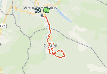
Trail Walking of 8.1 km to be discovered at Occitania, Pyrénées-Orientales, Vernet-les-Bains. This trail is proposed by Dadou 1.
Description
Départ hôtel du Portugal
Prendre la direction de Casteil
Prendre la direction de l’abbaye après le village de Casteil.
Retour par le sentier très difficile jusqu’à Casteil et reprendre les sentiers pour Vernet les bains.
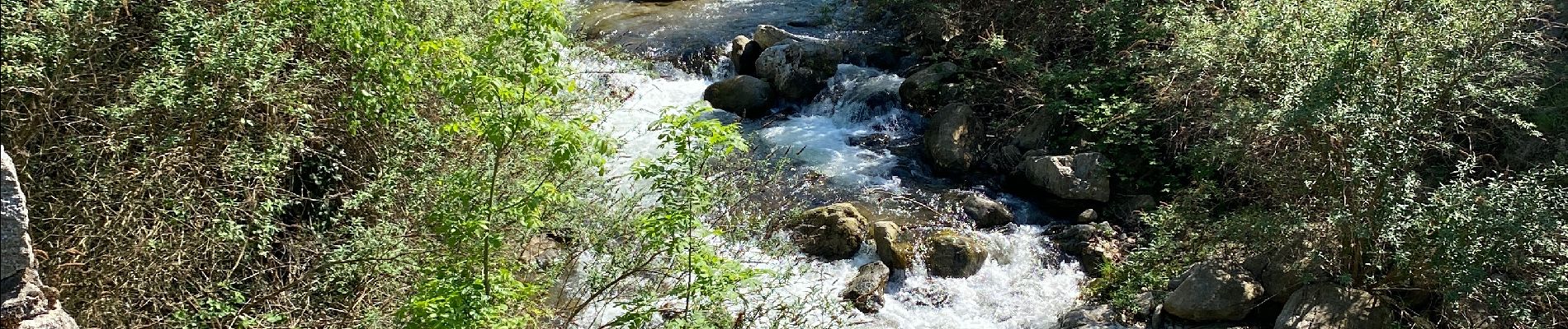
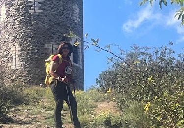
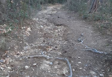
Positioning
Country:
France
Region :
Occitania
Department/Province :
Pyrénées-Orientales
Municipality :
Vernet-les-Bains
Location:
Unknown
Start:(Dec)
Start:(UTM)
449845 ; 4710404 (31T) N.
Comments
Trails nearby
![Trail Walking Casteil - rando casteil du cady - Photo](https://media.geolcdn.com/t/375/260/352b0394-d6dc-4c9d-b4d3-5f316da4dd05.jpg&format=jpg&maxdim=2)
![Walking Walking](https://static1.geolcdn.com/sitytour/trail-icons/101.png)
rando casteil du cady
Walking
Very easy
(1)
Casteil,
Occitania,
Pyrénées-Orientales,
France
![](/images/other/stat-length.png)
5.3 km | 8.7 km-effort
3h 16min
![](https://static1.geolcdn.com/siteimages/upload/files/16400158638029165_repeat_loop_refresh_sync_direction_icon.png)
No
![Trail Walking Vernet-les-Bains - La tour de Goa - Photo](https://media.geolcdn.com/t/375/260/ext.jpg?maxdim=2&url=https%3A%2F%2Fservices.sitytrail.com%2FGeolivesWS%2FDownloadMedia.ashx%3FTrailID%3D109701%26Media%3D4392_3.jpg)
![Walking Walking](https://static1.geolcdn.com/sitytour/trail-icons/101.png)
La tour de Goa
Walking
Difficult
(2)
Vernet-les-Bains,
Occitania,
Pyrénées-Orientales,
France
![](/images/other/stat-length.png)
15.4 km | 31 km-effort
6h 30min
![](https://static1.geolcdn.com/siteimages/upload/files/16400158638029165_repeat_loop_refresh_sync_direction_icon.png)
Yes
![Trail Walking Vernet-les-Bains - Cascade des Anglais à Vernet les Bains - Photo](https://media.geolcdn.com/t/375/260/ext.jpg?maxdim=2&url=https%3A%2F%2Fstatic1.geolcdn.com%2Fsiteimages%2Fupload%2Ffiles%2F1553511878bg_sport_marche.png)
![Walking Walking](https://static1.geolcdn.com/sitytour/trail-icons/101.png)
Cascade des Anglais à Vernet les Bains
Walking
Difficult
(1)
Vernet-les-Bains,
Occitania,
Pyrénées-Orientales,
France
![](/images/other/stat-length.png)
3.9 km | 6.6 km-effort
1h 34min
![](https://static1.geolcdn.com/siteimages/upload/files/16400158638029165_repeat_loop_refresh_sync_direction_icon.png)
Yes
![Trail Walking Sahorre - Mattes rouges - Photo](https://media.geolcdn.com/t/375/260/ext.jpg?maxdim=2&url=https%3A%2F%2Fservices.sitytrail.com%2FGeolivesWS%2FDownloadMedia.ashx%3FTrailID%3D161092%26Media%3D20121103105150.jpg)
![Walking Walking](https://static1.geolcdn.com/sitytour/trail-icons/101.png)
Mattes rouges
Walking
Medium
(1)
Sahorre,
Occitania,
Pyrénées-Orientales,
France
![](/images/other/stat-length.png)
11.5 km | 21 km-effort
4h 32min
![](https://static1.geolcdn.com/siteimages/upload/files/16400158638029165_repeat_loop_refresh_sync_direction_icon.png)
Yes
![Trail Walking Taurinya - le Canigou depuis le col de Millères - Photo](https://media.geolcdn.com/t/375/260/ext.jpg?maxdim=2&url=https%3A%2F%2Fstatic1.geolcdn.com%2Fsiteimages%2Fupload%2Ffiles%2F1553511878bg_sport_marche.png)
![Walking Walking](https://static1.geolcdn.com/sitytour/trail-icons/101.png)
le Canigou depuis le col de Millères
Walking
Difficult
(1)
Taurinya,
Occitania,
Pyrénées-Orientales,
France
![](/images/other/stat-length.png)
22 km | 48 km-effort
8h 30min
![](https://static1.geolcdn.com/siteimages/upload/files/16400158638029165_repeat_loop_refresh_sync_direction_icon.png)
Yes
![Trail Walking Taurinya - b - Photo](https://media.geolcdn.com/t/375/260/3dd340e8-99b2-41f7-a00f-44f941b5bfec.jpg&format=jpg&maxdim=2)
![Walking Walking](https://static1.geolcdn.com/sitytour/trail-icons/101.png)
b
Walking
Very difficult
Taurinya,
Occitania,
Pyrénées-Orientales,
France
![](/images/other/stat-length.png)
14.7 km | 23 km-effort
6h 7min
![](https://static1.geolcdn.com/siteimages/upload/files/16400158638029165_repeat_loop_refresh_sync_direction_icon.png)
Yes
![Trail sport Corneilla-de-Conflent - 20241219 Boucle depuis Villefranche-de-Conflent - Photo](https://media.geolcdn.com/t/375/260/181e15a5-6185-4f02-acf7-8c66afb44142.jpg&format=jpg&maxdim=2)
20241219 Boucle depuis Villefranche-de-Conflent
sport
Very easy
Corneilla-de-Conflent,
Occitania,
Pyrénées-Orientales,
France
![](/images/other/stat-length.png)
18 km | 29 km-effort
Unknown
![](https://static1.geolcdn.com/siteimages/upload/files/16400158638029165_repeat_loop_refresh_sync_direction_icon.png)
Yes
![Trail Walking Vernet-les-Bains - Tour de Goa - Vernet les Bains -Pyrénées Orientales - Photo](https://media.geolcdn.com/t/375/260/c3e59293-b0f6-4e05-8fb8-b01c4600098f.jpg&format=jpg&maxdim=2)
![Walking Walking](https://static1.geolcdn.com/sitytour/trail-icons/101.png)
Tour de Goa - Vernet les Bains -Pyrénées Orientales
Walking
Difficult
Vernet-les-Bains,
Occitania,
Pyrénées-Orientales,
France
![](/images/other/stat-length.png)
10.8 km | 18.8 km-effort
5h 37min
![](https://static1.geolcdn.com/siteimages/upload/files/16400158638029165_repeat_loop_refresh_sync_direction_icon.png)
Yes
![Trail Walking Fuilla - fuilla (66) - Photo](https://media.geolcdn.com/t/375/260/52a4cc98-58c8-4d12-9f81-88a2231fa3d3.jpg&format=jpg&maxdim=2)
![Walking Walking](https://static1.geolcdn.com/sitytour/trail-icons/101.png)
fuilla (66)
Walking
Difficult
Fuilla,
Occitania,
Pyrénées-Orientales,
France
![](/images/other/stat-length.png)
11.7 km | 17.8 km-effort
5h 57min
![](https://static1.geolcdn.com/siteimages/upload/files/16400158638029165_repeat_loop_refresh_sync_direction_icon.png)
Yes