![](/images/other/stat-length.png)
![Trail Walking Le Quesnoy - circuit des rempart - Photo](https://media.geolcdn.com/t/1900/400/ext.pjpeg?maxdim=2&url=https%3A%2F%2Fstatic1.geolcdn.com%2Fsiteimages%2Fupload%2Ffiles%2F1553511878bg_sport_marche.png)
circuit des rempart
rmc59
User
![Length](/images/other/stat-length.png)
Length
4.2 km
![Max alt](https://static1.geolcdn.com/siteimages/upload/files/1508320355ic_sort_altitude_max_24dp.png)
Max alt
135 m
![Uphill gradient](https://static1.geolcdn.com/siteimages/upload/files/1508320355ic_sort_den_pos_24dp.png)
Uphill gradient
40 m
![Km-Effort](/images/other/stat-length.png)
Km-Effort
4.8 km
![Min alt](https://static1.geolcdn.com/siteimages/upload/files/1508320355ic_sort_altitude_min_24dp.png)
Min alt
116 m
![Downhill gradient](https://static1.geolcdn.com/siteimages/upload/files/1508320355ic_sort_den_neg_24dp.png)
Downhill gradient
39 m
![Boucle](https://static1.geolcdn.com/siteimages/upload/files/16400158638029165_repeat_loop_refresh_sync_direction_icon.png)
Boucle
Yes
Creation date :
2018-08-17 14:31:57.91
Updated on :
2018-08-17 14:31:57.91
![Walking](https://static1.geolcdn.com/sitytour/trail-icons/101.png)
1h12
Difficulty : Unknown
![Scan this QR Code to open this trail in the SityTrail application](https://capi.geolives.com/qq0zvz2zws4bq2lad0pu/sitytour/trails/323204/qr.png?size=200)
FREE GPS app for hiking
About
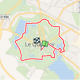
Trail Walking of 4.2 km to be discovered at Hauts-de-France, Nord, Le Quesnoy. This trail is proposed by rmc59.
Description
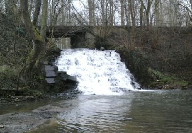
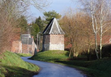
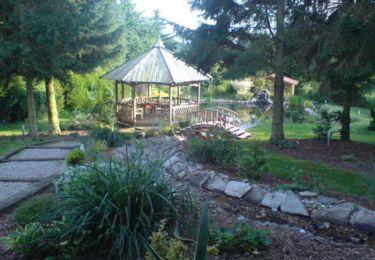
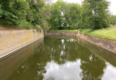
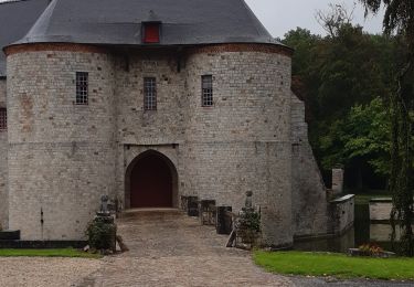
Au cœur de la citadelle quercitaine, découvrez les ouvrages de défense élaborés sous Charles Quint et Louis XIV. En période de pluie, le port de chaussures étanches est nécessaire.
Positioning
Country:
France
Region :
Hauts-de-France
Department/Province :
Nord
Municipality :
Le Quesnoy
Location:
Unknown
Start:(Dec)
Start:(UTM)
545396 ; 5566202 (31U) N.
Comments
Trails nearby
![Trail Walking Villers-Pol - Circuit de la Cascade de Quélipont - Photo](https://media.geolcdn.com/t/375/260/ext.jpg?maxdim=2&url=https%3A%2F%2Fservices.sitytrail.com%2FGeolivesWS%2FDownloadMedia.ashx%3FTrailID%3D394296%26Media%3Dfix__20150310092637.jpg)
![Walking Walking](https://static1.geolcdn.com/sitytour/trail-icons/101.png)
Circuit de la Cascade de Quélipont
Walking
Easy
(5)
Villers-Pol,
Hauts-de-France,
Nord,
France
![](/images/other/stat-length.png)
9.3 km | 10.4 km-effort
2h 18min
![](https://static1.geolcdn.com/siteimages/upload/files/16400158638029165_repeat_loop_refresh_sync_direction_icon.png)
Yes
![Trail Walking Gommegnies - Le chemin de la Licorne (Gommegnies) - Photo](https://media.geolcdn.com/t/375/260/ext.jpg?maxdim=2&url=https%3A%2F%2Fservices.sitytrail.com%2FGeolivesWS%2FDownloadMedia.ashx%3FTrailID%3D109763%26Media%3D4596_6.jpg)
![Walking Walking](https://static1.geolcdn.com/sitytour/trail-icons/101.png)
Le chemin de la Licorne (Gommegnies)
Walking
Medium
(2)
Gommegnies,
Hauts-de-France,
Nord,
France
![](/images/other/stat-length.png)
12.1 km | 13.2 km-effort
3h 0min
![](https://static1.geolcdn.com/siteimages/upload/files/16400158638029165_repeat_loop_refresh_sync_direction_icon.png)
Yes
![Trail Walking Villers-Pol - Autour de Villers-Pol - Photo](https://media.geolcdn.com/t/375/260/ext.jpg?maxdim=2&url=https%3A%2F%2Fservices.sitytrail.com%2FGeolivesWS%2FDownloadMedia.ashx%3FTrailID%3D109837%26Media%3D4808_1.jpg)
![Walking Walking](https://static1.geolcdn.com/sitytour/trail-icons/101.png)
Autour de Villers-Pol
Walking
Easy
(2)
Villers-Pol,
Hauts-de-France,
Nord,
France
![](/images/other/stat-length.png)
7.7 km | 8.7 km-effort
1h 49min
![](https://static1.geolcdn.com/siteimages/upload/files/16400158638029165_repeat_loop_refresh_sync_direction_icon.png)
Yes
![Trail Walking Le Quesnoy - Le Quesnoy 12,4 km - Photo](https://media.geolcdn.com/t/375/260/76b3f4c0-48b8-4e34-97d3-32afb5521623.jpg&format=jpg&maxdim=2)
![Walking Walking](https://static1.geolcdn.com/sitytour/trail-icons/101.png)
Le Quesnoy 12,4 km
Walking
Easy
Le Quesnoy,
Hauts-de-France,
Nord,
France
![](/images/other/stat-length.png)
12.3 km | 13.8 km-effort
4h 5min
![](https://static1.geolcdn.com/siteimages/upload/files/16400158638029165_repeat_loop_refresh_sync_direction_icon.png)
Yes
![Trail Walking Le Quesnoy - le château de Potelle - Photo](https://media.geolcdn.com/t/375/260/ext.jpg?maxdim=2&url=https%3A%2F%2Fstatic1.geolcdn.com%2Fsiteimages%2Fupload%2Ffiles%2F1553511878bg_sport_marche.png)
![Walking Walking](https://static1.geolcdn.com/sitytour/trail-icons/101.png)
le château de Potelle
Walking
Easy
(1)
Le Quesnoy,
Hauts-de-France,
Nord,
France
![](/images/other/stat-length.png)
10.4 km | 11.7 km-effort
2h 26min
![](https://static1.geolcdn.com/siteimages/upload/files/16400158638029165_repeat_loop_refresh_sync_direction_icon.png)
Yes
![Trail Walking Frasnoy - Circuit de Saint - Ghislain (Frasnoy) - Photo](https://media.geolcdn.com/t/375/260/ext.jpg?maxdim=2&url=https%3A%2F%2Fservices.sitytrail.com%2FGeolivesWS%2FDownloadMedia.ashx%3FTrailID%3D109838%26Media%3D4809_3.jpg)
![Walking Walking](https://static1.geolcdn.com/sitytour/trail-icons/101.png)
Circuit de Saint - Ghislain (Frasnoy)
Walking
Medium
(2)
Frasnoy,
Hauts-de-France,
Nord,
France
![](/images/other/stat-length.png)
11 km | 12.3 km-effort
3h 15min
![](https://static1.geolcdn.com/siteimages/upload/files/16400158638029165_repeat_loop_refresh_sync_direction_icon.png)
Yes
![Trail Nordic walking Potelle - Pont à vaches. Locquignol. Retour - Photo](https://media.geolcdn.com/t/375/260/5e197de6-91b2-4df8-8d8d-d5fee2106cc8.jpg&format=jpg&maxdim=2)
![Nordic walking Nordic walking](https://static1.geolcdn.com/sitytour/trail-icons/102.png)
Pont à vaches. Locquignol. Retour
Nordic walking
Easy
(1)
Potelle,
Hauts-de-France,
Nord,
France
![](/images/other/stat-length.png)
6.2 km | 7.1 km-effort
1h 15min
![](https://static1.geolcdn.com/siteimages/upload/files/16400158638029165_repeat_loop_refresh_sync_direction_icon.png)
Yes
![Trail Walking Louvignies-Quesnoy - Ecaillon - Photo](https://media.geolcdn.com/t/375/260/f40029df-9c2d-4418-91c9-597f98d91065.jpg&format=jpg&maxdim=2)
![Walking Walking](https://static1.geolcdn.com/sitytour/trail-icons/101.png)
Ecaillon
Walking
Medium
Louvignies-Quesnoy,
Hauts-de-France,
Nord,
France
![](/images/other/stat-length.png)
11.9 km | 13.3 km-effort
2h 28min
![](https://static1.geolcdn.com/siteimages/upload/files/16400158638029165_repeat_loop_refresh_sync_direction_icon.png)
Yes
![Trail Walking Le Quesnoy - Chateau de Potelle - Photo](https://media.geolcdn.com/t/375/260/1f16bd7f-2948-4d46-8189-d1cce1bd487a.jpg&format=jpg&maxdim=2)
![Walking Walking](https://static1.geolcdn.com/sitytour/trail-icons/101.png)
Chateau de Potelle
Walking
Difficult
Le Quesnoy,
Hauts-de-France,
Nord,
France
![](/images/other/stat-length.png)
11 km | 12.4 km-effort
2h 49min
![](https://static1.geolcdn.com/siteimages/upload/files/16400158638029165_repeat_loop_refresh_sync_direction_icon.png)
Yes
59.221