![](/images/other/stat-length.png)
![Trail Walking Le Boulay - le Boulay - circuits Le pain sec et le Boulay avec variante le Sentier - 21.4km 180m 5h15 - 2022 05 05 - Photo](https://media.geolcdn.com/t/1900/400/7bbdc975-98a0-4a8f-8bd9-b7c135231252.jpg&format=pjpeg&maxdim=2)
le Boulay - circuits Le pain sec et le Boulay avec variante le Sentier - 21.4km 180m 5h15 - 2022 05 05
Orcal37
User GUIDE
![Length](/images/other/stat-length.png)
Length
21 km
![Max alt](https://static1.geolcdn.com/siteimages/upload/files/1508320355ic_sort_altitude_max_24dp.png)
Max alt
172 m
![Uphill gradient](https://static1.geolcdn.com/siteimages/upload/files/1508320355ic_sort_den_pos_24dp.png)
Uphill gradient
181 m
![Km-Effort](/images/other/stat-length.png)
Km-Effort
24 km
![Min alt](https://static1.geolcdn.com/siteimages/upload/files/1508320355ic_sort_altitude_min_24dp.png)
Min alt
119 m
![Downhill gradient](https://static1.geolcdn.com/siteimages/upload/files/1508320355ic_sort_den_neg_24dp.png)
Downhill gradient
181 m
![Boucle](https://static1.geolcdn.com/siteimages/upload/files/16400158638029165_repeat_loop_refresh_sync_direction_icon.png)
Boucle
Yes
Creation date :
2022-05-05 09:30:44.075
Updated on :
2022-05-06 09:32:42.413
![Walking](https://static1.geolcdn.com/sitytour/trail-icons/101.png)
5h15
Difficulty : Easy
![Scan this QR Code to open this trail in the SityTrail application](https://capi.geolives.com/qq0zvz2zws4bq2lad0pu/sitytour/trails/3230939/qr.png?size=200)
FREE GPS app for hiking
About
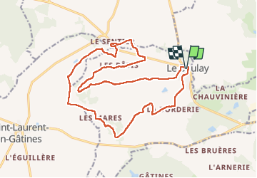
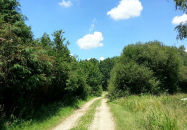
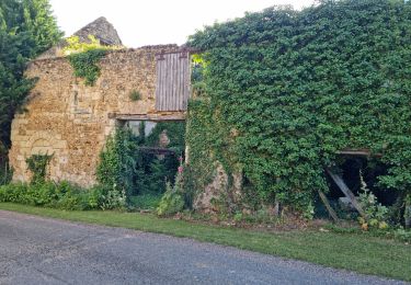
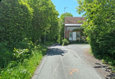
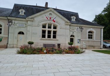
Trail Walking of 21 km to be discovered at Centre-Loire Valley, Indre-et-Loire, Le Boulay. This trail is proposed by Orcal37.
Description
le Boulay - circuits Le pain sec et le Boulay avec variante le Sentier - balisage bleu jaune puis bleu puis le Sentier puis retour au balisage jaune - 21.4km 180m 5h15 - 2022 05 05
Positioning
Country:
France
Region :
Centre-Loire Valley
Department/Province :
Indre-et-Loire
Municipality :
Le Boulay
Location:
Unknown
Start:(Dec)
Start:(UTM)
338921 ; 5274827 (31T) N.
Comments
Trails nearby
![Trail Walking - Monthodon - l'Aître Adam - 18.1km 140m 4h00 (35mn) - 2023 07 26 - Photo](https://media.geolcdn.com/t/375/260/3ad63fdb-ea8c-4f0a-920f-34c8d6a23e40.jpg&format=jpg&maxdim=2)
![Walking Walking](https://static1.geolcdn.com/sitytour/trail-icons/101.png)
Monthodon - l'Aître Adam - 18.1km 140m 4h00 (35mn) - 2023 07 26
Walking
Easy
(1)
,
Centre-Loire Valley,
Indre-et-Loire,
France
![](/images/other/stat-length.png)
18.2 km | 20 km-effort
4h 0min
![](https://static1.geolcdn.com/siteimages/upload/files/16400158638029165_repeat_loop_refresh_sync_direction_icon.png)
Yes
![Trail Walking Neuville-sur-Brenne - Neuville-sur-Brenne - 9.8km 125m 2h15 - 2023 07 19 - Photo](https://media.geolcdn.com/t/375/260/a41b1f96-ab1d-45c7-b385-bbd885690007.jpg&format=jpg&maxdim=2)
![Walking Walking](https://static1.geolcdn.com/sitytour/trail-icons/101.png)
Neuville-sur-Brenne - 9.8km 125m 2h15 - 2023 07 19
Walking
Very easy
Neuville-sur-Brenne,
Centre-Loire Valley,
Indre-et-Loire,
France
![](/images/other/stat-length.png)
9.2 km | 10.8 km-effort
2h 15min
![](https://static1.geolcdn.com/siteimages/upload/files/16400158638029165_repeat_loop_refresh_sync_direction_icon.png)
Yes
![Trail Walking Authon - Authon - Monthodon - 13.6km 130m 3h00 (30mn) - 2023 07 19 - Photo](https://media.geolcdn.com/t/375/260/81a589f6-34b6-404b-9b26-b7d15bc13e45.jpg&format=jpg&maxdim=2)
![Walking Walking](https://static1.geolcdn.com/sitytour/trail-icons/101.png)
Authon - Monthodon - 13.6km 130m 3h00 (30mn) - 2023 07 19
Walking
Very easy
Authon,
Centre-Loire Valley,
Loir-et-Cher,
France
![](/images/other/stat-length.png)
13.6 km | 15.4 km-effort
3h 0min
![](https://static1.geolcdn.com/siteimages/upload/files/16400158638029165_repeat_loop_refresh_sync_direction_icon.png)
Yes
![Trail Walking Château-Renault - Château-Renault - GR655ouest Villechauve - 21.9km 235m 4h55 (30mn) - 2021 10 23 - Photo](https://media.geolcdn.com/t/375/260/f56af21b-37d8-43a1-8e30-6f94c58a9a00.jpg&format=jpg&maxdim=2)
![Walking Walking](https://static1.geolcdn.com/sitytour/trail-icons/101.png)
Château-Renault - GR655ouest Villechauve - 21.9km 235m 4h55 (30mn) - 2021 10 23
Walking
Easy
Château-Renault,
Centre-Loire Valley,
Indre-et-Loire,
France
![](/images/other/stat-length.png)
22 km | 25 km-effort
4h 55min
![](https://static1.geolcdn.com/siteimages/upload/files/16400158638029165_repeat_loop_refresh_sync_direction_icon.png)
Yes
![Trail Walking Monthodon - Monthodon - et Le Sentier - 26.7km 230m 6h00 - 2018 07 15 - public - Photo](https://media.geolcdn.com/t/375/260/ext.jpg?maxdim=2&url=https%3A%2F%2Fservices.sitytrail.com%2FGeolivesWS%2FDownloadMedia.ashx%3FTrailID%3D1004638%26Media%3Dfix__20180715141736.jpg)
![Walking Walking](https://static1.geolcdn.com/sitytour/trail-icons/101.png)
Monthodon - et Le Sentier - 26.7km 230m 6h00 - 2018 07 15 - public
Walking
Easy
Monthodon,
Centre-Loire Valley,
Indre-et-Loire,
France
![](/images/other/stat-length.png)
27 km | 30 km-effort
5h 45min
![](https://static1.geolcdn.com/siteimages/upload/files/16400158638029165_repeat_loop_refresh_sync_direction_icon.png)
Yes
![Trail Walking Villedômer - Villedômer - Photo](https://media.geolcdn.com/t/375/260/01205bfa-a16a-4b1b-9536-49c99ad5bf3a.jpg&format=jpg&maxdim=2)
![Walking Walking](https://static1.geolcdn.com/sitytour/trail-icons/101.png)
Villedômer
Walking
Easy
Villedômer,
Centre-Loire Valley,
Indre-et-Loire,
France
![](/images/other/stat-length.png)
10.8 km | 12.8 km-effort
2h 54min
![](https://static1.geolcdn.com/siteimages/upload/files/16400158638029165_repeat_loop_refresh_sync_direction_icon.png)
Yes
![Trail Walking Neuville-sur-Brenne - Neuville-sur-Brenne - Photo](https://media.geolcdn.com/t/375/260/38e67fb2-a433-4c14-914d-8e3592594fd7.jpg&format=jpg&maxdim=2)
![Walking Walking](https://static1.geolcdn.com/sitytour/trail-icons/101.png)
Neuville-sur-Brenne
Walking
Difficult
Neuville-sur-Brenne,
Centre-Loire Valley,
Indre-et-Loire,
France
![](/images/other/stat-length.png)
14.6 km | 17 km-effort
3h 52min
![](https://static1.geolcdn.com/siteimages/upload/files/16400158638029165_repeat_loop_refresh_sync_direction_icon.png)
Yes
![Trail Walking Monthodon - Monthodon Le Sentier - Photo](https://media.geolcdn.com/t/375/260/86376099-ac84-49f8-82e1-db4414073e78.jpg&format=jpg&maxdim=2)
![Walking Walking](https://static1.geolcdn.com/sitytour/trail-icons/101.png)
Monthodon Le Sentier
Walking
Medium
Monthodon,
Centre-Loire Valley,
Indre-et-Loire,
France
![](/images/other/stat-length.png)
8.5 km | 9.5 km-effort
2h 9min
![](https://static1.geolcdn.com/siteimages/upload/files/16400158638029165_repeat_loop_refresh_sync_direction_icon.png)
Yes
![Trail Walking Authon - Authon - Chateau-Renault - Photo](https://media.geolcdn.com/t/375/260/4a1814d5-5fa4-44e1-b54a-55669a1ea87f.jpg&format=jpg&maxdim=2)
![Walking Walking](https://static1.geolcdn.com/sitytour/trail-icons/101.png)
Authon - Chateau-Renault
Walking
Easy
Authon,
Centre-Loire Valley,
Loir-et-Cher,
France
![](/images/other/stat-length.png)
25 km | 30 km-effort
6h 40min
![](https://static1.geolcdn.com/siteimages/upload/files/16400158638029165_repeat_loop_refresh_sync_direction_icon.png)
Yes