


Parc Etosha Namibia

nave
User

Length
130 km

Max alt
1212 m

Uphill gradient
851 m
Km-Effort
142 km

Min alt
1089 m

Downhill gradient
888 m
Boucle
No
Creation date :
2022-05-03 04:41:02.554
Updated on :
2022-05-03 11:41:14.349
6h48
Difficulty : Very easy

FREE GPS app for hiking
 SityTrail
IGN / Geographical institutes
SityTrail World
The world is yours!
About
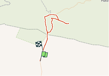
Trail 4x4 of 130 km to be discovered at Kunene Region. This trail is proposed by nave.
Description
Circuit a travers le parc Etosha en 4X4 en passant par les points d'eau
Photos


Positioning
Country:
Namibia
Region :
Kunene Region
Department/Province :
Unknown
Municipality :
Unknown
Location:
Unknown
Start:(Dec)
Start:(UTM)
592021 ; 7837354 (33K) S.
Comments
Trails nearby