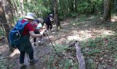
Trail Walking Souligny - Montaigu, BOUILLY - Photo

Montaigu, BOUILLY

© OpenStreetMap contributors
Length
Length
15.7 km
Max alt
Max alt
286 m
Uphill gradient
Uphill gradient
412 m
Km-Effort
Km-Effort  
21 km
Min alt
Min alt
164 m
Downhill gradient
Downhill gradient
412 m
Boucle
Boucle
Yes
Creation date :
2022-05-01 07:54:37.922
Updated on :
2022-05-31 14:11:16.102

(0 Reviews)

Walking
Walking
4h14
Difficulty : Difficult

Scan this QR Code to open this trail in the SityTrail application

FREE GPS app for hiking

Logo SityTrail SityTrail

IGN / Geographical institutes

Download SityTrail from the App Store Download SityTrail from Google Play

Logo SityTrail SityTrail World

The world is yours!

Download SityTrail from the App Store Download SityTrail from Google Play Download SityTrail on Huawei AppGallery

About

Trail Walking of 15.7 km to be discovered at Grand Est, Aube, Souligny. This trail is proposed by jeannine grandjean.

Description

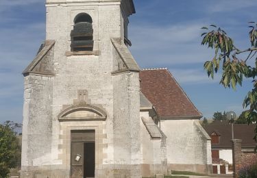
superbe rando à partir du site verdoyant de Montaigu avec son petit ruisseau et sa fontaine ; monter à l'oppidum, d'où l'on a un superbe panorama sur la Plaine de Champagne. Le pittoresque village des Grandes Vallées mérite le détour. Beaucoup de dénivelé, mais des sentiers praticables et très bien entretenus.
Chemins bien balisés mais il faut être très attentif dans les bois...

Elevation profile

Photos

Positioning

Country:
France
Region :
Grand Est
Department/Province :
Aube
Municipality :
Souligny
Location:
Unknown
Start:(UTM)
572709 ; 5340085 (31U) N.

Trails nearby

Trail Walking Prugny - Montbernange - Photo
Walking
FPortier

Walking

Medium
(1)
Prugny, Grand Est, Aube, France
9.4 km | 12 km-effort
2h 19min
Yes
Trail Walking Bouilly - Bouilly le 30.07.22 (9.6kms) N° 2 - Photo
Walking
COTELEVELYNE

Walking

Medium
(1)
Bouilly, Grand Est, Aube, France
8.1 km | 10.5 km-effort
2h 23min
Yes
Trail Walking Souligny - Souligny 16km le 11/06/2019 - Photo
Walking
francis1952

Walking

Difficult
(1)
Souligny, Grand Est, Aube, France
16 km | 0 m-effort
3h 9min
Yes
Trail Mountain bike Laines-aux-Bois - montaigutour toto aout217 - Photo
Mountain bike
Tollard

Mountain bike

Difficult
(1)
Laines-aux-Bois, Grand Est, Aube, France
31 km | 42 km-effort
3h 6min
Yes
Trail Mountain bike Laines-aux-Bois - cource xc cwb Laines Aux Bois 2017 - Photo
Mountain bike
Tollard

Mountain bike

Difficult
(3)
Laines-aux-Bois, Grand Est, Aube, France
6.6 km | 9.9 km-effort
38min
Yes
Trail Mountain bike Laines-aux-Bois - hors piste phiphi - Photo
Mountain bike
Tollard

Mountain bike

Difficult
(1)
Laines-aux-Bois, Grand Est, Aube, France
26 km | 35 km-effort
3h 11min
No
Trail Walking Vauchassis - Vauchassis Bercenay - Photo
Walking
FPortier

Walking

Difficult
Vauchassis, Grand Est, Aube, France
9.6 km | 12.3 km-effort
2h 44min
Yes
Trail Walking Laines-aux-Bois - Laines Aux Bois - Photo
Walking
FPortier

Walking

Medium
Laines-aux-Bois, Grand Est, Aube, France
8 km | 10.2 km-effort
2h 11min
Yes
Trail Walking Laines-aux-Bois - Lainesauxbois7kmPR - Photo
Walking
FPortier

Walking

Medium
(1)
Laines-aux-Bois, Grand Est, Aube, France
7 km | 9 km-effort
2h 3min
Yes


Close
My subscriptions