![](/images/other/stat-length.png)
![Trail Walking Brissac-Loire-Aubance - Saint Rémy la Varenne par Chauvigné - Photo](https://media.geolcdn.com/t/1900/400/ext.pjpeg?maxdim=2&url=https%3A%2F%2Fstatic1.geolcdn.com%2Fsiteimages%2Fupload%2Ffiles%2F1553511878bg_sport_marche.png)
Saint Rémy la Varenne par Chauvigné
Association ARCA49
Autour de la randonnée
![Length](/images/other/stat-length.png)
Length
6.4 km
![Max alt](https://static1.geolcdn.com/siteimages/upload/files/1508320355ic_sort_altitude_max_24dp.png)
Max alt
62 m
![Uphill gradient](https://static1.geolcdn.com/siteimages/upload/files/1508320355ic_sort_den_pos_24dp.png)
Uphill gradient
84 m
![Km-Effort](/images/other/stat-length.png)
Km-Effort
7.5 km
![Min alt](https://static1.geolcdn.com/siteimages/upload/files/1508320355ic_sort_altitude_min_24dp.png)
Min alt
14 m
![Downhill gradient](https://static1.geolcdn.com/siteimages/upload/files/1508320355ic_sort_den_neg_24dp.png)
Downhill gradient
83 m
![Boucle](https://static1.geolcdn.com/siteimages/upload/files/16400158638029165_repeat_loop_refresh_sync_direction_icon.png)
Boucle
Yes
Creation date :
2019-11-29 15:16:35.81
Updated on :
2022-12-20 14:30:27.896
![Walking](https://static1.geolcdn.com/sitytour/trail-icons/101.png)
1h36
Difficulty : Medium
![Scan this QR Code to open this trail in the SityTrail application](https://capi.geolives.com/qq0zvz2zws4bq2lad0pu/sitytour/trails/3220603/qr.png?size=200)
FREE GPS app for hiking
About
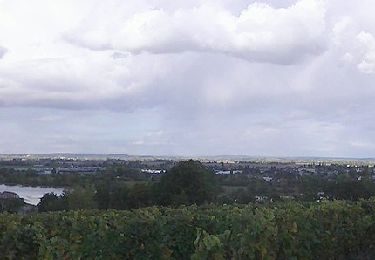
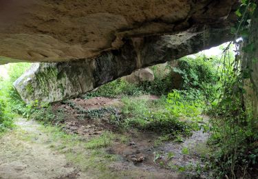
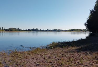
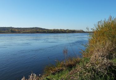
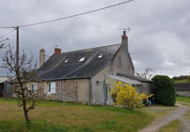
Trail Walking of 6.4 km to be discovered at Pays de la Loire, Maine-et-Loire, Brissac-Loire-Aubance. This trail is proposed by Association ARCA49.
Description
Retraités ARCA49 de l'Après-Midi. Attention, la randonnée peut être impraticable en cas de crue de la Loire.
Positioning
Country:
France
Region :
Pays de la Loire
Department/Province :
Maine-et-Loire
Municipality :
Brissac-Loire-Aubance
Location:
Unknown
Start:(Dec)
Start:(UTM)
702495 ; 5252921 (30T) N.
Comments
Trails nearby
![Trail On foot Gennes-Val-de-Loire - De Loire et Forêt - Photo](https://media.geolcdn.com/t/375/260/5de94cdf-0f77-4880-98ea-e0c0aebf5951.jpeg&format=jpg&maxdim=2)
![On foot On foot](https://static1.geolcdn.com/sitytour/trail-icons/100.png)
De Loire et Forêt
On foot
Easy
Gennes-Val-de-Loire,
Pays de la Loire,
Maine-et-Loire,
France
![](/images/other/stat-length.png)
7.4 km | 9.1 km-effort
2h 4min
![](https://static1.geolcdn.com/siteimages/upload/files/16400158638029165_repeat_loop_refresh_sync_direction_icon.png)
Yes
![Trail Walking Brissac-Loire-Aubance - St Rémy la Varenne - Gennes - Photo](https://media.geolcdn.com/t/375/260/fd426757-904c-4439-934e-1e922d6cb724.jpg&format=jpg&maxdim=2)
![Walking Walking](https://static1.geolcdn.com/sitytour/trail-icons/101.png)
St Rémy la Varenne - Gennes
Walking
Medium
Brissac-Loire-Aubance,
Pays de la Loire,
Maine-et-Loire,
France
![](/images/other/stat-length.png)
18 km | 22 km-effort
5h 8min
![](https://static1.geolcdn.com/siteimages/upload/files/16400158638029165_repeat_loop_refresh_sync_direction_icon.png)
No
![Trail Walking Brissac-Loire-Aubance - St Rémy la Varenne - Photo](https://media.geolcdn.com/t/375/260/0ad2ae6f-a65c-4370-9717-5c16c4accc77.jpg&format=jpg&maxdim=2)
![Walking Walking](https://static1.geolcdn.com/sitytour/trail-icons/101.png)
St Rémy la Varenne
Walking
Very difficult
Brissac-Loire-Aubance,
Pays de la Loire,
Maine-et-Loire,
France
![](/images/other/stat-length.png)
16.8 km | 19.4 km-effort
4h 24min
![](https://static1.geolcdn.com/siteimages/upload/files/16400158638029165_repeat_loop_refresh_sync_direction_icon.png)
Yes
![Trail Walking Loire-Authion - St Mathurin sur Loire - Photo](https://media.geolcdn.com/t/375/260/10cae68a-3ba9-46cf-9d58-bf2a2a8054f5.jpg&format=jpg&maxdim=2)
![Walking Walking](https://static1.geolcdn.com/sitytour/trail-icons/101.png)
St Mathurin sur Loire
Walking
Difficult
Loire-Authion,
Pays de la Loire,
Maine-et-Loire,
France
![](/images/other/stat-length.png)
24 km | 26 km-effort
4h 4min
![](https://static1.geolcdn.com/siteimages/upload/files/16400158638029165_repeat_loop_refresh_sync_direction_icon.png)
Yes
![Trail Walking Blaison-Saint-Sulpice - Blaison-Gohier - Photo](https://media.geolcdn.com/t/375/260/b6bc34ef-545f-4ef4-91f2-1a689f1a681e.jpg&format=jpg&maxdim=2)
![Walking Walking](https://static1.geolcdn.com/sitytour/trail-icons/101.png)
Blaison-Gohier
Walking
Easy
Blaison-Saint-Sulpice,
Pays de la Loire,
Maine-et-Loire,
France
![](/images/other/stat-length.png)
9.7 km | 11.6 km-effort
3h 12min
![](https://static1.geolcdn.com/siteimages/upload/files/16400158638029165_repeat_loop_refresh_sync_direction_icon.png)
Yes
![Trail Walking Gennes-Val-de-Loire - Le chemin des vieilles pierres saint georges des 7 voies - Photo](https://media.geolcdn.com/t/375/260/ext.jpg?maxdim=2&url=https%3A%2F%2Fservices.sitytrail.com%2FGeolivesWS%2FDownloadMedia.ashx%3FTrailID%3D569665%26Media%3Dfix__20160515143000.jpg)
![Walking Walking](https://static1.geolcdn.com/sitytour/trail-icons/101.png)
Le chemin des vieilles pierres saint georges des 7 voies
Walking
Very easy
Gennes-Val-de-Loire,
Pays de la Loire,
Maine-et-Loire,
France
![](/images/other/stat-length.png)
16.1 km | 18.7 km-effort
4h 40min
![](https://static1.geolcdn.com/siteimages/upload/files/16400158638029165_repeat_loop_refresh_sync_direction_icon.png)
Yes
![Trail Walking Gennes-Val-de-Loire - De Loire en forêt - Le Thoureil - Photo](https://media.geolcdn.com/t/375/260/ext.jpg?maxdim=2&url=https%3A%2F%2Fservices.sitytrail.com%2FGeolivesWS%2FDownloadMedia.ashx%3FTrailID%3D108834%26Media%3D2338_1.jpg)
![Walking Walking](https://static1.geolcdn.com/sitytour/trail-icons/101.png)
De Loire en forêt - Le Thoureil
Walking
Medium
Gennes-Val-de-Loire,
Pays de la Loire,
Maine-et-Loire,
France
![](/images/other/stat-length.png)
7.3 km | 9.1 km-effort
2h 15min
![](https://static1.geolcdn.com/siteimages/upload/files/16400158638029165_repeat_loop_refresh_sync_direction_icon.png)
Yes
![Trail Walking Gennes-Val-de-Loire - /49/Gennes-Val de Loire/Le Thoureil - Photo](https://media.geolcdn.com/t/375/260/ext.jpg?maxdim=2&url=https%3A%2F%2Fstatic1.geolcdn.com%2Fsiteimages%2Fupload%2Ffiles%2F1553511878bg_sport_marche.png)
![Walking Walking](https://static1.geolcdn.com/sitytour/trail-icons/101.png)
/49/Gennes-Val de Loire/Le Thoureil
Walking
Difficult
Gennes-Val-de-Loire,
Pays de la Loire,
Maine-et-Loire,
France
![](/images/other/stat-length.png)
11.2 km | 13.5 km-effort
3h 2min
![](https://static1.geolcdn.com/siteimages/upload/files/16400158638029165_repeat_loop_refresh_sync_direction_icon.png)
Yes
![Trail Walking Brissac-Loire-Aubance - /49/Brissac Loire Aubance/Coutures - Photo](https://media.geolcdn.com/t/375/260/ext.jpg?maxdim=2&url=https%3A%2F%2Fstatic1.geolcdn.com%2Fsiteimages%2Fupload%2Ffiles%2F1553511878bg_sport_marche.png)
![Walking Walking](https://static1.geolcdn.com/sitytour/trail-icons/101.png)
/49/Brissac Loire Aubance/Coutures
Walking
Difficult
Brissac-Loire-Aubance,
Pays de la Loire,
Maine-et-Loire,
France
![](/images/other/stat-length.png)
10.7 km | 12.7 km-effort
2h 52min
![](https://static1.geolcdn.com/siteimages/upload/files/16400158638029165_repeat_loop_refresh_sync_direction_icon.png)
Yes