14.2 km | 16.2 km-effort
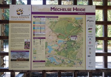
mechelse heide
moniquebvin
User
Length
10.3 km
Max alt
95 m
Uphill gradient
126 m
Km-Effort
12 km
Min alt
51 m
Downhill gradient
121 m
Boucle
Yes
Creation date :
2022-04-27 09:37:57.075
Updated on :
2022-04-27 13:12:46.407
3h33
Difficulty : Easy
FREE GPS app for hiking
About
Trail Walking of 10.3 km to be discovered at Flanders, Limburg, Maasmechelen. This trail is proposed by moniquebvin.
Description
Super balade nature combinant les tracés jaune et rouge. Départ au parking (200 premiers metres non enregistrés-partir à droite)
Positioning
Country:
Belgium
Region :
Flanders
Department/Province :
Limburg
Municipality :
Maasmechelen
Location:
Mechelen-aan-de-Maas
Start:(Dec)
Start:(UTM)
686730 ; 5650703 (31U) N.
Comments
Trails nearby
Erfgoedwandeling Eisden Tuinwijk
On foot
Easy
Maasmechelen,
Flanders,
Limburg,
Belgium
3.1 km | 3.3 km-effort
44min
Yes
Connecterra Rode driehoek
On foot
Easy
Dilsen-Stokkem,
Flanders,
Limburg,
Belgium
6.2 km | 7 km-effort
1h 35min
No
Station As Groene rechthoek
On foot
Easy
Maasmechelen,
Flanders,
Limburg,
Belgium
3.3 km | 3.8 km-effort
51min
Yes
Leut & Meeswijk Gele zeshoek
On foot
Easy
Maasmechelen,
Flanders,
Limburg,
Belgium
7 km | 7.4 km-effort
1h 40min
Yes
Station As Blauwe ruit
On foot
Easy
Maasmechelen,
Flanders,
Limburg,
Belgium
6.5 km | 7.1 km-effort
1h 36min
Yes
Station As Rode driehoek
On foot
Easy
Maasmechelen,
Flanders,
Limburg,
Belgium
12 km | 13.4 km-effort
3h 3min
Yes
Litzberg groene rechthoek
On foot
Easy
Dilsen-Stokkem,
Flanders,
Limburg,
Belgium
3 km | 3.7 km-effort
49min
Yes