Trail Walking Vals-les-Bains - r longeserre puy les ayres ste marguerite tesseaux - Photo

r longeserre puy les ayres ste marguerite tesseaux

 07es18
07es18

User

© OpenStreetMap contributors
Length
Length
19.9 km
Max alt
Max alt
982 m
Uphill gradient
Uphill gradient
904 m
Km-Effort
Km-Effort  
32 km
Min alt
Min alt
288 m
Downhill gradient
Downhill gradient
904 m
Boucle
Boucle
Yes
Creation date :
2022-04-26 07:12:55.263
Updated on :
2022-04-27 08:38:19.839

(0 Reviews)

Walking
Walking
5h41
Difficulty : Difficult

Scan this QR Code to open this trail in the SityTrail application

FREE GPS app for hiking

Logo SityTrail SityTrail

IGN / Geographical institutes

Download SityTrail from the App Store Download SityTrail from Google Play

Logo SityTrail SityTrail World

The world is yours!

Download SityTrail from the App Store Download SityTrail from Google Play Download SityTrail on Huawei AppGallery

About

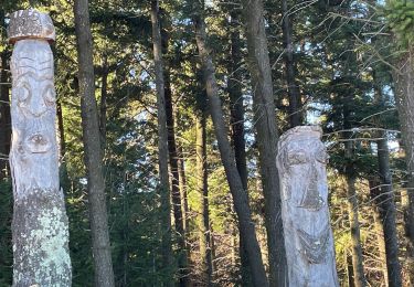
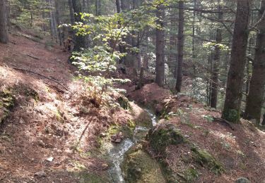
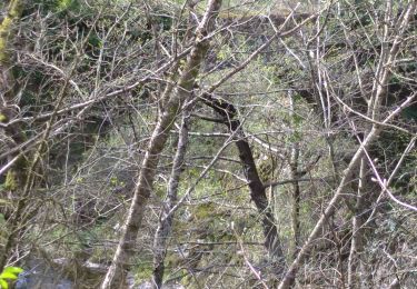
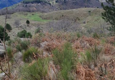
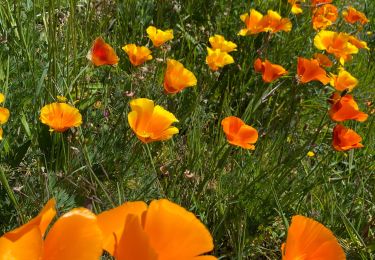
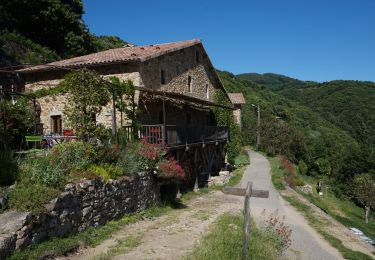
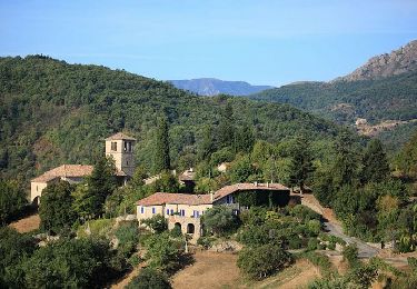
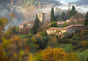
Trail Walking of 19.9 km to be discovered at Auvergne-Rhône-Alpes, Ardèche, Vals-les-Bains. This trail is proposed by 07es18.

Description

chemin très aléatoire au-dessus du col de sétias.

Elevation profile

Positioning

Country:
France
Region :
Auvergne-Rhône-Alpes
Department/Province :
Ardèche
Municipality :
Vals-les-Bains
Location:
Unknown
Start:(UTM)
606971 ; 4945812 (31T) N.

Trails nearby

Trail Walking Lentillères - Lentillières_les cretes_les Hameaux-13-02-17 - Photo
Walking
coureursdecretes

Walking

Very easy
(1)
Lentillères, Auvergne-Rhône-Alpes, Ardèche, France
12.2 km | 18.7 km-effort
3h 58min
Yes
Trail Walking Vals-les-Bains - 07 vals les bains 27.10.2022 - Photo
Walking
GUIDE
randodyssée

Walking

Easy
Vals-les-Bains, Auvergne-Rhône-Alpes, Ardèche, France
17.6 km | 29 km-effort
7h 24min
Yes
Trail Walking Fabras - Fabras  - Photo
Walking
MoiClaude

Walking

Medium
(1)
Fabras, Auvergne-Rhône-Alpes, Ardèche, France
6.4 km | 9.7 km-effort
1h 49min
No
Trail Walking Vals-les-Bains - 07 vals les bains/ Sandron/ haut segur - Photo
Walking
GUIDE
randodyssée

Walking

Medium
Vals-les-Bains, Auvergne-Rhône-Alpes, Ardèche, France
18.8 km | 31 km-effort
7h 23min
Yes
Trail Walking Saint-Andéol-de-Vals - 07 st Andeol de vals - Photo
Walking
GUIDE
randodyssée

Walking

Easy
Saint-Andéol-de-Vals, Auvergne-Rhône-Alpes, Ardèche, France
15.3 km | 24 km-effort
6h 3min
Yes
Trail Walking Fabras - Fabras Jaujac les orgues basaltiques  - Photo
Walking
GUIDE
Roger Philippe Wallez

Walking

Very difficult
Fabras, Auvergne-Rhône-Alpes, Ardèche, France
14.9 km | 22 km-effort
5h 17min
Yes
Trail Walking Pont-de-Labeaume - 2022-09-20_11h09m21_Ste Marguerite-Aubignas 18km.gpx (1).xml - Photo
Walking
GUIDE
chancha

Walking

Very difficult
Pont-de-Labeaume, Auvergne-Rhône-Alpes, Ardèche, France
18.2 km | 29 km-effort
6h 35min
Yes
Trail Walking Pont-de-Labeaume - 2022-09-20_11h08m03_Pt Labeaume Chirols Meyras 12km.gpx.xml - Photo
Walking
GUIDE
chancha

Walking

Medium
Pont-de-Labeaume, Auvergne-Rhône-Alpes, Ardèche, France
11.8 km | 17.8 km-effort
4h 2min
Yes
Trail Walking Pont-de-Labeaume - 2022-09-20_11h07m40_Autour de Niegles 10km.gpx (1).xml - Photo
Walking
GUIDE
chancha

Walking

Medium
Pont-de-Labeaume, Auvergne-Rhône-Alpes, Ardèche, France
9.2 km | 13.4 km-effort
3h 6min
Yes


Close
My subscriptions