


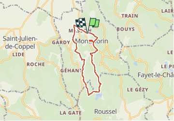


21 km | 30 km-effort


User


FREE GPS app for hiking
 SityTrail
IGN / Geographical institutes
SityTrail World
The world is yours!
Trail Walking of 11.8 km to be discovered at Auvergne-Rhône-Alpes, Puy-de-Dôme, Montmorin. This trail is proposed by LEPOSTIER63.
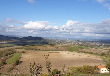
Très beau circuit dans la Toscane d'Auvergne avec pour toile de fond le château de Montmorin , la vue sur la chaine des puys et les paysages de la campagne environnante ,circuit très
vallonné qui demande quelques efforts

On foot
On foot

Walking

Walking

Walking
Walking
Walking

Walking

Walking