


Thy National Park long

adubarry
User
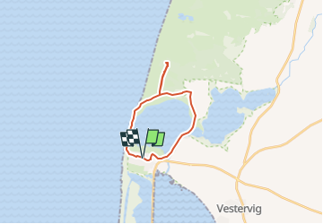

Length
14.1 km

Max alt
23 m

Uphill gradient
53 m
Km-Effort
14.8 km

Min alt
-1 m

Downhill gradient
52 m
Boucle
Yes
Creation date :
2022-04-23 13:31:37.979
Updated on :
2022-04-23 13:31:59.714
3h21
Difficulty : Difficult

FREE GPS app for hiking
 SityTrail
IGN / Geographical institutes
SityTrail World
The world is yours!
About
Trail Walking of 14.1 km to be discovered at North Denmark Region. This trail is proposed by adubarry.
Positioning
Country:
Denmark
Region :
North Denmark Region
Department/Province :
Unknown
Municipality :
Unknown
Location:
Unknown
Start:(Dec)
Start:(UTM)
453826 ; 6293514 (32V) N.
Comments
Trails nearby