


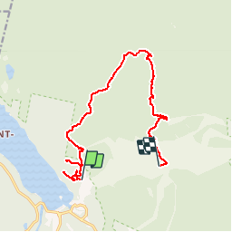


14.7 km | 23 km-effort


User


FREE GPS app for hiking
 SityTrail
IGN / Geographical institutes
SityTrail World
The world is yours!
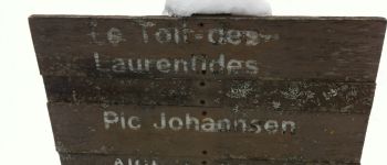
Trail Snowshoes of 15.3 km to be discovered at Quebec, Les Laurentides, Mont-Tremblant. This trail is proposed by jmnogues.


Walking
Walking