


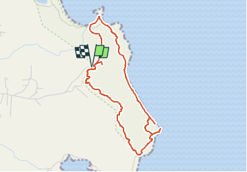

3.9 km | 4.7 km-effort


User


FREE GPS app for hiking
 SityTrail
IGN / Geographical institutes
SityTrail World
The world is yours!
Trail Walking of 6 km to be discovered at Martinique, Unknown, Le Marin. This trail is proposed by ThereseH.
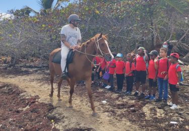
Boucle dans le cadre d'une prestation de médiation animale auprès d'un jeune public autiste (7 de 16 à 21 ans) non sportif.
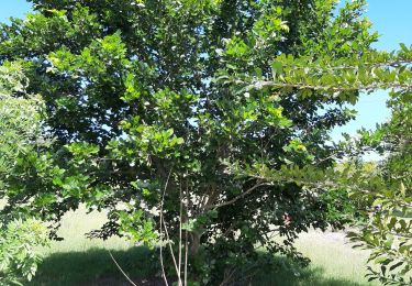
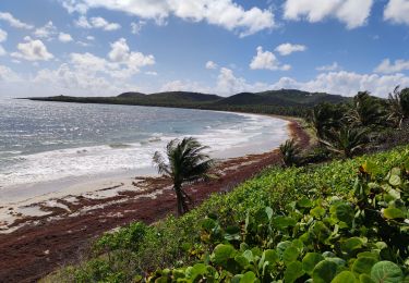
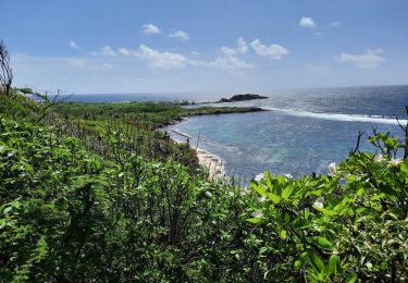
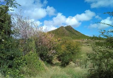
Boucle sans difficulté majeure offrant point de vue sur le littoral atlantique vers le Vauclin et après Grosse Roche vers Saint Anne. Chemin de croix jusque la chapelle des marins offrant panorama sur la montagne du Vauclin et le morne Carrière avec les éoliennes malheureusement couchées actuellement. Végétation de littoral sèche avec cactus cierge et palette, raisinier bord de mer et cocotiers. Pause bord de mer Près du "coeur" de Grosse roche, lancer de balle avec les chiens. Retour par le Morne avec Agaves et point de vue sur la Chapelle et la belle mare que nous visitons avant de partir. Bain des chiens l'eau rafraichissante. Temps un peu chaud malgré les alizés.
Walking

Walking

Walking
Walking
Walking
Walking
Walking

Walking

sport