Trail Electric bike Saint-Sauveur-sur-Tinée - Vignols en partant de St Sauveur sur Tinée - Photo

Vignols en partant de St Sauveur sur Tinée

 franquen
franquen

User

© OpenStreetMap contributors
Length
Length
36 km
Max alt
Max alt
1641 m
Uphill gradient
Uphill gradient
1498 m
Km-Effort
Km-Effort  
56 km
Min alt
Min alt
505 m
Downhill gradient
Downhill gradient
1521 m
Boucle
Boucle
No
Creation date :
2022-04-18 08:41:23.203
Updated on :
2022-04-18 17:10:13.2

(0 Reviews)

Electric bike
Electric bike
4h00
Difficulty : Easy

Scan this QR Code to open this trail in the SityTrail application

FREE GPS app for hiking

Logo SityTrail SityTrail

IGN / Geographical institutes

Download SityTrail from the App Store Download SityTrail from Google Play

Logo SityTrail SityTrail World

The world is yours!

Download SityTrail from the App Store Download SityTrail from Google Play Download SityTrail on Huawei AppGallery

About

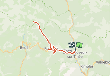
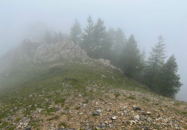
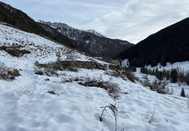
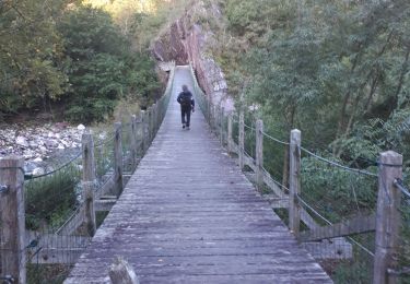
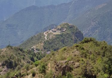
Trail Electric bike of 36 km to be discovered at Provence-Alpes-Côte d'Azur, Maritime Alps, Saint-Sauveur-sur-Tinée. This trail is proposed by franquen.

Description

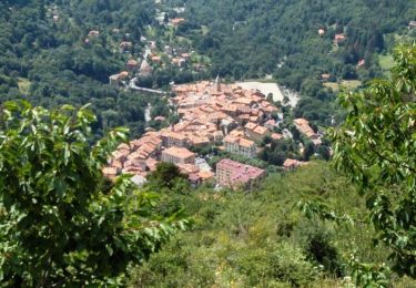
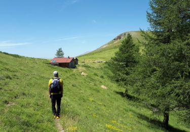
Belle balade en pente régulière avec une pause resto à Roubion au retour (auberge du Moulin)

Elevation profile

Positioning

Country:
France
Region :
Provence-Alpes-Côte d'Azur
Department/Province :
Maritime Alps
Municipality :
Saint-Sauveur-sur-Tinée
Location:
Unknown
Start:(UTM)
348250 ; 4883370 (32T) N.

Trails nearby

Trail Walking Saint-Sauveur-sur-Tinée - Via Alpina - D58: St Sauveur-sur-Tinée > St-Martin-Vésubie - Photo
Walking
tracegps

Walking

Very difficult
(1)
Saint-Sauveur-sur-Tinée, Provence-Alpes-Côte d'Azur, Maritime Alps, France
18.1 km | 33 km-effort
6h 0min
No
Trail On foot Rimplas - Circuit de la Couletta - Photo
On foot
GUIDE+

On foot

Easy
Rimplas, Provence-Alpes-Côte d'Azur, Maritime Alps, France
6.5 km | 11.9 km-effort
2h 42min
Yes
Trail On foot Roure - Circuit de Roure - Photo
On foot
GUIDE+

On foot

Easy
(1)
Roure, Provence-Alpes-Côte d'Azur, Maritime Alps, France
7.6 km | 15.6 km-effort
3h 33min
Yes
Trail Walking Roure - Mont Autcellier - Photo
Walking
fredopaca

Walking

Easy
(1)
Roure, Provence-Alpes-Côte d'Azur, Maritime Alps, France
18 km | 31 km-effort
5h 48min
Yes
Trail Walking Roure - Mont Autcellier de Roure au Refuge Longon J1 - Photo
Walking
GrouGary

Walking

Medium
Roure, Provence-Alpes-Côte d'Azur, Maritime Alps, France
10 km | 19.2 km-effort
4h 21min
No
Trail Walking Roure - Mont Gravières - Photo
Walking
bozo1970

Walking

Very difficult
Roure, Provence-Alpes-Côte d'Azur, Maritime Alps, France
13.4 km | 26 km-effort
4h 22min
Yes
Trail Walking Saint-Sauveur-sur-Tinée - Mollières Hiver - Photo
Walking
bozo1970

Walking

Very difficult
Saint-Sauveur-sur-Tinée, Provence-Alpes-Côte d'Azur, Maritime Alps, France
18 km | 31 km-effort
5h 1min
Yes
Trail Walking Saint-Sauveur-sur-Tinée - St Sauveur Tinee par Abeliera - Photo
Walking
GrouGary

Walking

Difficult
Saint-Sauveur-sur-Tinée, Provence-Alpes-Côte d'Azur, Maritime Alps, France
14.6 km | 27 km-effort
5h 9min
Yes
Trail Walking Rimplas - Rimplas - La Couletta - Photo
Walking
PhilB24

Walking

Medium
Rimplas, Provence-Alpes-Côte d'Azur, Maritime Alps, France
6.8 km | 12.7 km-effort
2h 1min
Yes


Close
My subscriptions