Trail Other activity Culoz - Culoz Arviere  - Photo
 svp59
svp59

User

© OpenStreetMap contributors
Length
Length
18.8 km
Max alt
Max alt
1523 m
Uphill gradient
Uphill gradient
1395 m
Km-Effort
Km-Effort  
34 km
Min alt
Min alt
236 m
Downhill gradient
Downhill gradient
312 m
Boucle
Boucle
No
Creation date :
2014-12-10 00:00:00.0
Updated on :
2014-12-10 00:00:00.0

(0 Reviews)

Other activity
Other activity
8h58
Difficulty : Unknown

Scan this QR Code to open this trail in the SityTrail application

FREE GPS app for hiking

Logo SityTrail SityTrail

IGN / Geographical institutes

Download SityTrail from the App Store Download SityTrail from Google Play

Logo SityTrail SityTrail World

The world is yours!

Download SityTrail from the App Store Download SityTrail from Google Play Download SityTrail on Huawei AppGallery

About

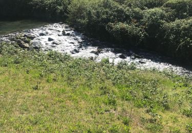
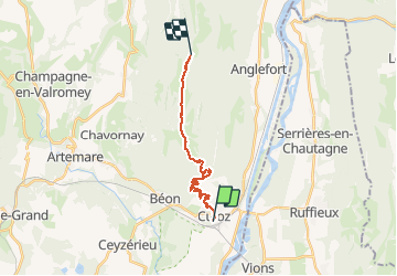
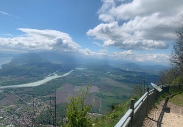
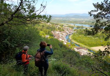
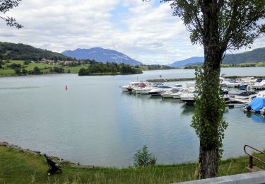
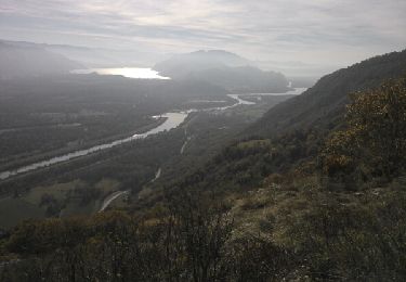
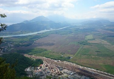
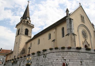
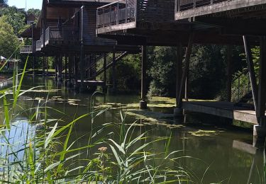
Trail Other activity of 18.8 km to be discovered at Auvergne-Rhône-Alpes, Ain, Culoz. This trail is proposed by svp59.

Elevation profile

Photos

Points of interest

Point of interest Culoz - Point 2 - Photo
svp59
CULOZ 

Positioning

Country:
France
Region :
Auvergne-Rhône-Alpes
Department/Province :
Ain
Municipality :
Culoz
Location:
Unknown
Start:(UTM)
715878 ; 5080615 (31T) N.

Trails nearby

Trail Walking Béon - Pierre chandruraz.  - Photo
Walking
cailloux74

Walking

Very difficult
Béon, Auvergne-Rhône-Alpes, Ain, France
57 km | 84 km-effort
5h 52min
No
Trail sport Culoz - Fenestre - Photo
sport
Biquette73

sport

Very easy
Culoz, Auvergne-Rhône-Alpes, Ain, France
12.4 km | 22 km-effort
Unknown
Yes
Trail Walking Chanaz - SAVOIE: CHANAZ - SAINT PIERRE DE CURTILLE - JONGIEUX - Photo
Walking
djeepee74

Walking

Difficult
Chanaz, Auvergne-Rhône-Alpes, Savoy, France
26 km | 37 km-effort
8h 19min
Yes
Trail Hybrid bike Culoz - ViaRhôna Culoz-Ambérieu 140km - Photo
Hybrid bike
GUIDE
thonyc

Hybrid bike

Medium
Culoz, Auvergne-Rhône-Alpes, Ain, France
140 km | 159 km-effort
14h 0min
No
Trail Walking Anglefort - les sarrasins - Photo
Walking
jibe01

Walking

Medium
Anglefort, Auvergne-Rhône-Alpes, Ain, France
10.8 km | 16.3 km-effort
3h 18min
No
Trail Walking Béon - Roche percée  - Photo
Walking
Arvierie56@Gmail.com

Walking

Medium
Béon, Auvergne-Rhône-Alpes, Ain, France
9.1 km | 16.5 km-effort
2h 58min
Yes
Trail Walking Serrières-en-Chautagne - Sur les Pas des Huguenots - Serrières en Chautagne - Seyssel - Photo
Walking
tracegps

Walking

Medium
Serrières-en-Chautagne, Auvergne-Rhône-Alpes, Savoy, France
10.8 km | 12.5 km-effort
3h 0min
No
Trail Walking Chanaz - Chanaz 2 - Photo
Walking
Jackoyo

Walking

Very easy
Chanaz, Auvergne-Rhône-Alpes, Savoy, France
12.1 km | 15.5 km-effort
2h 40min
Yes
Trail Walking Chanaz - Chanaz - Photo
Walking
Sylvain Ravillard

Walking

Easy
Chanaz, Auvergne-Rhône-Alpes, Savoy, France
5.3 km | 6 km-effort
2h 26min
No


Close
My subscriptions