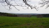

Deigné - Forestia - Rouge Thier

mumu.larandonneuse
User GUIDE

Length
11.8 km

Max alt
367 m

Uphill gradient
236 m

Km-Effort
14.9 km

Min alt
215 m

Downhill gradient
239 m
Boucle
Yes
Creation date :
2022-04-13 07:48:04.166
Updated on :
2022-04-13 23:37:43.152
2h36
Difficulty : Easy

FREE GPS app for hiking
About
Trail Walking of 11.8 km to be discovered at Wallonia, Liège, Aywaille. This trail is proposed by mumu.larandonneuse.
Description
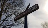
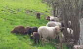
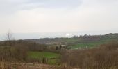
🇧🇪 Une belle randonnée forestière et campagnarde passant par le Ménobu, le bois Renard, le Parc à Gibiers Forestia, le domaine des Bruyères et Rouge Thier.
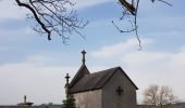
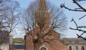
📍 & 🅿️ au centre de Deigné à l'église.
➡️ Possibilité de combiner avec la visite du parc à gibiers de La Reid.
Positioning
Country:
Belgium
Region :
Wallonia
Department/Province :
Liège
Municipality :
Aywaille
Location:
Unknown
Start:(Dec)
Start:(UTM)
693555 ; 5598521 (31U) N.
Comments
Trails nearby
RB-Lg-24_La-Reid_via-racc-1


Walking
(11)
Theux,
Wallonia,
Liège,
Belgium

15.9 km | 21 km-effort
4h 50min
Yes
RB-Lg-12 - De Sougné-Remouchamps à Deigné et retour


Walking
Difficult
(9)
Aywaille,
Wallonia,
Liège,
Belgium

24 km | 34 km-effort
7h 39min
Yes
aywaille . florzé . martinrive . septroux . aywaille


Walking
Easy
(6)
Aywaille,
Wallonia,
Liège,
Belgium

11.1 km | 15.4 km-effort
2h 48min
Yes
Petite remontée du Ninglispo


Walking
Medium
(9)
Aywaille,
Wallonia,
Liège,
Belgium

6.7 km | 9.7 km-effort
2h 11min
Yes
RB-LG-12 - Raccourci 2


Walking
Difficult
(6)
Aywaille,
Wallonia,
Liège,
Belgium

17 km | 25 km-effort
5h 46min
Yes

Banneux - Rouge Thier - Adzeux


Walking
Easy
(3)
Sprimont,
Wallonia,
Liège,
Belgium

9.1 km | 11.3 km-effort
2h 34min
Yes

2021-04-23_12h03m48_1081


Walking
Medium
(1)
Aywaille,
Wallonia,
Liège,
Belgium

17.3 km | 24 km-effort
5h 25min
Yes
2021-02-21_16h28m36_1382


Walking
Medium
(1)
Aywaille,
Wallonia,
Liège,
Belgium

15.7 km | 22 km-effort
4h 53min
Yes


 SityTrail


