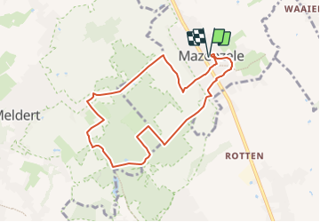
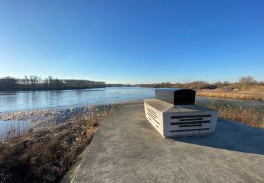
![](/images/other/stat-length.png)
![Trail Walking Opwijk - 20220416 Hyacintentocht lus 7 km Kravaalbos via Terberglos en Lus Groenedreef - Photo](https://media.geolcdn.com/t/1900/400/46788d29-1ae5-46c6-b1d8-3c147da02f0c.jpg&format=pjpeg&maxdim=2)
20220416 Hyacintentocht lus 7 km Kravaalbos via Terberglos en Lus Groenedreef
ElGino
User
![Length](/images/other/stat-length.png)
![Max alt](https://static1.geolcdn.com/siteimages/upload/files/1508320355ic_sort_altitude_max_24dp.png)
![Uphill gradient](https://static1.geolcdn.com/siteimages/upload/files/1508320355ic_sort_den_pos_24dp.png)
![Km-Effort](/images/other/stat-length.png)
![Min alt](https://static1.geolcdn.com/siteimages/upload/files/1508320355ic_sort_altitude_min_24dp.png)
![Downhill gradient](https://static1.geolcdn.com/siteimages/upload/files/1508320355ic_sort_den_neg_24dp.png)
![Boucle](https://static1.geolcdn.com/siteimages/upload/files/16400158638029165_repeat_loop_refresh_sync_direction_icon.png)
![Walking](https://static1.geolcdn.com/sitytour/trail-icons/101.png)
1h48
Difficulty : Medium
![Scan this QR Code to open this trail in the SityTrail application](https://capi.geolives.com/qq0zvz2zws4bq2lad0pu/sitytour/trails/3202543/qr.png?size=200)
FREE GPS app for hiking
About
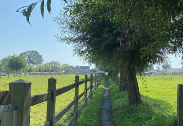
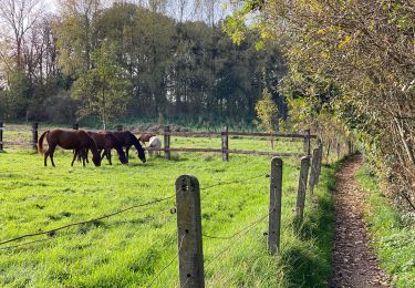
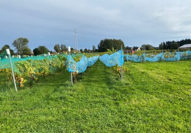
Trail Walking of 7.4 km to be discovered at Flanders, Flemish Brabant, Opwijk. This trail is proposed by ElGino.
Description
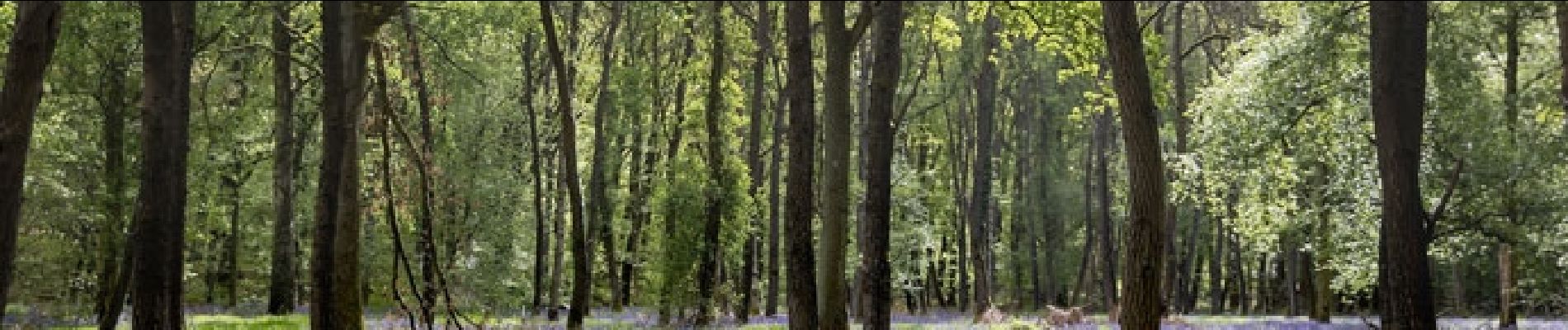
Dorp verlaten via Geleyweg en dan rechts via Heydeweg richting Oude Heirbaan alwaar we rechts nemen en op kruising links richting bos. Via Huizekens richting domein Landgoed Haelterman via de Kravaalveldbaan waar we halfverwege links afslaan richting Terberglos. We volgen Tergerglos (schuin rechts afslaan van het pad) tot het 2e kruispunt (4 wegkruispunt met oa GR) en nemen links richting Groenedreef. WEg steigt ferm en het laatste lange rechte stuk, de Groenedreef, brengt ons in Mazenzele. Dit stuk ligt al volledig op Brabant. Parcours 4 km sluit aan bij het verlaten van bos. REchts links naar Bosstraat Mazenzele en vervolgens via Landbouwmuseum Vedderboom richting Dorp via Dries. wa 7,4 km
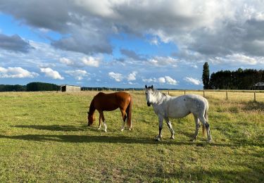
Positioning
Comments
Trails nearby
![Trail Horseback riding Opwijk - Wikiloc - Meldert vanuit De Kleine Deugd - Photo](https://media.geolcdn.com/t/375/260/ext.jpg?maxdim=2&url=https%3A%2F%2Fstatic1.geolcdn.com%2Fsiteimages%2Fupload%2Ffiles%2F1524743154cheval.jpg)
![Horseback riding Horseback riding](https://static1.geolcdn.com/sitytour/trail-icons/301.png)
Horseback riding
![](/images/other/stat-length.png)
![](https://static1.geolcdn.com/siteimages/upload/files/16400158638029165_repeat_loop_refresh_sync_direction_icon.png)
![Trail On foot Aalst - Kersenwandeling - Photo](https://media.geolcdn.com/t/375/260/ea2bda03-7aab-439e-ac2f-d6e170d9c15f.jpeg&format=jpg&maxdim=2)
![On foot On foot](https://static1.geolcdn.com/sitytour/trail-icons/100.png)
On foot
![](/images/other/stat-length.png)
![](https://static1.geolcdn.com/siteimages/upload/files/16400158638029165_repeat_loop_refresh_sync_direction_icon.png)
![Trail On foot Lebbeke - Mennenpad - Photo](https://media.geolcdn.com/t/375/260/9ca09073-979e-439c-9e92-d1334cfb6bb5.jpeg&format=jpg&maxdim=2)
![On foot On foot](https://static1.geolcdn.com/sitytour/trail-icons/100.png)
![Trail Walking Asse - Asse 25 km - Photo](https://media.geolcdn.com/t/375/260/93373654-1789-4a22-a980-4e4078e012f6.jpg&format=jpg&maxdim=2)
![Walking Walking](https://static1.geolcdn.com/sitytour/trail-icons/101.png)
![Trail Walking Merchtem - GR126 : Merchtem - Mariekerke - Photo](https://media.geolcdn.com/t/375/260/be036740-a01c-42d1-b024-7439497fcebd.jpeg&format=jpg&maxdim=2)
![Walking Walking](https://static1.geolcdn.com/sitytour/trail-icons/101.png)
Walking
![](/images/other/stat-length.png)
![](https://static1.geolcdn.com/siteimages/upload/files/16400158638029165_repeat_loop_refresh_sync_direction_icon.png)
![Trail Walking Asse - S-GR Groene Gordel: Mollem - Ternat - Photo](https://media.geolcdn.com/t/375/260/6faef7af-0d0f-4faa-bb47-f1d7e98a3199.jpeg&format=jpg&maxdim=2)
![Walking Walking](https://static1.geolcdn.com/sitytour/trail-icons/101.png)
Walking
![](/images/other/stat-length.png)
![](https://static1.geolcdn.com/siteimages/upload/files/16400158638029165_repeat_loop_refresh_sync_direction_icon.png)
![Trail Walking Asse - Asse 10,7 km - Photo](https://media.geolcdn.com/t/375/260/0cbdcab9-dd9e-496b-b40e-0779d93b5c23.jpg&format=jpg&maxdim=2)
![Walking Walking](https://static1.geolcdn.com/sitytour/trail-icons/101.png)
Walking
![](/images/other/stat-length.png)
![](https://static1.geolcdn.com/siteimages/upload/files/16400158638029165_repeat_loop_refresh_sync_direction_icon.png)
![Trail Walking Asse - Asse Kravaalbos 6,1 km - Photo](https://media.geolcdn.com/t/375/260/25a33a83-112b-4dd2-b149-e23b8049088b.jpg&format=jpg&maxdim=2)
![Walking Walking](https://static1.geolcdn.com/sitytour/trail-icons/101.png)
Walking
![](/images/other/stat-length.png)
![](https://static1.geolcdn.com/siteimages/upload/files/16400158638029165_repeat_loop_refresh_sync_direction_icon.png)
![Trail Walking Asse - Asbeek 8 km - Photo](https://media.geolcdn.com/t/375/260/c9378bb3-5963-4357-b9f0-3509a536491f.jpg&format=jpg&maxdim=2)
![Walking Walking](https://static1.geolcdn.com/sitytour/trail-icons/101.png)
Walking
![](/images/other/stat-length.png)
![](https://static1.geolcdn.com/siteimages/upload/files/16400158638029165_repeat_loop_refresh_sync_direction_icon.png)