![](/images/other/stat-length.png)
activity_8521682946
pascalou73
User GUIDE
![Length](/images/other/stat-length.png)
Length
45 km
![Max alt](https://static1.geolcdn.com/siteimages/upload/files/1508320355ic_sort_altitude_max_24dp.png)
Max alt
636 m
![Uphill gradient](https://static1.geolcdn.com/siteimages/upload/files/1508320355ic_sort_den_pos_24dp.png)
Uphill gradient
986 m
![Km-Effort](/images/other/stat-length.png)
Km-Effort
58 km
![Min alt](https://static1.geolcdn.com/siteimages/upload/files/1508320355ic_sort_altitude_min_24dp.png)
Min alt
323 m
![Downhill gradient](https://static1.geolcdn.com/siteimages/upload/files/1508320355ic_sort_den_neg_24dp.png)
Downhill gradient
998 m
![Boucle](https://static1.geolcdn.com/siteimages/upload/files/16400158638029165_repeat_loop_refresh_sync_direction_icon.png)
Boucle
Yes
Creation date :
2022-03-29 12:42:44.89
Updated on :
2022-03-29 12:44:48.756
![Mountain bike](https://static1.geolcdn.com/sitytour/trail-icons/202.png)
4h00
Difficulty : Very difficult
![Scan this QR Code to open this trail in the SityTrail application](https://capi.geolives.com/qq0zvz2zws4bq2lad0pu/sitytour/trails/3184928/qr.png?size=200)
FREE GPS app for hiking
About
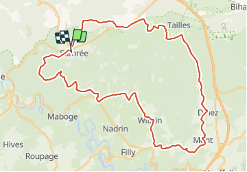
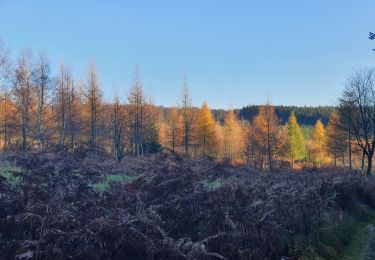
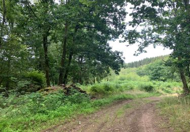
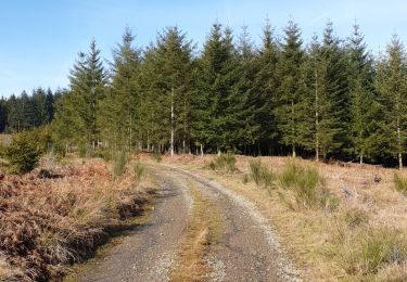
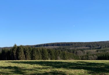
Trail Mountain bike of 45 km to be discovered at Wallonia, Luxembourg, La Roche-en-Ardenne. This trail is proposed by pascalou73.
Description
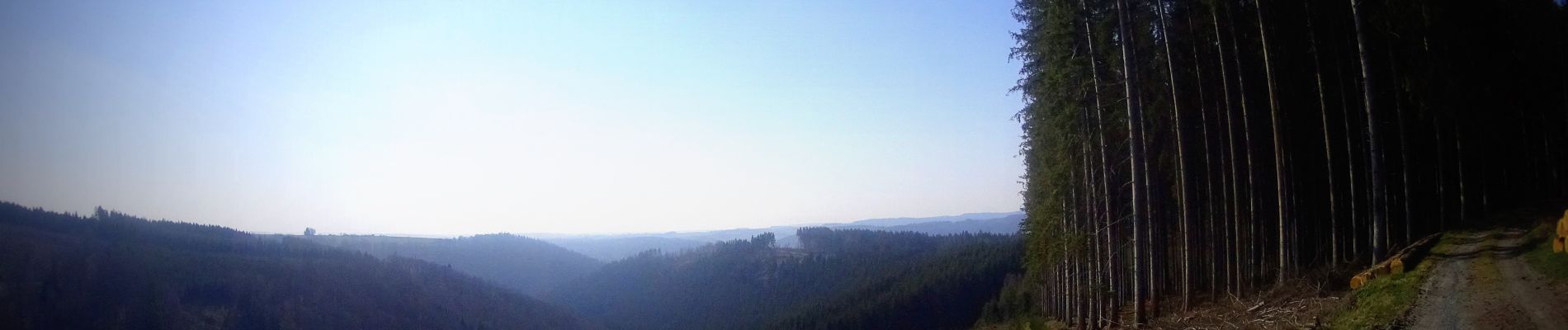
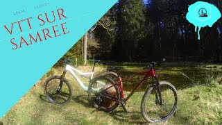
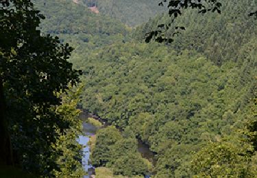
Voilà une randonnée VTT sur la région des Ardenne au départ du village de Samrée .Un VTT avec de beaux points de vue sur la région et de très beaux chemins..
Positioning
Country:
Belgium
Region :
Wallonia
Department/Province :
Luxembourg
Municipality :
La Roche-en-Ardenne
Location:
Unknown
Start:(Dec)
Start:(UTM)
688092 ; 5565344 (31U) N.
Comments
Trails nearby
![Trail Walking La Roche-en-Ardenne - RB-Lu-05 - Au gré de l’Ourthe, la balade des panoramas - Photo](https://media.geolcdn.com/t/375/260/ext.jpg?maxdim=2&url=https%3A%2F%2Fservices.sitytrail.com%2FGeolivesWS%2FDownloadMedia.ashx%3FTrailID%3D179614%26Media%3Ddb2598db-79d7-4bc8-afb7-55d65e443283.jpg)
![Walking Walking](https://static1.geolcdn.com/sitytour/trail-icons/101.png)
RB-Lu-05 - Au gré de l’Ourthe, la balade des panoramas
Walking
Very difficult
(6)
La Roche-en-Ardenne,
Wallonia,
Luxembourg,
Belgium
![](/images/other/stat-length.png)
23 km | 34 km-effort
7h 37min
![](https://static1.geolcdn.com/siteimages/upload/files/16400158638029165_repeat_loop_refresh_sync_direction_icon.png)
Yes
![Trail Walking La Roche-en-Ardenne - Bérismenil - Circuit Natura 2000, des sites qui valent le détour - Lx19 - Photo](https://media.geolcdn.com/t/375/260/ext.jpg?maxdim=2&url=https%3A%2F%2Fservices.sitytrail.com%2FGeolivesWS%2FDownloadMedia.ashx%3FTrailID%3D356413%26Media%3D926c17f8-7479-49f8-a1c9-842bf0b93137.JPG)
![Walking Walking](https://static1.geolcdn.com/sitytour/trail-icons/101.png)
Bérismenil - Circuit Natura 2000, des sites qui valent le détour - Lx19
Walking
Medium
(4)
La Roche-en-Ardenne,
Wallonia,
Luxembourg,
Belgium
![](/images/other/stat-length.png)
7.4 km | 10.4 km-effort
2h 15min
![](https://static1.geolcdn.com/siteimages/upload/files/16400158638029165_repeat_loop_refresh_sync_direction_icon.png)
Yes
![Trail Walking La Roche-en-Ardenne - rando samrée 26/11/2020 - Photo](https://media.geolcdn.com/t/375/260/b9b92636-327b-470f-9fef-3742386ec0a6.jpg&format=jpg&maxdim=2)
![Walking Walking](https://static1.geolcdn.com/sitytour/trail-icons/101.png)
rando samrée 26/11/2020
Walking
Medium
(3)
La Roche-en-Ardenne,
Wallonia,
Luxembourg,
Belgium
![](/images/other/stat-length.png)
19 km | 25 km-effort
4h 44min
![](https://static1.geolcdn.com/siteimages/upload/files/16400158638029165_repeat_loop_refresh_sync_direction_icon.png)
Yes
![Trail Walking La Roche-en-Ardenne - Samree-maboge-Samree - Photo](https://media.geolcdn.com/t/375/260/b1140dd6-ef3b-4be2-9da7-c3279afff05d.jpeg&format=jpg&maxdim=2)
![Walking Walking](https://static1.geolcdn.com/sitytour/trail-icons/101.png)
Samree-maboge-Samree
Walking
(1)
La Roche-en-Ardenne,
Wallonia,
Luxembourg,
Belgium
![](/images/other/stat-length.png)
15.2 km | 21 km-effort
3h 36min
![](https://static1.geolcdn.com/siteimages/upload/files/16400158638029165_repeat_loop_refresh_sync_direction_icon.png)
Yes
![Trail Walking La Roche-en-Ardenne - Balade à Samrée - Photo](https://media.geolcdn.com/t/375/260/8ac758ba-e05d-40e0-9a71-4c66a47c27c2.jpg&format=jpg&maxdim=2)
![Walking Walking](https://static1.geolcdn.com/sitytour/trail-icons/101.png)
Balade à Samrée
Walking
Very easy
(1)
La Roche-en-Ardenne,
Wallonia,
Luxembourg,
Belgium
![](/images/other/stat-length.png)
11.2 km | 15.7 km-effort
4h 30min
![](https://static1.geolcdn.com/siteimages/upload/files/16400158638029165_repeat_loop_refresh_sync_direction_icon.png)
Yes
![Trail Walking La Roche-en-Ardenne - Celtes et Ourthe - Photo](https://media.geolcdn.com/t/375/260/ext.jpg?maxdim=2&url=https%3A%2F%2Fservices.sitytrail.com%2FGeolivesWS%2FDownloadMedia.ashx%3FTrailID%3D854402%26Media%3Dfix__20171030123801.jpg)
![Walking Walking](https://static1.geolcdn.com/sitytour/trail-icons/101.png)
Celtes et Ourthe
Walking
Difficult
(1)
La Roche-en-Ardenne,
Wallonia,
Luxembourg,
Belgium
![](/images/other/stat-length.png)
9.8 km | 13.4 km-effort
3h 4min
![](https://static1.geolcdn.com/siteimages/upload/files/16400158638029165_repeat_loop_refresh_sync_direction_icon.png)
Yes
![Trail Walking La Roche-en-Ardenne - Un petit tour dans les fagnes de la goutte en partant de Samree - Photo](https://media.geolcdn.com/t/375/260/faa437e4-187a-4ff0-9cbb-6255b11e3348.jpg&format=jpg&maxdim=2)
![Walking Walking](https://static1.geolcdn.com/sitytour/trail-icons/101.png)
Un petit tour dans les fagnes de la goutte en partant de Samree
Walking
(2)
La Roche-en-Ardenne,
Wallonia,
Luxembourg,
Belgium
![](/images/other/stat-length.png)
14.6 km | 18.5 km-effort
3h 0min
![](https://static1.geolcdn.com/siteimages/upload/files/16400158638029165_repeat_loop_refresh_sync_direction_icon.png)
Yes
![Trail Walking La Roche-en-Ardenne - très belle - Photo](https://media.geolcdn.com/t/375/260/20ac222d-4563-44a0-a49e-63d4fb5a1b07.jpg&format=jpg&maxdim=2)
![Walking Walking](https://static1.geolcdn.com/sitytour/trail-icons/101.png)
très belle
Walking
Very easy
(1)
La Roche-en-Ardenne,
Wallonia,
Luxembourg,
Belgium
![](/images/other/stat-length.png)
22 km | 31 km-effort
4h 49min
![](https://static1.geolcdn.com/siteimages/upload/files/16400158638029165_repeat_loop_refresh_sync_direction_icon.png)
Yes
![Trail Walking Manhay - RF-Lu-04 En surplomb de l'ancienne ligne SNCV de l'Aisne : Dochamps - Photo](https://media.geolcdn.com/t/375/260/ext.jpg?maxdim=2&url=https%3A%2F%2Fstatic1.geolcdn.com%2Fsiteimages%2Fupload%2Ffiles%2F1553511878bg_sport_marche.png)
![Walking Walking](https://static1.geolcdn.com/sitytour/trail-icons/101.png)
RF-Lu-04 En surplomb de l'ancienne ligne SNCV de l'Aisne : Dochamps
Walking
Very easy
(4)
Manhay,
Wallonia,
Luxembourg,
Belgium
![](/images/other/stat-length.png)
14.4 km | 19.2 km-effort
4h 5min
![](https://static1.geolcdn.com/siteimages/upload/files/16400158638029165_repeat_loop_refresh_sync_direction_icon.png)
Yes