


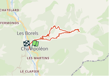

6.3 km | 9.9 km-effort


User


FREE GPS app for hiking
 SityTrail
IGN / Geographical institutes
SityTrail World
The world is yours!
Trail Walking of 8.3 km to be discovered at Provence-Alpes-Côte d'Azur, Hautes-Alpes, Champoléon. This trail is proposed by chris13370.
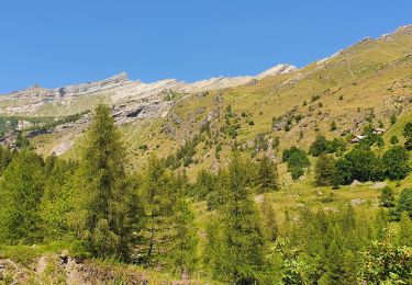
Très jolie balade le long du torrent jusqu'à l'ancien village de Meollion faite fin mars.
NB parking 200m du lieu de départ.


Walking

Walking

On foot

Walking

Walking

Touring skiing

Touring skiing

Touring skiing
Walking