![](/images/other/stat-length.png)
![Trail Walking São Jorge - Levada do Rei (Rother n°30) - Photo](https://media.geolcdn.com/t/1900/400/ext.pjpeg?maxdim=2&url=https%3A%2F%2Fmedia.geolcdn.com%2Ff%2Fe8b2347b-7816-4bfc-9bb5-128a6365d6b3.jpg)
Levada do Rei (Rother n°30)
Bart2015
User
![Length](/images/other/stat-length.png)
Length
11.2 km
![Max alt](https://static1.geolcdn.com/siteimages/upload/files/1508320355ic_sort_altitude_max_24dp.png)
Max alt
681 m
![Uphill gradient](https://static1.geolcdn.com/siteimages/upload/files/1508320355ic_sort_den_pos_24dp.png)
Uphill gradient
757 m
![Km-Effort](/images/other/stat-length.png)
Km-Effort
21 km
![Min alt](https://static1.geolcdn.com/siteimages/upload/files/1508320355ic_sort_altitude_min_24dp.png)
Min alt
481 m
![Downhill gradient](https://static1.geolcdn.com/siteimages/upload/files/1508320355ic_sort_den_neg_24dp.png)
Downhill gradient
754 m
![Boucle](https://static1.geolcdn.com/siteimages/upload/files/16400158638029165_repeat_loop_refresh_sync_direction_icon.png)
Boucle
Yes
Creation date :
2022-03-28 10:27:01.376
Updated on :
2022-05-01 12:18:28.26
![Walking](https://static1.geolcdn.com/sitytour/trail-icons/101.png)
3h20
Difficulty : Easy
![Scan this QR Code to open this trail in the SityTrail application](https://capi.geolives.com/qq0zvz2zws4bq2lad0pu/sitytour/trails/3183960/qr.png?size=200)
FREE GPS app for hiking
About
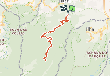
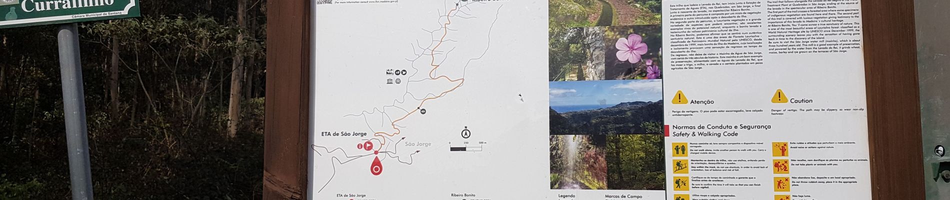
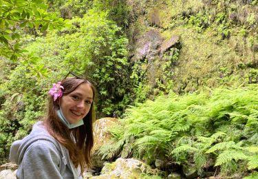
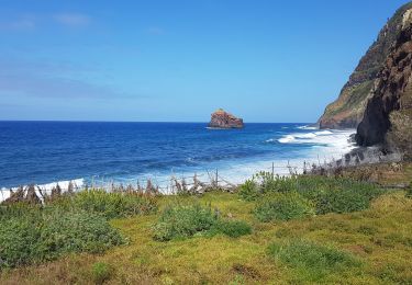
Trail Walking of 11.2 km to be discovered at Madeira, Unknown, São Jorge. This trail is proposed by Bart2015.
Description
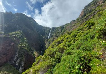
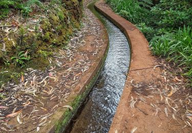
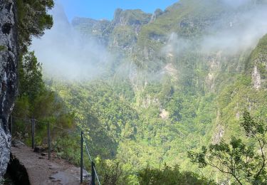
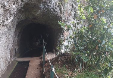
Très belle randonnée qui longe la levada du Roi en passant par de nombreux tunnels : chaussures hautes et frontales indispensables. Passages sous des petites cascades ...
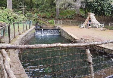
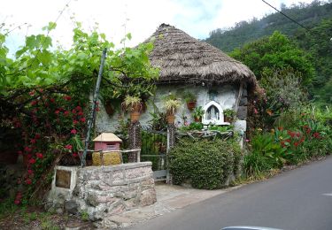
Au retour, petit arrêt au bar qui ravira les enfants : nombreux animaux ...
Bonne rando ...
Positioning
Country:
Portugal
Region :
Madeira
Department/Province :
Unknown
Municipality :
São Jorge
Location:
Unknown
Start:(Dec)
Start:(UTM)
319835 ; 3632638 (28S) N.
Comments
Trails nearby
![Trail On foot São Jorge - Levada do Rei - Photo](https://media.geolcdn.com/t/375/260/ext.jpg?maxdim=2&url=https%3A%2F%2Fmedia.geolcdn.com%2Ff%2Fad2e6574-6500-4312-ba05-965d1dec2ca5.jpeg)
![On foot On foot](https://static1.geolcdn.com/sitytour/trail-icons/100.png)
![Trail Walking São Jorge - Chemin côtier de Sao Jorge, Jardim do Mar - Photo](https://media.geolcdn.com/t/375/260/ext.jpg?maxdim=2&url=https%3A%2F%2Fmedia.geolcdn.com%2Ff%2F2e9012ad-3680-4644-9105-ed30e57e38db.jpg)
![Walking Walking](https://static1.geolcdn.com/sitytour/trail-icons/101.png)
Chemin côtier de Sao Jorge, Jardim do Mar
Walking
Easy
São Jorge,
Madeira,
Unknown,
Portugal
![](/images/other/stat-length.png)
3.7 km | 6.1 km-effort
47min
![](https://static1.geolcdn.com/siteimages/upload/files/16400158638029165_repeat_loop_refresh_sync_direction_icon.png)
No
![Trail Walking São Jorge - Levada do Rei - Photo](https://media.geolcdn.com/t/375/260/ext.jpg?maxdim=2&url=https%3A%2F%2Fmedia.geolcdn.com%2Ff%2F443f8af1-1954-490d-94a5-a22a2310f178.jpg)
![Walking Walking](https://static1.geolcdn.com/sitytour/trail-icons/101.png)
Levada do Rei
Walking
Medium
São Jorge,
Madeira,
Unknown,
Portugal
![](/images/other/stat-length.png)
13.5 km | 29 km-effort
3h 40min
![](https://static1.geolcdn.com/siteimages/upload/files/16400158638029165_repeat_loop_refresh_sync_direction_icon.png)
Yes
![Trail Walking Santana - Madère : Caldeirao Verde puis Caldeirao do Inferno - Photo](https://media.geolcdn.com/t/375/260/ext.jpg?maxdim=2&url=https%3A%2F%2Fmedia.geolcdn.com%2Ff%2Fef41a944-c8ff-4418-bdbf-f8d0546813d8.jpg)
![Walking Walking](https://static1.geolcdn.com/sitytour/trail-icons/101.png)
Madère : Caldeirao Verde puis Caldeirao do Inferno
Walking
Difficult
(1)
Santana,
Madeira,
Unknown,
Portugal
![](/images/other/stat-length.png)
19.2 km | 47 km-effort
4h 55min
![](https://static1.geolcdn.com/siteimages/upload/files/16400158638029165_repeat_loop_refresh_sync_direction_icon.png)
Yes
![Trail On foot Santana - Levada de Santana - Photo](https://media.geolcdn.com/t/375/260/ext.jpg?maxdim=2&url=https%3A%2F%2Fmedia.geolcdn.com%2Ff%2F33d9e5f4-bd6f-4870-a067-4b92080d24aa.jpeg)
![On foot On foot](https://static1.geolcdn.com/sitytour/trail-icons/100.png)
![Trail Walking Santana - Levada - Photo](https://media.geolcdn.com/t/375/260/ext.jpg?maxdim=2&url=https%3A%2F%2Fmedia.geolcdn.com%2Ff%2F03ee4b08-3f24-439e-9aa1-4e685facb43b.jpg)
![Walking Walking](https://static1.geolcdn.com/sitytour/trail-icons/101.png)
![Trail Walking São Jorge - Levada del Rei - Photo](https://media.geolcdn.com/t/375/260/ext.jpg?maxdim=2&url=https%3A%2F%2Fmedia.geolcdn.com%2Ff%2F57676c26-efbe-41f8-bb7d-c6580707a20b.jpg)
![Walking Walking](https://static1.geolcdn.com/sitytour/trail-icons/101.png)
Levada del Rei
Walking
Medium
São Jorge,
Madeira,
Unknown,
Portugal
![](/images/other/stat-length.png)
5.9 km | 11.3 km-effort
2h 17min
![](https://static1.geolcdn.com/siteimages/upload/files/16400158638029165_repeat_loop_refresh_sync_direction_icon.png)
No
![Trail Walking São Jorge - Levada del Rei - Photo](https://media.geolcdn.com/t/375/260/ext.jpg?maxdim=2&url=https%3A%2F%2Fmedia.geolcdn.com%2Ff%2Fda388e2c-042c-4a5e-9235-c83fc49eebf4.jpg)
![Walking Walking](https://static1.geolcdn.com/sitytour/trail-icons/101.png)
Levada del Rei
Walking
Very difficult
São Jorge,
Madeira,
Unknown,
Portugal
![](/images/other/stat-length.png)
10.9 km | 20 km-effort
2h 27min
![](https://static1.geolcdn.com/siteimages/upload/files/16400158638029165_repeat_loop_refresh_sync_direction_icon.png)
Yes
![Trail Walking Santana - Santana - Photo](https://media.geolcdn.com/t/375/260/ext.jpg?maxdim=2&url=https%3A%2F%2Fmedia.geolcdn.com%2Ff%2F6294fcdc-e596-4918-9422-7fd7010a9d4a.jpg)
![Walking Walking](https://static1.geolcdn.com/sitytour/trail-icons/101.png)