![](/images/other/stat-length.png)
![Trail Mountain bike Thouars-sur-Garonne - De la Baïse à la Garonne - Thouars-sur-Garonne - Photo](https://media.geolcdn.com/t/1900/400/ext.pjpeg?maxdim=2&url=https%3A%2F%2Fservices.sitytrail.com%2FGeolivesWS%2FDownloadMedia.ashx%3FTrailID%3D318087%26Media%3D17547_1.jpg)
De la Baïse à la Garonne - Thouars-sur-Garonne
tracegps
User
![Length](/images/other/stat-length.png)
![Max alt](https://static1.geolcdn.com/siteimages/upload/files/1508320355ic_sort_altitude_max_24dp.png)
![Uphill gradient](https://static1.geolcdn.com/siteimages/upload/files/1508320355ic_sort_den_pos_24dp.png)
![Km-Effort](/images/other/stat-length.png)
![Min alt](https://static1.geolcdn.com/siteimages/upload/files/1508320355ic_sort_altitude_min_24dp.png)
![Downhill gradient](https://static1.geolcdn.com/siteimages/upload/files/1508320355ic_sort_den_neg_24dp.png)
![Boucle](https://static1.geolcdn.com/siteimages/upload/files/16400158638029165_repeat_loop_refresh_sync_direction_icon.png)
![Mountain bike](https://static1.geolcdn.com/sitytour/trail-icons/202.png)
1h00
Difficulty : Easy
![Scan this QR Code to open this trail in the SityTrail application](https://capi.geolives.com/qq0zvz2zws4bq2lad0pu/sitytour/trails/318087/qr.png?size=200)
FREE GPS app for hiking
About
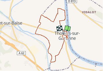
Trail Mountain bike of 8.6 km to be discovered at New Aquitaine, Lot-et-Garonne, Thouars-sur-Garonne. This trail is proposed by tracegps.
Description
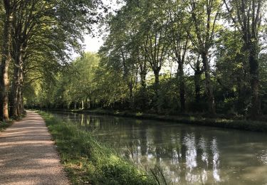
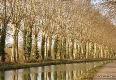
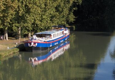
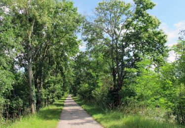
Tracé dans une plaine céréalière et maraîchère entre la Baïse et la Garonne, ce circuit est entouré par les collines viticoles de Feugarolles, au sud, Buzet à l’ouest et boisées au-dessus d’Aiguillon et sur le Pech de Berre. Départ de la mairie de Thouars-sur-Garonne. Téléchargez la fiche de cette randonnée sur le site du Tourisme du Lot et Garonne.
Positioning
Comments
Trails nearby
![Trail On foot Buzet-sur-Baïse - Buzet, un port entre Canal et Baïse - 13.1 km - Photo](https://media.geolcdn.com/t/375/260/54f3a69e-3715-4dbc-a60c-ba13ee3ca3fa.jpeg&format=jpg&maxdim=2)
![On foot On foot](https://static1.geolcdn.com/sitytour/trail-icons/100.png)
On foot
![](/images/other/stat-length.png)
![](https://static1.geolcdn.com/siteimages/upload/files/16400158638029165_repeat_loop_refresh_sync_direction_icon.png)
![Trail On foot Buzet-sur-Baïse - Buzet-sur-Baïse, randonnée autour du Château - 11.1 km - Photo](https://media.geolcdn.com/t/375/260/54f3a69e-3715-4dbc-a60c-ba13ee3ca3fa.jpeg&format=jpg&maxdim=2)
![On foot On foot](https://static1.geolcdn.com/sitytour/trail-icons/100.png)
On foot
![](/images/other/stat-length.png)
![](https://static1.geolcdn.com/siteimages/upload/files/16400158638029165_repeat_loop_refresh_sync_direction_icon.png)
![Trail On foot Saint-Pierre-de-Buzet - Saint-Pierre-de-Buzet, vignes, pins et chênes lièges - 6.5 km - Photo](https://media.geolcdn.com/t/375/260/578f6de7-22c9-4fad-bcf2-ba3640d0910a.jpeg&format=jpg&maxdim=2)
![On foot On foot](https://static1.geolcdn.com/sitytour/trail-icons/100.png)
On foot
![](/images/other/stat-length.png)
![](https://static1.geolcdn.com/siteimages/upload/files/16400158638029165_repeat_loop_refresh_sync_direction_icon.png)
![Trail On foot Vianne - Buzet, un pont-canal sur la Baïse - 8.5 km - Photo](https://media.geolcdn.com/t/375/260/54f3a69e-3715-4dbc-a60c-ba13ee3ca3fa.jpeg&format=jpg&maxdim=2)
![On foot On foot](https://static1.geolcdn.com/sitytour/trail-icons/100.png)
On foot
![](/images/other/stat-length.png)
![](https://static1.geolcdn.com/siteimages/upload/files/16400158638029165_repeat_loop_refresh_sync_direction_icon.png)
![Trail Hybrid bike Damazan - Canal de la Garonne - Photo](https://media.geolcdn.com/t/375/260/25c5747e-6a5a-4905-a2f9-2d790cfee421.jpg&format=jpg&maxdim=2)
![Hybrid bike Hybrid bike](https://static1.geolcdn.com/sitytour/trail-icons/203.png)
Hybrid bike
![](/images/other/stat-length.png)
![](https://static1.geolcdn.com/siteimages/upload/files/16400158638029165_repeat_loop_refresh_sync_direction_icon.png)
![Trail Mountain bike Damazan - La bastide du Canal de Garonne - Damazan - Photo](https://media.geolcdn.com/t/375/260/ext.jpg?maxdim=2&url=https%3A%2F%2Fservices.sitytrail.com%2FGeolivesWS%2FDownloadMedia.ashx%3FTrailID%3D318079%26Media%3D17544_3.jpg)
![Mountain bike Mountain bike](https://static1.geolcdn.com/sitytour/trail-icons/202.png)
Mountain bike
![](/images/other/stat-length.png)
![](https://static1.geolcdn.com/siteimages/upload/files/16400158638029165_repeat_loop_refresh_sync_direction_icon.png)
![Trail Walking Damazan - La bastide du Canal de Garonne - Damazan - Photo](https://media.geolcdn.com/t/375/260/ext.jpg?maxdim=2&url=https%3A%2F%2Fservices.sitytrail.com%2FGeolivesWS%2FDownloadMedia.ashx%3FTrailID%3D318078%26Media%3D17544_5.jpg)
![Walking Walking](https://static1.geolcdn.com/sitytour/trail-icons/101.png)
Walking
![](/images/other/stat-length.png)
![](https://static1.geolcdn.com/siteimages/upload/files/16400158638029165_repeat_loop_refresh_sync_direction_icon.png)
![Trail Walking Buzet-sur-Baïse - Buzet-sur-Baïse, un pont-canal sur la Baïse - Photo](https://media.geolcdn.com/t/375/260/ext.jpg?maxdim=2&url=https%3A%2F%2Fservices.sitytrail.com%2FGeolivesWS%2FDownloadMedia.ashx%3FTrailID%3D317224%26Media%3D16400_5.jpg)
![Walking Walking](https://static1.geolcdn.com/sitytour/trail-icons/101.png)
Walking
![](/images/other/stat-length.png)
![](https://static1.geolcdn.com/siteimages/upload/files/16400158638029165_repeat_loop_refresh_sync_direction_icon.png)
![Trail Hybrid bike Damazan - Damazan Caubeyres - Photo](https://media.geolcdn.com/t/375/260/728b4b2a-058a-43b5-bc3d-2ba49ed1b942.jpg&format=jpg&maxdim=2)
![Hybrid bike Hybrid bike](https://static1.geolcdn.com/sitytour/trail-icons/203.png)
Hybrid bike
![](/images/other/stat-length.png)
![](https://static1.geolcdn.com/siteimages/upload/files/16400158638029165_repeat_loop_refresh_sync_direction_icon.png)