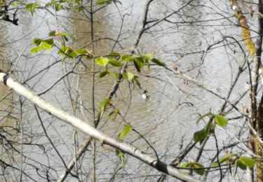
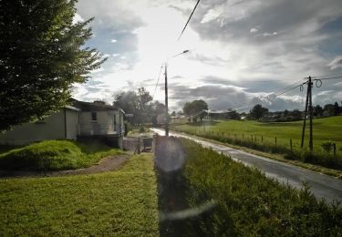
Trail Walking Saint-Clément - Sur les Rails de Bussières - Saint Clément - Pays de Tulle - Photo

Sur les Rails de Bussières - Saint Clément - Pays de Tulle

 tracegps
tracegps

User

© OpenStreetMap contributors
Length
Length
9.9 km
Max alt
Max alt
510 m
Uphill gradient
Uphill gradient
184 m
Km-Effort
Km-Effort  
12.4 km
Min alt
Min alt
396 m
Downhill gradient
Downhill gradient
183 m
Boucle
Boucle
Yes
Creation date :
2014-12-10 00:00:00.0
Updated on :
2014-12-10 00:00:00.0

(0 Reviews)

Walking
Walking
2h15
Difficulty : Medium

Scan this QR Code to open this trail in the SityTrail application

FREE GPS app for hiking

Logo SityTrail SityTrail

IGN / Geographical institutes

Download SityTrail from the App Store Download SityTrail from Google Play

Logo SityTrail SityTrail World

The world is yours!

Download SityTrail from the App Store Download SityTrail from Google Play Download SityTrail on Huawei AppGallery

About

Trail Walking of 9.9 km to be discovered at New Aquitaine, Corrèze, Saint-Clément. This trail is proposed by tracegps.

Description

"Sur les rails de Bussières", vous propose une randonnée sans difficulté sur l'ancienne voie du P.O.C ("Paris-Orléans-Corrèze" affectueusement appelé "Le Transcailladou"). Vous traverserez des espaces boisés entrecoupés de prairies verdoyantes, à la découverte d'étangs, de moulins et de magnifiques points de vue. Téléchargez la fiche du circuit sur le site du Tourisme en Limousin.

Elevation profile

Photos

Positioning

Country:
France
Region :
New Aquitaine
Department/Province :
Corrèze
Municipality :
Saint-Clément
Location:
Unknown
Start:(Dec)
Start:(UTM)
397004 ; 5021741 (31T) N.

Trails nearby

Trail Walking Lagraulière - Lagraulière - Le Picoulet - Photo
Walking
houbart

Walking

Easy
(1)
Lagraulière, New Aquitaine, Corrèze, France
4.8 km | 5.8 km-effort
1h 10min
Yes
Trail Walking Lagraulière - Lagauliere - Photo
Walking
dlaudain

Walking

Very easy
Lagraulière, New Aquitaine, Corrèze, France
4.8 km | 5.8 km-effort
1h 10min
Yes
Trail Walking Lagraulière - Lagraulière- Forêt de Blanchefort - Photo
Walking
houbart

Walking

Very easy
(1)
Lagraulière, New Aquitaine, Corrèze, France
8.9 km | 11.6 km-effort
2h 28min
Yes
Trail Walking Lagraulière - Le Moulin de Mazel - Lagraulière - Pays de Tulle - Photo
Walking
tracegps

Walking

Medium
(2)
Lagraulière, New Aquitaine, Corrèze, France
9.1 km | 11.6 km-effort
2h 30min
Yes
Trail Walking Lagraulière - Lagrauliere - Photo
Walking
houbart

Walking

Medium
Lagraulière, New Aquitaine, Corrèze, France
9.8 km | 12.2 km-effort
2h 37min
Yes
Trail Walking Lagraulière - lagrauliere - Photo
Walking
personono

Walking

Very easy
Lagraulière, New Aquitaine, Corrèze, France
13.8 km | 17.1 km-effort
3h 21min
No
Trail Walking Chanteix - Chanteix- Du puy Maurians aux Zignalets - Photo
Walking
houbart

Walking

Easy
Chanteix, New Aquitaine, Corrèze, France
7.6 km | 9.8 km-effort
2h 14min
Yes
Trail Mountain bike Saint-Clément - St Clement  - Photo
Mountain bike
mo63170

Mountain bike

Difficult
Saint-Clément, New Aquitaine, Corrèze, France
30 km | 38 km-effort
1h 39min
Yes
Trail Electric bike Seilhac - Boucle lac de Bournazel-Uzerche - Photo
Electric bike
th.feur

Electric bike

Easy
Seilhac, New Aquitaine, Corrèze, France
35 km | 43 km-effort
2h 21min
Yes


Close
My subscriptions