


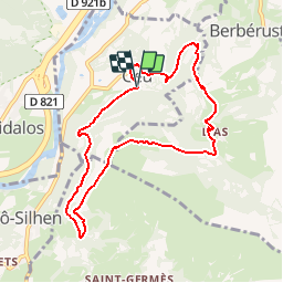

11.8 km | 20 km-effort

User


FREE GPS app for hiking
 SityTrail
IGN / Geographical institutes
SityTrail World
The world is yours!
Trail Walking of 8.8 km to be discovered at Occitania, Hautespyrenees, Geu. This trail is proposed by tracegps.
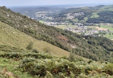
Départ de l’église de Geu. Par un sentier en sous-bois, on monte jusqu'aux cabanes de Bruchou, puis on continue à flanc en dessous du Cap des Bentails. Belles vues sur la vallée d'Argelès et le Massif du Pibeste. On passe ensuite au petit village de Lias pour redescendre vers Geu.


Walking

Walking

Electric bike

Walking
Walking

Walking

Walking
Walking
Walking